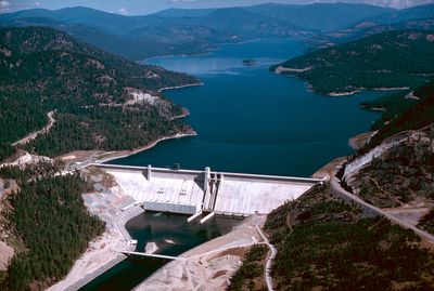
Libby Dam, Hydroelectric power station in Lincoln County, Montana
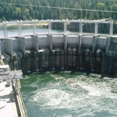
Libby Dam is a concrete hydroelectric facility spanning roughly one kilometer across the Kootenai River and creating a large reservoir. The water behind it reaches depths of about 110 meters at its lowest point and supplies the region with power through five turbines.
Construction began in 1966 under the U.S. Corps of Engineers as a joint project between nations to manage water and generate power. The completion resulted in the relocation of several communities, including the entire town of Rexford.
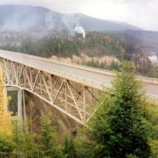
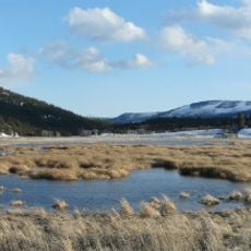
The name Koocanusa reflects cooperation between the Kootenai Indians, Canada, and the United States in this water project. Visitors can see how the reservoir shapes the local environment and the role water plays in the region's life today.
The site is free to visit and accessible year-round, though winter weather brings harsh conditions to the area. Parking and viewpoint areas are available, offering views of the water and surrounding mountains.
The facility features a system allowing water to be released from different depths of the reservoir to manage temperatures downstream. This approach helps protect fish habitats and supports the river's natural ecosystem.
Location: Lincoln County
Inception: 1975
Length: 931 m
Made from material: concrete
GPS coordinates: 48.40846,-115.31048
Latest update: December 8, 2025 19:54
Kootenai Falls
33.8 km
Whitefish Lake State Park
69.5 km
Snowshoe Peak
34.8 km
Moyie River Canyon Bridge
73.4 km
Cabinet Gorge Dam
66.4 km
Lost Trail National Wildlife Refuge
40.2 km
Theodore Roosevelt Memorial Bridge
43.1 km
Kootenai Falls Swinging Bridge
34.4 km
Lockridge Medical Clinic
72 km
Libby High School
18.1 km
Troy Jail
43.2 km
Farmers and Merchants State Bank
55.9 km
Ant Flat Ranger Station
47.5 km
Scandinavian Methodist Church
77.2 km
Cabinet National Forest
68.4 km
Eureka Community Hall
74.7 km
First Presbyterian Church of Whitefish
72 km
Snyder House
77 km
Charles Boles House
76 km
Boyd's Shop
77.3 km
Fisher House
77.2 km
Bull River Guard Station
48.3 km
Ray E. Taylor House
71.8 km
Beaman House
77.2 km
Bruyer Granary
77 km
Bader-Jaquette and Westwang Houses and Rental Property
77 km
Wanda Hollensteiner Art Gallery
75.8 km
Star Peak Lookout
57.6 kmVisited this place? Tap the stars to rate it and share your experience / photos with the community! Try now! You can cancel it anytime.
Discover hidden gems everywhere you go!
From secret cafés to breathtaking viewpoints, skip the crowded tourist spots and find places that match your style. Our app makes it easy with voice search, smart filtering, route optimization, and insider tips from travelers worldwide. Download now for the complete mobile experience.
A unique approach to discovering new places❞
— Le Figaro
All the places worth exploring❞
— France Info
A tailor-made excursion in just a few clicks❞
— 20 Minutes