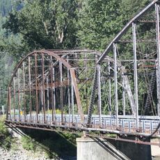
Kootenai Falls Swinging Bridge
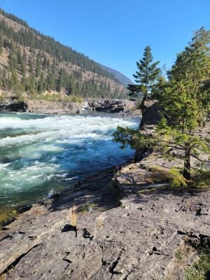
The Kootenai Falls Swinging Bridge is a pedestrian crossing that spans across the river, suspended well above the flowing water below. The structure allows visitors to walk from one side to the other while viewing the landscape and water features from above.
The original bridge was built by the Forest Service to access fire control areas, but a major flood in 1984 destroyed it. The current reinforced structure was rebuilt afterward and remains in use today.
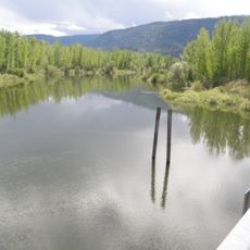
The river below holds deep meaning for Native American tribes whose ancestors lived along these waters for generations, a connection still felt in the landscape today.
A short hiking trail from the Highway 2 parking area leads to the bridge in just a few minutes. The crossing itself is safe for visitors of most fitness levels, though the walkway can feel bouncy underfoot.
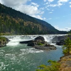
This location served as a filming site for major motion pictures, attracting filmmakers to capture the natural waterfalls and river rapids visible from the bridge. The dramatic water features made it a sought-after backdrop for movie productions.
The community of curious travelers
AroundUs brings together thousands of curated places, local tips, and hidden gems, enriched daily by 60,000 contributors worldwide.