Chest opened
+${chestReward.xp} XP
Explorer
NOUVEAU ×${chestReward.collectible.quantity}
tapez pour fermer

See the monuments around you in AR Open chests in the app

Around Us is built for your phone — point your camera at the streets and discover the monuments and places around you in augmented reality. Around Us is built for your phone — chests unlock when you walk, explore and capture nearby places.

•

Enable Location

We need your location to show you interesting places around you

Discover nearby places

Find interesting locations and hidden gems around you

Precise directions

Get accurate directions and distances to places

Your location is never shared with other users. It's only used when you tap the location button.

Ha Ling Peak

Log in to your account

Start exploring — it's free

Trusted by 93,780 travelers worldwide

Continue with Google
Continue with Apple
or

We will send you a code to connect

By continuing, you accept our Terms and Conditions and our Privacy Policy

Check your inbox

We've sent a pincode in your inbox. Please enter the code below.

Ha Ling Peak

Ha Ling Peak, Mountain peak in Bow Valley, Canada.

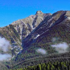
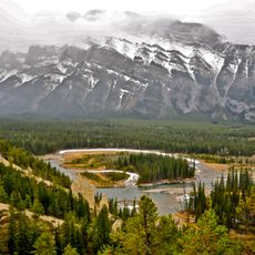
Ha Ling Peak is a 2,407-metre summit at the northwestern end of Ehagay Nakoda, immediately south of Canmore, Alberta. Its upper face is pale grey and tan rock, fluted with vertical gullies, narrowing to a rounded summit on the left. Below the bare rock, dense dark green coniferous forest climbs into the gullies, while a rugged grey ridge with shadowed cliffs rises on the right.

In 1896, a Chinese railway worker reached the summit in less than ten hours to win a bet, planting a flag at the peak. The mountain was officially renamed in 1997 to honor this historic climb.

Locals first called it The Beehive; after Ha Ling's 1896 climb they renamed it Chinaman's Peak in his honour, though the name only became official in 1980. It was changed to Ha Ling Peak in 1997, part of a wider Alberta project renaming offensive or colonial place names. A 2018 CBC documentary follows that renaming debate.

The round-trip hike covers about 8 kilometers with an elevation gain of roughly 800 meters, typically taking four to six hours for most hikers. Start early and bring weather-appropriate clothing and sturdy footwear for the best experience.

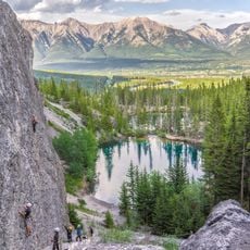
The peak was long known locally as The Beehive before Ha Ling's 1896 bet. The north side holds several technical climbing routes up the face, plus a difficult scramble up Canmore Couloir between Mount Lawrence Grassi and Miner's Col.

The community of curious travelers

AroundUs brings together thousands of curated places, local tips, and hidden gems, enriched daily by 93,780 contributors worldwide.

Start exploring
Location
Elevation above the sea
2,407 m
GPS coordinates
51.06330,-115.40200
Latest update
November 4, 2026 04:12
Reviews
Share your experience

No review yet

Discussions
Start a discussion...

No discussion yet

« Ha Ling Peak - Mountain peak in Bow Valley, Canada » is provided by Around Us (aroundus.com). Images and texts are derived from Wikimedia project under a Creative Commons license. You are allowed to copy, distribute, and modify copies of this page, under the conditions set by the license, as long as this note is clearly visible.

Discover hidden gems everywhere you go!

From secret cafés to breathtaking viewpoints, skip the crowded tourist spots and find places that match your style. Our app makes it easy with voice search, smart filtering, route optimization, and insider tips from travelers worldwide. Download now for the complete mobile experience.
Around Us App Screenshot
❝

A unique approach to discovering new places❞

— Le Figaro

❝

All the places worth exploring❞

— France Info

❝

A tailor-made excursion in just a few clicks❞

— 20 Minutes

Around Us
Travel Guide & Maps
Download

Send to your phone

QR Code
1

Open the camera app on your mobile.

2

Point at the QR code with your camera. A notification will appear.

3

Tap the notification to open the link.