Chest opened
+${chestReward.xp} XP
Explorer
NOUVEAU ×${chestReward.collectible.quantity}
tapez pour fermer
Chest locked

Open chests in the app

Around Us is built for your phone — chests unlock when you walk, explore and capture nearby places.

Enable Location

We need your location to show you interesting places around you

Discover nearby places

Find interesting locations and hidden gems around you

Precise directions

Get accurate directions and distances to places

Your location is never shared with other users. It's only used when you tap the location button.

Bighorn Basin

Log in to your account

Start exploring — it's free

Trusted by 72,890 travelers worldwide

Continue with Google
Continue with Apple
or

We will send you a code to connect

By continuing, you accept our Terms and Conditions and our Privacy Policy

Check your inbox

We've sent a pincode in your inbox. Please enter the code below.

Bighorn Basin
Discussion Reviews 1 Photos
15.7k Popularity

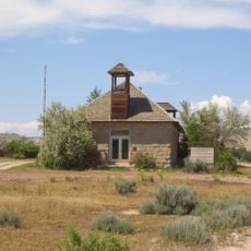
Bighorn Basin, Structural basin in Big Horn County, Wyoming, US

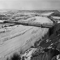
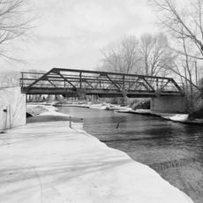
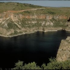
The Bighorn Basin is a structural basin in Wyoming, bounded by the Absaroka Range, Bighorn Mountains, Owl Creek Mountains, and Bridger Mountains. This formation covers roughly 160 kilometers across the landscape.

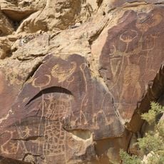
Shoshone and Crow peoples made their home here long before European settlers arrived in the 1800s. Later European presence gradually transformed settlement patterns across the region.

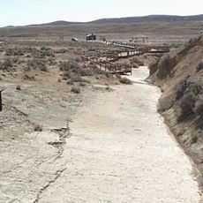
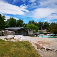
Communities in the basin still practice agriculture relying on irrigation systems to grow sugar beets and raise cattle. These activities shape daily life and show how people have adapted to making the land productive.

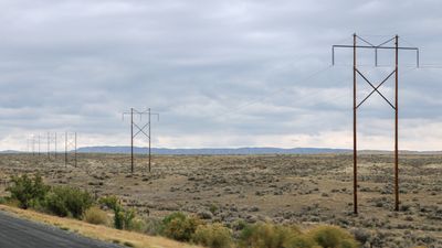
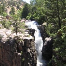
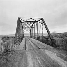
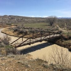
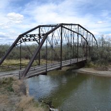
The towns of Cody, Thermopolis, Worland, and Powell connect via several highways that provide access to recreation areas and research sites. Visitors should prepare for dry conditions and wide distances between settlements.

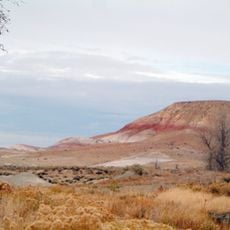
The region gets only 15 to 25 centimeters of rain each year, creating dry conditions that support only certain plant and animal life. This harsh climate has shaped an ecology that catches many visitors off guard.

The community of curious travelers

AroundUs brings together thousands of curated places, local tips, and hidden gems, enriched daily by 60,000 contributors worldwide.

Start exploring
Location
GPS coordinates
44.30000,-108.20000
Latest update
December 7, 2025 19:29
Around this place
Medicine Wheel/Medicine Mountain National Historic Landmark
United States of America

Medicine Wheel/Medicine Mountain National Historic Landmark

62.6 km
Cloverly Formation
United States of America

Cloverly Formation

61.7 km
Hot Springs State Park
United States of America

Hot Springs State Park

71.8 km
Wyoming Dinosaur Center
United States of America

Wyoming Dinosaur Center

73.1 km
Irma Hotel
United States of America

Irma Hotel

73.2 km
Legend Rock
United States of America

Legend Rock

64.4 km
Red Gulch Dinosaur Tracksite
United States of America

Red Gulch Dinosaur Tracksite

38.8 km
Shell Falls
United States of America

Shell Falls

56.4 km
Wyoming Basin
United States of America

Wyoming Basin

37 km
Hyart Theater
United States of America

Hyart Theater

61.7 km
Buffalo Bill Boyhood Home
United States of America

Buffalo Bill Boyhood Home

73.7 km
State Bath house
United States of America

State Bath house

72.1 km
EJZ Bridge over Shoshone River
United States of America

EJZ Bridge over Shoshone River

62.7 km
EFP Bridge over Owl Creek
United States of America

EFP Bridge over Owl Creek

69.5 km
Lower Shell School House
United States of America

Lower Shell School House

32.4 km
First National Bank of Meeteetse
United States of America

First National Bank of Meeteetse

55 km
Worland House
United States of America

Worland House

37.1 km
Alex Halone House
United States of America

Alex Halone House

73.3 km
Downtown Thermopolis Historic District
United States of America

Downtown Thermopolis Historic District

72.8 km
Star Plunge
United States of America

Star Plunge

72.1 km
EJE Bridge over Shell Creek
United States of America

EJE Bridge over Shell Creek

41 km
United States of America

Ralston Community Clubhouse

71.3 km
EJP County Line Bridge
United States of America

EJP County Line Bridge

43.8 km
Rairden Bridge
United States of America

Rairden Bridge

25.6 km
Kirby Jail and Town Hall
United States of America

Kirby Jail and Town Hall

55.1 km
Washakie Museum & Cultural Center
United States of America

Washakie Museum & Cultural Center

37.8 km
Cody Theatre
United States of America

Cody Theatre

73.2 km
Bighorn Canyon National Recreation Area (parke sa Estados Unidos, Wyoming)
United States of America

Bighorn Canyon National Recreation Area (parke sa Estados Unidos, Wyoming)

65.5 km
Show the full map
Reviews
Share your experience

No review yet

Discussions
Start a discussion...

No discussion yet

« Bighorn Basin - Structural basin in Big Horn County, Wyoming, US » is provided by Around Us (aroundus.com). Images and texts are derived from Wikimedia project under a Creative Commons license. You are allowed to copy, distribute, and modify copies of this page, under the conditions set by the license, as long as this note is clearly visible.

Discover hidden gems everywhere you go!

From secret cafés to breathtaking viewpoints, skip the crowded tourist spots and find places that match your style. Our app makes it easy with voice search, smart filtering, route optimization, and insider tips from travelers worldwide. Download now for the complete mobile experience.

Around Us App Screenshot

A unique approach to discovering new places

Le Figaro

All the places worth exploring

France Info

A tailor-made excursion in just a few clicks

20 Minutes

Around Us
Travel Guide & Maps
Download

Send to your phone

QR Code
1

Open the camera app on your mobile.

2

Point at the QR code with your camera. A notification will appear.

3

Tap the notification to open the link.