Pryor Mountains Wild Horse Range

Log in to your account

AroundUs is a community-driven map of interesting places, built by curious explorers like you. It grows with every review, story, and photo you share.
Connect to save your favorite spots, contribute locations, and create personalized routes.
By continuing, you accept our Terms and Conditions and our Privacy Policy

Pryor Mountains Wild Horse Range

Add to collection
Map
Suggest a change
Share

Pryor Mountains Wild Horse Range, Wild horse refuge in Montana, United States

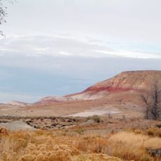
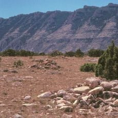
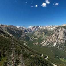
Pryor Mountains Wild Horse Range is a protected area spanning Montana and Wyoming with landscapes ranging from desert basins to mountain meadows at different elevations. The terrain encompasses diverse habitats that support a stable population of free-roaming horses throughout the year.

This refuge was established in 1968 as the first dedicated sanctuary for free-roaming Spanish Barb horses in the United States. The creation of this protected land represented a major turning point in preserving this historical breed.

The horses carry visible traits from their Spanish colonial ancestry that you can observe during a visit. These animals represent a living link to the early days of European settlement in North America.

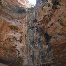
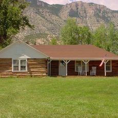
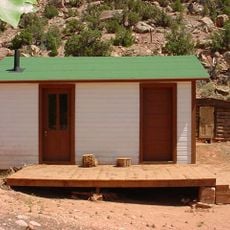
The area is accessible from three entrance points in Montana and Wyoming, giving visitors multiple options for entry. Sturdy footwear and weather-appropriate clothing are essential as the land features rough conditions and varying elevations.

These horses display distinctive physical markers of their Spanish heritage, including dorsal stripes and striped legs that are uncommon in modern mustang populations. These visible traits make the herd recognizable and serve as a living record of their genetic past.

Location: Montana

Location: Big Horn County

Website: http://blm.gov/mt/st/en/fo/billings_field_office/wildhorses.html

GPS coordinates: 45.05330,-108.32300

Latest update: December 7, 2025 20:45

Photos
Around this place
Medicine Wheel/Medicine Mountain National Historic Landmark
United States of America

Medicine Wheel/Medicine Mountain National Historic Landmark

40.5 km
Cloverly Formation
United States of America

Cloverly Formation

24.7 km
Natural Trap Cave
United States of America

Natural Trap Cave

13.6 km
Chief Plenty Coups State Park and Home
United States of America

Chief Plenty Coups State Park and Home

45.2 km
Bighorn Lake
United States of America

Bighorn Lake

40.3 km
Hyart Theater
United States of America

Hyart Theater

24.5 km
Bad Pass Trail
United States of America

Bad Pass Trail

6.5 km
Ewing-Snell Ranch
United States of America

Ewing-Snell Ranch

5.8 km
Cedarvale
United States of America

Cedarvale

9.2 km
Bighorn Ditch Headgate
United States of America

Bighorn Ditch Headgate

41.3 km
EJZ Bridge over Shoshone River
United States of America

EJZ Bridge over Shoshone River

25.5 km
Lower Shell School House
United States of America

Lower Shell School House

66.8 km
Gebo Barn
United States of America

Gebo Barn

56.7 km
EJE Bridge over Shell Creek
United States of America

EJE Bridge over Shell Creek

70.9 km
Ralston Community Clubhouse
United States of America

Ralston Community Clubhouse

56.1 km
Bearcreek Bank
United States of America

Bearcreek Bank

66.7 km
Forsman House
United States of America

Forsman House

53.1 km
Corey House
United States of America

Corey House

53.1 km
Calvary Episcopal Church
United States of America

Calvary Episcopal Church

74.3 km
Hester E. Suydam Boarding House
United States of America

Hester E. Suydam Boarding House

59.4 km
Glidden House
United States of America

Glidden House

53.2 km
Joliet Bridge
United States of America

Joliet Bridge

69.4 km
Fromberg Opera House
United States of America

Fromberg Opera House

59.4 km
Fromberg Concrete Arch Bridge
United States of America

Fromberg Concrete Arch Bridge

58.5 km
Raymond Hough House
United States of America

Raymond Hough House

53.6 km
Samuel Greenblatt House
United States of America

Samuel Greenblatt House

59.5 km
Rock Creek
United States of America

Rock Creek

65.7 km
Cal S. Taggart Bighorn Canyon Visitor Center
United States of America

Cal S. Taggart Bighorn Canyon Visitor Center

24.4 km
Show the full map
Reviews

Visited this place? Tap the stars to rate it and share your experience / photos with the community! Try now! You can cancel it anytime.

« Pryor Mountains Wild Horse Range - Wild horse refuge in Montana, United States » is provided by Around Us (aroundus.com). Images and texts are derived from Wikimedia project under a Creative Commons license. You are allowed to copy, distribute, and modify copies of this page, under the conditions set by the license, as long as this note is clearly visible.

Discover hidden gems everywhere you go!

From secret cafés to breathtaking viewpoints, skip the crowded tourist spots and find places that match your style. Our app makes it easy with voice search, smart filtering, route optimization, and insider tips from travelers worldwide. Download now for the complete mobile experience.

Around Us App Screenshot

A unique approach to discovering new places

Le Figaro

All the places worth exploring

France Info

A tailor-made excursion in just a few clicks

20 Minutes