Chest opened
+${chestReward.xp} XP
Explorer
NOUVEAU ×${chestReward.collectible.quantity}
tapez pour fermer
Chest locked

Open chests in the app

Around Us is built for your phone — chests unlock when you walk, explore and capture nearby places.

Enable Location

We need your location to show you interesting places around you

Discover nearby places

Find interesting locations and hidden gems around you

Precise directions

Get accurate directions and distances to places

Your location is never shared with other users. It's only used when you tap the location button.

Little Bighorn River

Log in to your account

Start exploring — it's free

Trusted by 72,883 travelers worldwide

Continue with Google
Continue with Apple
or

We will send you a code to connect

By continuing, you accept our Terms and Conditions and our Privacy Policy

Check your inbox

We've sent a pincode in your inbox. Please enter the code below.

Little Bighorn River
Discussion Reviews 1 Photos
28.4k Popularity

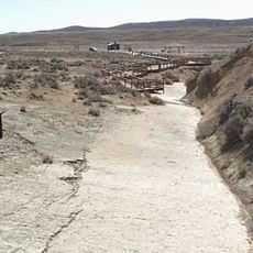
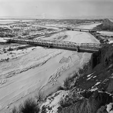
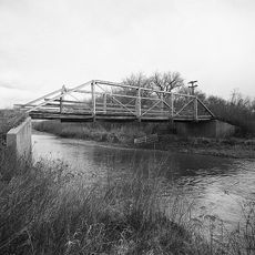
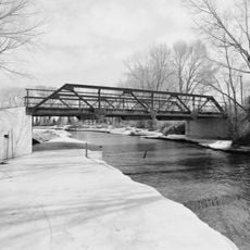
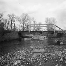
Little Bighorn River, River and battle site in Montana, United States.

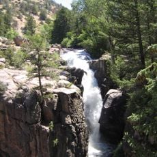
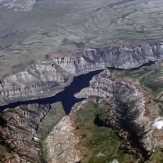
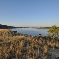
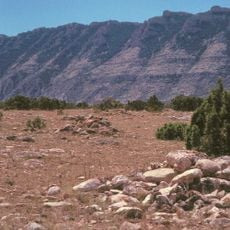
The Little Bighorn River is a waterway that flows roughly 138 miles through Wyoming and Montana before merging with the Bighorn River in the region. The water moves through open plains and rolling terrain, cutting through landscapes shaped by grasslands and scattered woodlands.

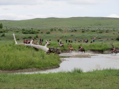
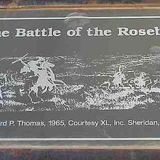
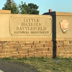
The river is best known as the site of the 1876 Battle of Little Bighorn, where warriors from several Native nations defeated the U.S. Army cavalry unit under Colonel Custer. This clash became a defining moment in the long conflict between American forces and tribal peoples.

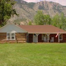
The river holds deep meaning for the Crow people, who gather here for ceremonies and rituals that connect them to their ancestral lands. These practices continue today along the banks, keeping their traditions alive.

Access to the river varies depending on whether you are in Wyoming or Montana, particularly in areas within the Crow Indian Reservation. Visitors planning fishing or other activities should check local regulations and requirements before arriving.

The river originates at Duncum Mountain and flows through a region home to cougars, black bears, and numerous bird species that are adapted to the varied terrain. This wildlife makes the landscape feel remote and wild in a way that draws nature lovers to explore it.

The community of curious travelers

AroundUs brings together thousands of curated places, local tips, and hidden gems, enriched daily by 60,000 contributors worldwide.

Start exploring
Location
GPS coordinates
45.00080,-107.62700
Latest update
December 20, 2025 12:38
Around this place
Medicine Wheel/Medicine Mountain National Historic Landmark
United States of America

Medicine Wheel/Medicine Mountain National Historic Landmark

30.3 km
Cloverly Formation
United States of America

Cloverly Formation

63 km
Natural Trap Cave
United States of America

Natural Trap Cave

44.7 km
Rosebud Battlefield State Park
United States of America

Rosebud Battlefield State Park

55.7 km
Little Bighorn Battlefield National Monument
United States of America

Little Bighorn Battlefield National Monument

65.3 km
Sheridan Inn
United States of America

Sheridan Inn

57.4 km
Red Gulch Dinosaur Tracksite
United States of America

Red Gulch Dinosaur Tracksite

58.7 km
Shell Falls
United States of America

Shell Falls

46.1 km
Bighorn Lake
United States of America

Bighorn Lake

42.9 km
Tongue River Reservoir State Park
United States of America

Tongue River Reservoir State Park

66.4 km
Trail End
United States of America

Trail End

56.6 km
Hyart Theater
United States of America

Hyart Theater

62.7 km
Bad Pass Trail
United States of America

Bad Pass Trail

51.1 km
Ewing-Snell Ranch
United States of America

Ewing-Snell Ranch

50.9 km
Cedarvale
United States of America

Cedarvale

48.2 km
Bighorn Ditch Headgate
United States of America

Bighorn Ditch Headgate

43.3 km
EJZ Bridge over Shoshone River
United States of America

EJZ Bridge over Shoshone River

66.1 km
Sheridan County Courthouse
United States of America

Sheridan County Courthouse

57.7 km
Lower Shell School House
United States of America

Lower Shell School House

58.7 km
ECR Kooi Bridge
United States of America

ECR Kooi Bridge

43.7 km
EJE Bridge over Shell Creek
United States of America

EJE Bridge over Shell Creek

53.7 km
ECS Bridge over Big Goose Creek
United States of America

ECS Bridge over Big Goose Creek

48.6 km
Holy Name Catholic School
United States of America

Holy Name Catholic School

58 km
Mount View
United States of America

Mount View

57.4 km
Odd Fellows Hall
United States of America

Odd Fellows Hall

61.7 km
Susan Wissler House
United States of America

Susan Wissler House

32 km
St. Peter's Episcopal Church
United States of America

St. Peter's Episcopal Church

57.4 km
Robinson-Smith House
United States of America

Robinson-Smith House

57.7 km
Show the full map
Reviews
Share your experience

No review yet

Discussions
Start a discussion...

No discussion yet

« Little Bighorn River - River and battle site in Montana, United States » is provided by Around Us (aroundus.com). Images and texts are derived from Wikimedia project under a Creative Commons license. You are allowed to copy, distribute, and modify copies of this page, under the conditions set by the license, as long as this note is clearly visible.

Discover hidden gems everywhere you go!

From secret cafés to breathtaking viewpoints, skip the crowded tourist spots and find places that match your style. Our app makes it easy with voice search, smart filtering, route optimization, and insider tips from travelers worldwide. Download now for the complete mobile experience.

Around Us App Screenshot

A unique approach to discovering new places

Le Figaro

All the places worth exploring

France Info

A tailor-made excursion in just a few clicks

20 Minutes

Around Us
Travel Guide & Maps
Download

Send to your phone

QR Code
1

Open the camera app on your mobile.

2

Point at the QR code with your camera. A notification will appear.

3

Tap the notification to open the link.