War Horse National Wildlife Refuge

Log in to your account

AroundUs is a community-driven map of interesting places, built by curious explorers like you. It grows with every review, story, and photo you share.
Connect to save your favorite spots, contribute locations, and create personalized routes.
Continue with Google
Continue with Apple
Continue with X
Continue with Facebook
Continue with email
By continuing, you accept our Terms and Conditions and our Privacy Policy
Create an account

War Horse National Wildlife Refuge

Add to collection
Map
Suggest a change
Share

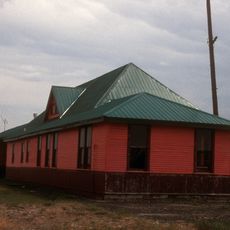
War Horse National Wildlife Refuge, National Wildlife Refuge in Petroleum County, Montana.

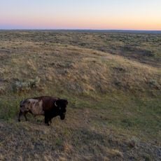
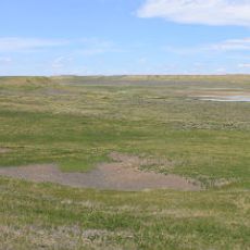
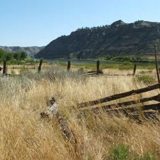
War Horse National Wildlife Refuge is a protected area in Petroleum County made up of three separate units featuring ponderosa pine forest, grassland savanna, and sagebrush plains. The varied landscapes support diverse wildlife and provide important stopover habitat for migratory birds.

The refuge was established in 1958 as part of efforts to protect migratory bird populations and native wildlife across the region. This designation helped secure important habitats at a time when conservation priorities were shifting toward ecosystem protection.

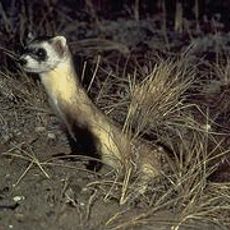
The refuge maintains important ecological research programs that monitor over 350 species of wildlife, contributing to Montana's conservation knowledge.

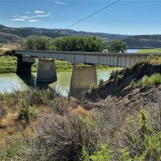
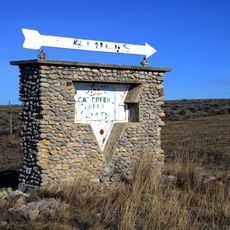
The refuge is divided into three separate units that visitors can explore independently for wildlife observation and photography. The War Horse Unit is located northwest of Winnett and serves as the main access point for visitors exploring this landscape.

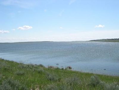
The Yellow Water Reservoir within the refuge experiences dramatic water level fluctuations that constantly reshape habitats for fish and waterfowl throughout the year. These changing conditions make each season distinctly different for visitors to experience.

Location: Montana

Inception: 1958

Website: https://fws.gov/refuge/war_horse

GPS coordinates: 46.90440,-108.50200

Latest update: December 13, 2025 17:03

Photos
Around this place
Lewis and Clark National Historic Trail
United States of America

Lewis and Clark National Historic Trail

107.2 km
American Prairie Reserve
United States of America

American Prairie Reserve

119.3 km
Rimrocks
United States of America

Rimrocks

122.8 km
Rimrock Auto Arena at MetraPark
United States of America

Rimrock Auto Arena at MetraPark

122.9 km
Lake Elmo State Park
United States of America

Lake Elmo State Park

118.6 km
Fred Robinson Bridge
United States of America

Fred Robinson Bridge

82 km
UL Bend National Wildlife Refuge
United States of America

UL Bend National Wildlife Refuge

89.2 km
Alberta Bair Theater
United States of America

Alberta Bair Theater

124.7 km
Hailstone National Wildlife Refuge
United States of America

Hailstone National Wildlife Refuge

112.6 km
Fergus County High School
United States of America

Fergus County High School

72.3 km
Yucca Theatre
United States of America

Yucca Theatre

118.5 km
Milwaukee Road Historic District
United States of America

Milwaukee Road Historic District

114.2 km
Masonic Temple
United States of America

Masonic Temple

72.4 km
Roundup Central School
United States of America

Roundup Central School

51 km
Lavina State Bank
United States of America

Lavina State Bank

75.6 km
St. Benedict's Catholic School
United States of America

St. Benedict's Catholic School

51.1 km
Prescott Commons
United States of America

Prescott Commons

123.2 km
Masonic Temple
United States of America

Masonic Temple

124.8 km
Lewistown Central Business Historic District
United States of America

Lewistown Central Business Historic District

72.6 km
Cat Creek Oil Field Sign
United States of America

Cat Creek Oil Field Sign

39.2 km
Austin North House
United States of America

Austin North House

124.5 km
Abraham and Mary Walton Hogeland House
United States of America

Abraham and Mary Walton Hogeland House

72.9 km
Ervin Homestead-Gist Bottom Historic District
United States of America

Ervin Homestead-Gist Bottom Historic District

107.3 km
Lewistown Courthouse Historic District
United States of America

Lewistown Courthouse Historic District

72.7 km
Anderson House
United States of America

Anderson House

72.7 km
Billings Chamber of Commerce Building
United States of America

Billings Chamber of Commerce Building

124.6 km
Lewistown Silk Stocking District
United States of America

Lewistown Silk Stocking District

72.5 km
Huntoon Residence
United States of America

Huntoon Residence

72.3 km
Show the full map
Reviews

Visited this place? Tap the stars to rate it and share your experience / photos with the community! Try now! You can cancel it anytime.

« War Horse National Wildlife Refuge - National Wildlife Refuge in Petroleum County, Montana » is provided by Around Us (aroundus.com). Images and texts are derived from Wikimedia project under a Creative Commons license. You are allowed to copy, distribute, and modify copies of this page, under the conditions set by the license, as long as this note is clearly visible.

Discover hidden gems everywhere you go!

From secret cafés to breathtaking viewpoints, skip the crowded tourist spots and find places that match your style. Our app makes it easy with voice search, smart filtering, route optimization, and insider tips from travelers worldwide. Download now for the complete mobile experience.

Around Us App Screenshot

A unique approach to discovering new places

Le Figaro

All the places worth exploring

France Info

A tailor-made excursion in just a few clicks

20 Minutes