Enable Location

We need your location to show you interesting places around you

Discover nearby places

Find interesting locations and hidden gems around you

Precise directions

Get accurate directions and distances to places

Your location is never shared with other users. It's only used when you tap the location button.

Fred Robinson Bridge

Log in to your account

Start exploring — it's free

Trusted by 61,921 travelers worldwide

Continue with Google
Continue with Apple
or

We will send you a code to connect

By continuing, you accept our Terms and Conditions and our Privacy Policy

Check your inbox

We've sent a pincode in your inbox. Please enter the code below.

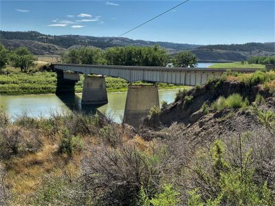
Fred Robinson Bridge, Steel bridge across Missouri River in Montana, United States.

The Fred Robinson Bridge is a steel structure that crosses the Missouri River and connects Fergus County to Phillips County. It features four steel girder sections positioned along US Route 191.

Construction was completed in 1959 and the structure was later added to the National Register of Historic Places. It resulted from years of effort to improve transportation access in the remote region.

The bridge carries the name of a state senator who championed the connection between local communities. It reflects how infrastructure shaped the social ties between the counties on either side.

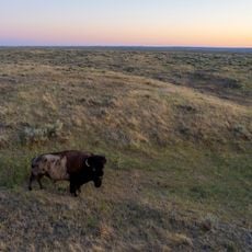
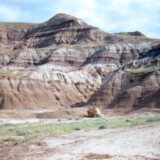
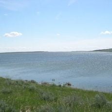
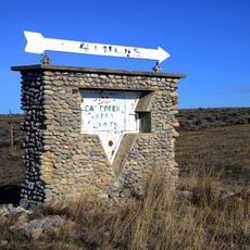
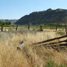
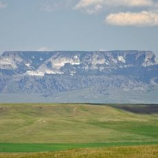
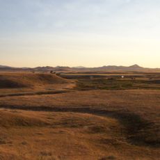
The bridge sits near the Upper Missouri River Breaks National Monument and can be reached from the north. The area is remote, so visitors should be prepared for varying road conditions depending on the season.

The structure is part of a Multiple Property Submission documenting Montana's steel bridge designs. It exemplifies how standardized steel construction methods were applied across different regions of the state.

The community of curious travelers

AroundUs brings together thousands of curated places, local tips, and hidden gems, enriched daily by 60,000 contributors worldwide.

Start exploring
Location
GPS coordinates
47.63080,-108.68500
Latest update
December 13, 2025 11:44
Around this place
American Prairie Reserve
United States of America

American Prairie Reserve

74.3 km
Bearpaw Shale
United States of America

Bearpaw Shale

91.9 km
United States of America

Charles M. Russell National Wildlife Refuge

112.8 km
Fort Assinniboine
United States of America

Fort Assinniboine

127.1 km
Eye of the Needle
United States of America

Eye of the Needle

107.6 km
UL Bend National Wildlife Refuge
United States of America

UL Bend National Wildlife Refuge

57.7 km
War Horse National Wildlife Refuge
United States of America

War Horse National Wildlife Refuge

82 km
Fergus County High School
United States of America

Fergus County High School

84.6 km
Great Plains Dinosaur Museum and Field Station
United States of America

Great Plains Dinosaur Museum and Field Station

101.5 km
Havre Residential Historic District
United States of America

Havre Residential Historic District

125.8 km
Dave's Texaco
United States of America

Dave's Texaco

114.6 km
Judith Landing Historic District
United States of America

Judith Landing Historic District

71.5 km
H. Earl Clack House
United States of America

H. Earl Clack House

126.1 km
Masonic Temple
United States of America

Masonic Temple

84.2 km
Phillips County Carnegie Library
United States of America

Phillips County Carnegie Library

101.1 km
Lewistown Central Business Historic District
United States of America

Lewistown Central Business Historic District

84.4 km
Carnegie Public Library
United States of America

Carnegie Public Library

126 km
Cat Creek Oil Field Sign
United States of America

Cat Creek Oil Field Sign

86.1 km
Abraham and Mary Walton Hogeland House
United States of America

Abraham and Mary Walton Hogeland House

84.5 km
Ervin Homestead-Gist Bottom Historic District
United States of America

Ervin Homestead-Gist Bottom Historic District

31.2 km
Lewistown Courthouse Historic District
United States of America

Lewistown Courthouse Historic District

84.7 km
Anderson House
United States of America

Anderson House

85 km
Lewistown Silk Stocking District
United States of America

Lewistown Silk Stocking District

84.1 km
Huntoon Residence
United States of America

Huntoon Residence

85 km
Havre Beneath the Streets
United States of America

Havre Beneath the Streets

126.5 km
Grand Theater
United States of America

Grand Theater

100.3 km
Square Butte
United States of America

Square Butte

118.3 km
Chief Joseph Battleground of the Bear's Paw
United States of America

Chief Joseph Battleground of the Bear's Paw

91.8 km
Show the full map
« Fred Robinson Bridge - Steel bridge across Missouri River in Montana, United States » is provided by Around Us (aroundus.com). Images and texts are derived from Wikimedia project under a Creative Commons license. You are allowed to copy, distribute, and modify copies of this page, under the conditions set by the license, as long as this note is clearly visible.

Discover hidden gems everywhere you go!

From secret cafés to breathtaking viewpoints, skip the crowded tourist spots and find places that match your style. Our app makes it easy with voice search, smart filtering, route optimization, and insider tips from travelers worldwide. Download now for the complete mobile experience.

Around Us App Screenshot

A unique approach to discovering new places

Le Figaro

All the places worth exploring

France Info

A tailor-made excursion in just a few clicks

20 Minutes

Around Us
Travel Guide & Maps
Download

Send to your phone

QR Code
1

Open the camera app on your mobile.

2

Point at the QR code with your camera. A notification will appear.

3

Tap the notification to open the link.