Enable Location

We need your location to show you interesting places around you

Discover nearby places

Find interesting locations and hidden gems around you

Precise directions

Get accurate directions and distances to places

Your location is never shared with other users. It's only used when you tap the location button.

Eye of the Needle

Log in to your account

Start exploring — it's free

Trusted by 61,932 travelers worldwide

Continue with Google
Continue with Apple
or

We will send you a code to connect

By continuing, you accept our Terms and Conditions and our Privacy Policy

Check your inbox

We've sent a pincode in your inbox. Please enter the code below.

Eye of the Needle

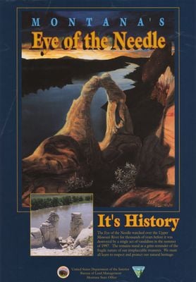
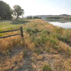
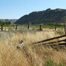
Eye of the Needle, Natural arch near Fort Benton, Montana, US

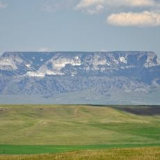
The Eye of the Needle was a natural stone arch formation rising along the Missouri River, consisting of two sandstone pillars connected at the top by a curved span. The structure dominated the surrounding river landscape with its distinctive silhouette.

The formation was documented in 1805 by Meriwether Lewis during the Lewis and Clark Expedition as they navigated the upper Missouri River. Natural forces eventually caused the arch structure to collapse in 1997.

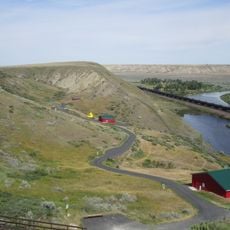
The arch served as a natural landmark for those traveling the Missouri River and exploring this remote corner of Montana. River travelers and locals used it as a reference point when moving through the area.

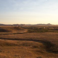
The site is accessible only by boat, located about 55 river miles east of Fort Benton near the Eagle Creek Campground. Visitors should note that only two sandstone pillars about 20 feet tall remain from the original formation.

The formation is connected to the Lewis and Clark Expedition, which documented its existence and provided proof that the structure had survived for millennia. Its destruction through gradual erosion shows how even substantial rock formations eventually give way to time and weather.

The community of curious travelers

AroundUs brings together thousands of curated places, local tips, and hidden gems, enriched daily by 60,000 contributors worldwide.

Start exploring
Location
GPS coordinates
47.91110,-110.06200
Latest update
December 12, 2025 17:48
Around this place
Great Falls
United States of America

Great Falls

88 km
Bearpaw Shale
Canada

Bearpaw Shale

56.3 km
Great Falls
United States of America

Great Falls

88.2 km
Fort Assinniboine
United States of America

Fort Assinniboine

68.5 km
Rainbow Falls
United States of America

Rainbow Falls

95.2 km
Rainbow Dam
United States of America

Rainbow Dam

95.3 km
Great Falls Portage
United States of America

Great Falls Portage

91.9 km
Great Falls Air Defense Sector
United States of America

Great Falls Air Defense Sector

94.7 km
Too Close For Comfort Site
United States of America

Too Close For Comfort Site

76.8 km
Fort Benton Historic District
United States of America

Fort Benton Historic District

46.5 km
Fort Benton Bridge
United States of America

Fort Benton Bridge

45.9 km
Havre Residential Historic District
United States of America

Havre Residential Historic District

76.3 km
Judith Landing Historic District
United States of America

Judith Landing Historic District

37.9 km
H. Earl Clack House
United States of America

H. Earl Clack House

76.4 km
First State Bank of Chester
United States of America

First State Bank of Chester

94.7 km
Young–Almas House
United States of America

Young–Almas House

80.9 km
Carnegie Public Library
United States of America

Carnegie Public Library

76.6 km
Chouteau County Courthouse
United States of America

Chouteau County Courthouse

46.2 km
Masonic Building
United States of America

Masonic Building

45.9 km
Ervin Homestead-Gist Bottom Historic District
United States of America

Ervin Homestead-Gist Bottom Historic District

79.4 km
Fort Benton Engine House
United States of America

Fort Benton Engine House

45.9 km
Grand Union Hotel
United States of America

Grand Union Hotel

46.5 km
Havre Beneath the Streets
United States of America

Havre Beneath the Streets

77 km
Old Fort Benton
United States of America

Old Fort Benton

46 km
Montana Agricultural Center
United States of America

Montana Agricultural Center

46.1 km
Square Butte
United States of America

Square Butte

50.4 km
Chief Joseph Battleground of the Bear's Paw
United States of America

Chief Joseph Battleground of the Bear's Paw

82.1 km
Rainbow Falls Bridge
United States of America

Rainbow Falls Bridge

95.4 km
Show the full map
« Eye of the Needle - Natural arch near Fort Benton, Montana, US » is provided by Around Us (aroundus.com). Images and texts are derived from Wikimedia project under a Creative Commons license. You are allowed to copy, distribute, and modify copies of this page, under the conditions set by the license, as long as this note is clearly visible.

Discover hidden gems everywhere you go!

From secret cafés to breathtaking viewpoints, skip the crowded tourist spots and find places that match your style. Our app makes it easy with voice search, smart filtering, route optimization, and insider tips from travelers worldwide. Download now for the complete mobile experience.

Around Us App Screenshot

A unique approach to discovering new places

Le Figaro

All the places worth exploring

France Info

A tailor-made excursion in just a few clicks

20 Minutes

Around Us
Travel Guide & Maps
Download

Send to your phone

QR Code
1

Open the camera app on your mobile.

2

Point at the QR code with your camera. A notification will appear.

3

Tap the notification to open the link.