Chest opened
+${chestReward.xp} XP
Explorer
NOUVEAU ×${chestReward.collectible.quantity}
tapez pour fermer

See the monuments around you in AR Open chests in the app

Around Us is built for your phone — point your camera at the streets and discover the monuments and places around you in augmented reality. Around Us is built for your phone — chests unlock when you walk, explore and capture nearby places.

•

Enable Location

We need your location to show you interesting places around you

Discover nearby places

Find interesting locations and hidden gems around you

Precise directions

Get accurate directions and distances to places

Your location is never shared with other users. It's only used when you tap the location button.

Rainbow Dam

Log in to your account

Start exploring — it's free

Trusted by 89,139 travelers worldwide

Continue with Google
Continue with Apple
or

We will send you a code to connect

By continuing, you accept our Terms and Conditions and our Privacy Policy

Check your inbox

We've sent a pincode in your inbox. Please enter the code below.

Discussion Reviews 1 Photos
3.3k Popularity

Rainbow Dam, Hydroelectric power station in Cascade County, Montana

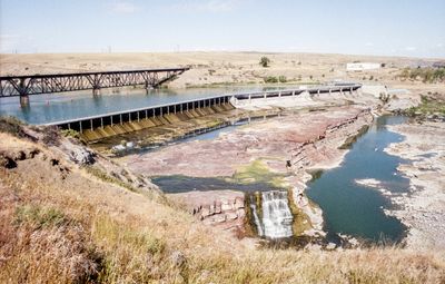
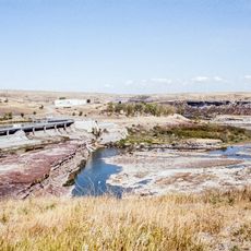
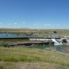
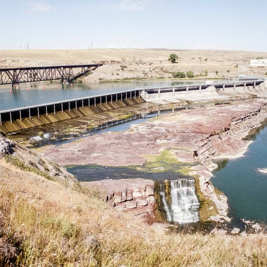
Rainbow Dam is a hydroelectric facility that stretches 322 meters across the Missouri River to harness water flow for power generation. The structure contains eight generating units that contribute to the region's electricity supply.

The facility was built in 1910 and began operating with eight generating units right away. Shortly after, in 1912, Montana Power Company took control of the installation.

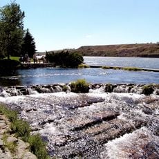
The dam takes its name from a striking waterfall in the area that has long been part of local identity and landscape. From the surroundings, visitors can sense how the structure ties together human engineering and the river's natural power.

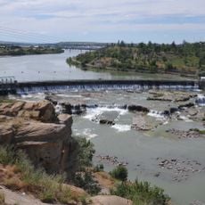
The site can be viewed from various spots near the river, giving good views of the structure and how water moves through the system. Best visibility comes from exploring different riverbank areas and outlooks along the surroundings.

Water flows through long pipes that extend over half a mile before returning to the river at another location downstream. This extended water route is an impressive technical detail that shows the system's complexity.

The community of curious travelers

AroundUs brings together thousands of curated places, local tips, and hidden gems, enriched daily by 60,000 contributors worldwide.

Start exploring
Location
Length
322 m
GPS coordinates
47.53368,-111.20685
Latest update
September 12, 2026 03:36
Around this place
Giant Springs
United States of America

Giant Springs

0.8 mi
Black Eagle Dam
United States of America

Black Eagle Dam

2.8 mi
490th Missile Squadron
United States of America

490th Missile Squadron

2.2 mi
Rainbow Falls
United States of America

Rainbow Falls

0.2 mi
Great Falls Air Defense Sector
United States of America

Great Falls Air Defense Sector

1.7 mi
United States of America

Colter Falls

0.5 mi
Elkhorn Diner Dining Facility
United States of America

Elkhorn Diner Dining Facility

1.5 mi
Rainbow Falls Bridge
United States of America

Rainbow Falls Bridge

500 ft
United States of America

Rainbow Dam Overlook

0.1 mi
United States of America

Black Eagle Falls

2.8 mi
United States of America

Statue

2.8 mi
United States of America

Scenic viewpoint

2.4 mi
United States of America

Rainbow Dam Overlook

0.2 mi
United States of America

Scenic viewpoint

2.6 mi
United States of America

Electric City Speedway

3.6 mi
United States of America

Steamboat Island Scenic Overlook

1.7 mi
United States of America

Crooked Falls

0.5 mi
United States of America

Black Eagle Dam

2.8 mi
United States of America

Monument featuring aircraft, tourist attraction

1.9 mi
United States of America

Monument featuring aircraft, tourist attraction

1.9 mi
United States of America

Monument featuring aircraft, tourist attraction

1.9 mi
United States of America

Tourist attraction, monument featuring aircraft

1.9 mi
United States of America

Monument featuring aircraft, tourist attraction

1.9 mi
United States of America

Monument featuring aircraft, tourist attraction

1.9 mi
United States of America

Monument featuring aircraft, tourist attraction

1.9 mi
United States of America

Tourist attraction, vehicle

1.9 mi
United States of America

Tourist attraction, vehicle

1.9 mi
United States of America

Vehicle, tourist attraction

1.9 mi
Show the full map
Reviews
Share your experience

No review yet

Discussions
Start a discussion...

No discussion yet

« Rainbow Dam - Hydroelectric power station in Cascade County, Montana » is provided by Around Us (aroundus.com). Images and texts are derived from Wikimedia project under a Creative Commons license. You are allowed to copy, distribute, and modify copies of this page, under the conditions set by the license, as long as this note is clearly visible.

Discover hidden gems everywhere you go!

From secret cafés to breathtaking viewpoints, skip the crowded tourist spots and find places that match your style. Our app makes it easy with voice search, smart filtering, route optimization, and insider tips from travelers worldwide. Download now for the complete mobile experience.

Around Us App Screenshot
❝

A unique approach to discovering new places❞

— Le Figaro

❝

All the places worth exploring❞

— France Info

❝

A tailor-made excursion in just a few clicks❞

— 20 Minutes

Around Us
Travel Guide & Maps
Download

Send to your phone

QR Code
1

Open the camera app on your mobile.

2

Point at the QR code with your camera. A notification will appear.

3

Tap the notification to open the link.