Great Falls Air Defense Sector

Log in to your account

AroundUs is a community-driven map of interesting places, built by curious explorers like you. It grows with every review, story, and photo you share.
Connect to save your favorite spots, contribute locations, and create personalized routes.
Continue with Google
Continue with Apple
Continue with X
Continue with Facebook
Continue with email
By continuing, you accept our Terms and Conditions and our Privacy Policy
Create an account

Great Falls Air Defense Sector

Add to collection
Map
Suggest a change
Share

Great Falls Air Defense Sector, Military defense installation in Great Falls, Montana

The Great Falls Air Defense Sector was a military command headquartered at Malmstrom Air Force Base that monitored airspace over Montana using radar surveillance systems. It served as the coordination hub for multiple fighter squadrons positioned across the region to detect and respond to potential threats.

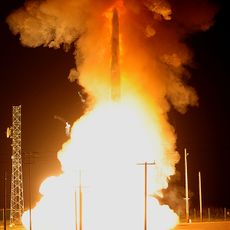
The sector was established in 1959 during the height of Cold War tensions to provide round-the-clock airspace surveillance over the central United States. Its deactivation in 1966 reflected changing defense strategies and the shift toward newer surveillance technologies.

The sector was deeply woven into Great Falls' identity as a military town, with defense operations shaping how residents understood their role in national security. Local families had members stationed there, and the base's presence influenced community life and civic pride throughout the Cold War.

The sector's headquarters was located at Malmstrom Air Force Base on the outskirts of Great Falls and was not open to the general public. Today, visitors interested in learning about this chapter of Cold War defense can visit museums and historical centers that document the base's role.

The facility was equipped with advanced AN/FSQ-7 computer systems that were state-of-the-art for their time, allowing the command to track aircraft movements in real time. These computers represented cutting-edge technology that was also adapted for other military operations across the country.

Location: Montana

GPS coordinates: 47.51640,-111.18200

Latest update: December 12, 2025 12:08

Photos
Around this place
Great Falls
United States of America

Great Falls

7.4 km
Black Eagle Dam
United States of America

Black Eagle Dam

6.1 km
First Peoples Buffalo Jump State Park
United States of America

First Peoples Buffalo Jump State Park

26.3 km
C. M. Russell Museum Complex
United States of America

C. M. Russell Museum Complex

7.9 km
Great Falls
United States of America

Great Falls

7.3 km
490th Missile Squadron
United States of America

490th Missile Squadron

1.4 km
Rainbow Falls
United States of America

Rainbow Falls

2.6 km
Rainbow Dam
United States of America

Rainbow Dam

2.6 km
Great Falls Portage
United States of America

Great Falls Portage

2.8 km
Sluice Boxes State Park
United States of America

Sluice Boxes State Park

42.9 km
Benton Lake National Wildlife Refuge
United States of America

Benton Lake National Wildlife Refuge

20.1 km
J. C. Adams Stone Barn
United States of America

J. C. Adams Stone Barn

38 km
Paris Gibson Square Museum of Art
United States of America

Paris Gibson Square Museum of Art

7.7 km
St. Ann's Cathedral
United States of America

St. Ann's Cathedral

8.6 km
Cascade County Courthouse
United States of America

Cascade County Courthouse

8.9 km
Timothy Edwards Collins Mansion
United States of America

Timothy Edwards Collins Mansion

11 km
Masonic Temple
United States of America

Masonic Temple

8.4 km
Tenth Street Bridge
United States of America

Tenth Street Bridge

8.1 km
Lee M. Ford House
United States of America

Lee M. Ford House

8.9 km
Margaret Block
United States of America

Margaret Block

8.9 km
Our Savior's Lutheran Church (Great Falls)
United States of America

Our Savior's Lutheran Church (Great Falls)

7.7 km
First English Evangelical Lutheran Church (Great Falls)
United States of America

First English Evangelical Lutheran Church (Great Falls)

8.5 km
Liberty Theatre
United States of America

Liberty Theatre

10.2 km
Great Falls Central Business Historic District
United States of America

Great Falls Central Business Historic District

8.8 km
First Presbyterian Church (Great Falls)
United States of America

First Presbyterian Church (Great Falls)

7.8 km
Trinity Lutheran Church (Great Falls)
United States of America

Trinity Lutheran Church (Great Falls)

7.9 km
Millegan Road Bridge
United States of America

Millegan Road Bridge

25.9 km
Rainbow Falls Bridge
United States of America

Rainbow Falls Bridge

2.8 km
Show the full map
Reviews

Visited this place? Tap the stars to rate it and share your experience / photos with the community! Try now! You can cancel it anytime.

« Great Falls Air Defense Sector - Military defense installation in Great Falls, Montana » is provided by Around Us (aroundus.com). Images and texts are derived from Wikimedia project under a Creative Commons license. You are allowed to copy, distribute, and modify copies of this page, under the conditions set by the license, as long as this note is clearly visible.

Discover hidden gems everywhere you go!

From secret cafés to breathtaking viewpoints, skip the crowded tourist spots and find places that match your style. Our app makes it easy with voice search, smart filtering, route optimization, and insider tips from travelers worldwide. Download now for the complete mobile experience.

Around Us App Screenshot

A unique approach to discovering new places

Le Figaro

All the places worth exploring

France Info

A tailor-made excursion in just a few clicks

20 Minutes