Chest opened
+${chestReward.xp} XP
Explorer
NOUVEAU ×${chestReward.collectible.quantity}
tapez pour fermer
Chest locked

Open chests in the app

Around Us is built for your phone — chests unlock when you walk, explore and capture nearby places.

Enable Location

We need your location to show you interesting places around you

Discover nearby places

Find interesting locations and hidden gems around you

Precise directions

Get accurate directions and distances to places

Your location is never shared with other users. It's only used when you tap the location button.

Thunder Basin National Grassland

Log in to your account

Start exploring — it's free

Trusted by 72,993 travelers worldwide

Continue with Google
Continue with Apple
or

We will send you a code to connect

By continuing, you accept our Terms and Conditions and our Privacy Policy

Check your inbox

We've sent a pincode in your inbox. Please enter the code below.

Thunder Basin National Grassland
Discussion Reviews 1 Photos
11.5k Popularity

Thunder Basin National Grassland, National grassland and forest in northeastern Wyoming, United States.

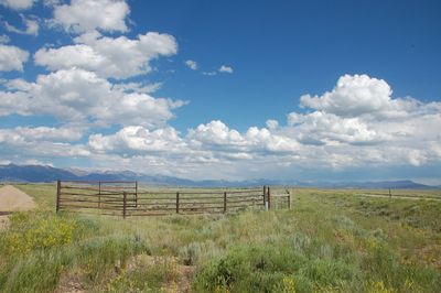
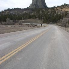
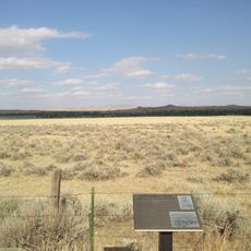
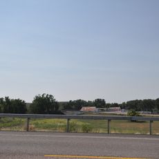
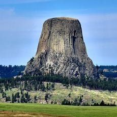
Thunder Basin National Grassland is a large tract of grassland and forest in northeastern Wyoming spanning roughly 547,000 acres, characterized by rolling hills, scattered rock outcrops, and open prairie. The terrain lies between the Big Horn Mountains and Black Hills and is crossed by numerous trails and roads.

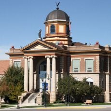
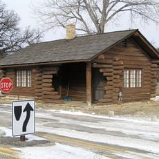
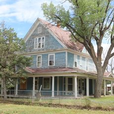
The area became a National Grassland in 1960 when the U.S. Forest Service took responsibility for managing federal, state, and private lands together. Before this official designation, ranchers and settlers had long adapted to living in this high plains environment.

Ranching families have raised cattle and sheep across this land for generations, shaping the rural character of Wyoming. The sight of herds grazing among the grasslands remains a defining feature of how people use this territory.

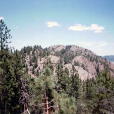
The grassland offers many trails suitable for hiking at different levels, ranging from short walks to longer treks across open prairie and wooded sections. Visitors should expect minimal facilities and come prepared with water and gear for the terrain.

The grassland serves as critical breeding habitat for mountain plovers, which nest in prairie dog colonies where they find protection from predators. This uncommon bird species depends on these specific conditions and is carefully monitored by land managers.

The community of curious travelers

AroundUs brings together thousands of curated places, local tips, and hidden gems, enriched daily by 60,000 contributors worldwide.

Start exploring
Location
Location
Location
Location
Location
Inception
June 23, 1960
GPS coordinates
43.68000,-105.02000
Latest update
December 8, 2025 13:40
Around this place
Tower Ladder
United States of America

Tower Ladder

104.2 km
Keyhole State Park
United States of America

Keyhole State Park

74.4 km
Inyan Kara Mountain
United States of America

Inyan Kara Mountain

80.1 km
Wyoming Highway 110
United States of America

Wyoming Highway 110

103.9 km
Old Headquarters Area Historic District
United States of America

Old Headquarters Area Historic District

104.2 km
Cantonment Reno
United States of America

Cantonment Reno

100 km
DSD Bridge over Cheyenne River
United States of America

DSD Bridge over Cheyenne River

77.3 km
Jenney Stockade Site
United States of America

Jenney Stockade Site

74.3 km
Christ Episcopal Church and Rectory
United States of America

Christ Episcopal Church and Rectory

106.6 km
Wyoming Army National Guard Cavalry Stable
United States of America

Wyoming Army National Guard Cavalry Stable

69.1 km
Morton Mansion
United States of America

Morton Mansion

106.6 km
EDZ Irigary Bridge
United States of America

EDZ Irigary Bridge

95.8 km
Sundance State Bank Building
United States of America

Sundance State Bank Building

95.7 km
Weston County Courthouse
United States of America

Weston County Courthouse

68.6 km
Entrance Station
United States of America

Entrance Station

104.4 km
Sundance School
United States of America

Sundance School

95.8 km
Gillette City Hall
United States of America

Gillette City Hall

94.9 km
Jewel Cave
United States of America

Jewel Cave

96 km
Devils Tower Information Marker
United States of America

Devils Tower Information Marker

101.5 km
Arthur and Ellen Colgan House
United States of America

Arthur and Ellen Colgan House

105.3 km
Douglas Railroad Interpretive Center
United States of America

Douglas Railroad Interpretive Center

106.7 km
Jewel Cave Ranger Station
United States of America

Jewel Cave Ranger Station

95 km
Historic Trail and Cave Entrance
United States of America

Historic Trail and Cave Entrance

94.9 km
Gillette Fishing Lake
United States of America

Gillette Fishing Lake

75.3 km
Dogie Theater
United States of America

Dogie Theater

68.5 km
Douglas Municipal Water Park
United States of America

Douglas Municipal Water Park

106.5 km
Jewel Cave Visitor Center
United States of America

Jewel Cave Visitor Center

96 km
Gillette College Pedestrian Bridge
United States of America

Gillette College Pedestrian Bridge

75.7 km
Show the full map
Reviews
Share your experience

No review yet

Discussions
Start a discussion...

No discussion yet

« Thunder Basin National Grassland - National grassland and forest in northeastern Wyoming, United States » is provided by Around Us (aroundus.com). Images and texts are derived from Wikimedia project under a Creative Commons license. You are allowed to copy, distribute, and modify copies of this page, under the conditions set by the license, as long as this note is clearly visible.

Discover hidden gems everywhere you go!

From secret cafés to breathtaking viewpoints, skip the crowded tourist spots and find places that match your style. Our app makes it easy with voice search, smart filtering, route optimization, and insider tips from travelers worldwide. Download now for the complete mobile experience.

Around Us App Screenshot

A unique approach to discovering new places

Le Figaro

All the places worth exploring

France Info

A tailor-made excursion in just a few clicks

20 Minutes

Around Us
Travel Guide & Maps
Download

Send to your phone

QR Code
1

Open the camera app on your mobile.

2

Point at the QR code with your camera. A notification will appear.

3

Tap the notification to open the link.