Enable Location

We need your location to show you interesting places around you

Discover nearby places

Find interesting locations and hidden gems around you

Precise directions

Get accurate directions and distances to places

Your location is never shared with other users. It's only used when you tap the location button.

Tiber Dam

Log in to your account

Start exploring — it's free

Trusted by 61,983 travelers worldwide

Continue with Google
Continue with Apple
or

We will send you a code to connect

By continuing, you accept our Terms and Conditions and our Privacy Policy

Check your inbox

We've sent a pincode in your inbox. Please enter the code below.

Tiber Dam

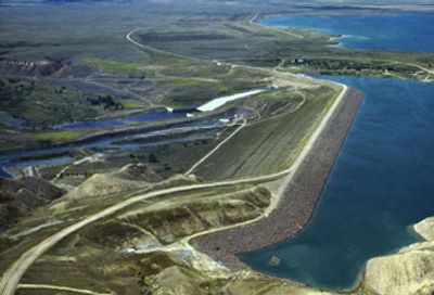
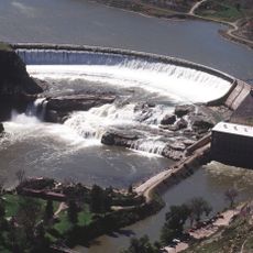
Tiber Dam, Embankment dam in Liberty County, Montana

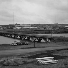
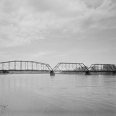
The Tiber Dam stretches across the Marias River, creating a large reservoir with numerous recreational areas surrounding the water. The structure is made of compacted earth and rock materials, with several boat ramps and camping facilities distributed around the shoreline.

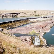
The dam was constructed between 1952 and 1956 to store water for irrigation and power generation. In later decades, reinforcement work was done to address erosion problems and improve structural integrity.

The dam and its reservoir serve as a gathering place where locals and visitors enjoy fishing and water activities together. People come here to spend time on the water and experience the outdoors as part of their regular recreation.

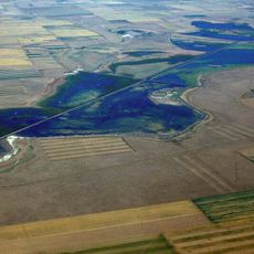
The area around the reservoir is easily accessible with multiple boat ramps and camping facilities spread around the shoreline. The nearest town with supplies and services is Chester, located a short drive away.

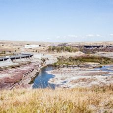
The dam creates a body of water with varying depths and shoreline characteristics across its expanse. This diversity in water conditions and landscape allows different recreational activities to thrive in the same location.

The community of curious travelers

AroundUs brings together thousands of curated places, local tips, and hidden gems, enriched daily by 60,000 contributors worldwide.

Start exploring
Location
GPS coordinates
48.32190,-111.09800
Latest update
December 12, 2025 12:07
Around this place
Great Falls
United States of America

Great Falls

83.7 km
Black Eagle Dam
United States of America

Black Eagle Dam

90.1 km
C. M. Russell Museum Complex
United States of America

C. M. Russell Museum Complex

91.5 km
Great Falls
United States of America

Great Falls

83.9 km
490th Missile Squadron
United States of America

490th Missile Squadron

91.2 km
Rainbow Falls
United States of America

Rainbow Falls

88 km
Rainbow Dam
United States of America

Rainbow Dam

88 km
Great Falls Portage
United States of America

Great Falls Portage

88.1 km
Great Falls Air Defense Sector
United States of America

Great Falls Air Defense Sector

89.9 km
Benton Lake National Wildlife Refuge
United States of America

Benton Lake National Wildlife Refuge

75.2 km
Eye of the Needle
United States of America

Eye of the Needle

89.5 km
St. Ann's Cathedral
United States of America

St. Ann's Cathedral

91.7 km
Montana ExpoPark
United States of America

Montana ExpoPark

91.4 km
Fort Benton Historic District
United States of America

Fort Benton Historic District

64.4 km
Cascade County Courthouse
United States of America

Cascade County Courthouse

91.8 km
Bethany Lutheran Church
United States of America

Bethany Lutheran Church

57.8 km
Tenth Street Bridge
United States of America

Tenth Street Bridge

90.2 km
Fort Benton Bridge
United States of America

Fort Benton Bridge

64.9 km
First State Bank of Chester
United States of America

First State Bank of Chester

23.5 km
Chouteau County Courthouse
United States of America

Chouteau County Courthouse

64.7 km
Masonic Building
United States of America

Masonic Building

64.9 km
Lee M. Ford House
United States of America

Lee M. Ford House

91.6 km
Fort Benton Engine House
United States of America

Fort Benton Engine House

64.9 km
Grand Union Hotel
United States of America

Grand Union Hotel

64.7 km
Old Fort Benton
United States of America

Old Fort Benton

64.5 km
First English Evangelical Lutheran Church (Great Falls)
United States of America

First English Evangelical Lutheran Church (Great Falls)

91.9 km
Montana Agricultural Center
United States of America

Montana Agricultural Center

64 km
Orpheum Theatre
United States of America

Orpheum Theatre

65.1 km
Show the full map
« Tiber Dam - Embankment dam in Liberty County, Montana » is provided by Around Us (aroundus.com). Images and texts are derived from Wikimedia project under a Creative Commons license. You are allowed to copy, distribute, and modify copies of this page, under the conditions set by the license, as long as this note is clearly visible.

Discover hidden gems everywhere you go!

From secret cafés to breathtaking viewpoints, skip the crowded tourist spots and find places that match your style. Our app makes it easy with voice search, smart filtering, route optimization, and insider tips from travelers worldwide. Download now for the complete mobile experience.

Around Us App Screenshot

A unique approach to discovering new places

Le Figaro

All the places worth exploring

France Info

A tailor-made excursion in just a few clicks

20 Minutes

Around Us
Travel Guide & Maps
Download

Send to your phone

QR Code
1

Open the camera app on your mobile.

2

Point at the QR code with your camera. A notification will appear.

3

Tap the notification to open the link.