Enable Location

We need your location to show you interesting places around you

Discover nearby places

Find interesting locations and hidden gems around you

Precise directions

Get accurate directions and distances to places

Your location is never shared with other users. It's only used when you tap the location button.

Briscoe County

Log in to your account

Start exploring — it's free

Trusted by 62,487 travelers worldwide

Continue with Google
Continue with Apple
or

We will send you a code to connect

By continuing, you accept our Terms and Conditions and our Privacy Policy

Check your inbox

We've sent a pincode in your inbox. Please enter the code below.

Briscoe County, County in Texas Panhandle, United States

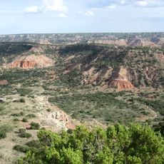
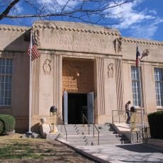
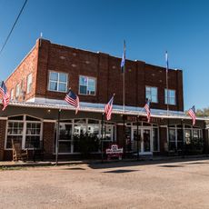
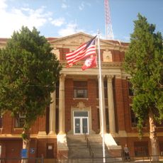
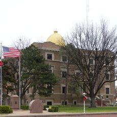
Briscoe County lies in northern Texas and spans a landscape of plains with scattered water reservoirs and gentle terrain. Silverton serves as the administrative center where county offices are located.

The county was established in 1892 and named after Andrew Briscoe, a merchant who signed the Texas Declaration of Independence. This connection to early Texas history remains part of the county's identity.

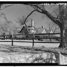
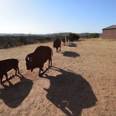
Local communities keep ranching and farming traditions alive through daily work and seasonal gatherings. This connection to rural life shapes how residents relate to each other and the land they work.

Highways 86 and 207 are the main routes that connect communities across the county. A car is necessary for getting around since settlements are spread out over the landscape.

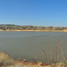
The Mackenzie Reservoir marks a location where cavalry campaigns took place during the 1870s frontier period. This waterway today stands as a reminder of the region's transition from conflict to settlement.

The community of curious travelers

AroundUs brings together thousands of curated places, local tips, and hidden gems, enriched daily by 60,000 contributors worldwide.

Start exploring
Location
Inception
1892
Capital city
Silverton
Shares border with
Armstrong County, Floyd County, Swisher County, Motley County, Donley County, Hall County
GPS coordinates
34.53000,-101.21000
Latest update
December 7, 2025 20:44
Around this place
Palo Duro Canyon
United States of America

Palo Duro Canyon

62.7 km
United States of America

American Quarter Horse Hall of Fame

91.9 km
Caprock Canyons State Park and Trailway
United States of America

Caprock Canyons State Park and Trailway

17.4 km
JA Ranch
United States of America

JA Ranch

32 km
Leaning Tower of Britten
United States of America

Leaning Tower of Britten

75.3 km
Buffalo Lake National Wildlife Refuge
United States of America

Buffalo Lake National Wildlife Refuge

92.2 km
Panhandle–Plains Historical Museum
United States of America

Panhandle–Plains Historical Museum

81.8 km
Amarillo National Bank Sox Stadium
United States of America

Amarillo National Bank Sox Stadium

92.6 km
McClellan Creek National Grassland
United States of America

McClellan Creek National Grassland

81.9 km
Texas Air & Space Museum
United States of America

Texas Air & Space Museum

88.5 km
Hotel Turkey
United States of America

Hotel Turkey

32.4 km
Charles and Mary Ann Goodnight Ranch House
United States of America

Charles and Mary Ann Goodnight Ranch House

55.8 km
Carson County Square House Museum
United States of America

Carson County Square House Museum

92.1 km
Midway Drive-In
United States of America

Midway Drive-In

27.6 km
Cruz Gigante de Groom
United States of America

Cruz Gigante de Groom

76.1 km
Donley County Courthouse and Jail
United States of America

Donley County Courthouse and Jail

53.9 km
Hall County Courthouse
United States of America

Hall County Courthouse

65.5 km
Lake Theo
United States of America

Lake Theo

18.4 km
Palo Duro State Park
United States of America

Palo Duro State Park

61.1 km
Llano Cemetery
United States of America

Llano Cemetery

91.9 km
Sandell Drive-In
United States of America

Sandell Drive-In

54.3 km
Lighthouse Peak
United States of America

Lighthouse Peak

63.5 km
Hale County Courthouse
United States of America

Hale County Courthouse

59.4 km
Randall County Courthouse
United States of America

Randall County Courthouse

82.5 km
Childress County Heritage Museum
United States of America

Childress County Heritage Museum

92.7 km
Texas Outdoor Musical
United States of America

Texas Outdoor Musical

65.6 km
Overlook Interpretive Center
United States of America

Overlook Interpretive Center

18.4 km
Caprock Canyons State Park and Trailway Scenic Overlook
United States of America

Caprock Canyons State Park and Trailway Scenic Overlook

17.4 km
Show the full map
Administrative divisions
« Briscoe County - County in Texas Panhandle, United States » is provided by Around Us (aroundus.com). Images and texts are derived from Wikimedia project under a Creative Commons license. You are allowed to copy, distribute, and modify copies of this page, under the conditions set by the license, as long as this note is clearly visible.

Discover hidden gems everywhere you go!

From secret cafés to breathtaking viewpoints, skip the crowded tourist spots and find places that match your style. Our app makes it easy with voice search, smart filtering, route optimization, and insider tips from travelers worldwide. Download now for the complete mobile experience.

Around Us App Screenshot

A unique approach to discovering new places

Le Figaro

All the places worth exploring

France Info

A tailor-made excursion in just a few clicks

20 Minutes

Around Us
Travel Guide & Maps
Download

Send to your phone

QR Code
1

Open the camera app on your mobile.

2

Point at the QR code with your camera. A notification will appear.

3

Tap the notification to open the link.