Enable Location

We need your location to show you interesting places around you

Discover nearby places

Find interesting locations and hidden gems around you

Precise directions

Get accurate directions and distances to places

Your location is never shared with other users. It's only used when you tap the location button.

Armstrong County

Log in to your account

Start exploring — it's free

Trusted by 61,509 travelers worldwide

Continue with Google
Continue with Apple
or

We will send you a code to connect

By continuing, you accept our Terms and Conditions and our Privacy Policy

Check your inbox

We've sent a pincode in your inbox. Please enter the code below.

Armstrong County, County administrative division in Texas Panhandle, United States

Description

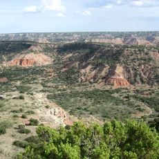
Armstrong County is an administrative division in Texas's Panhandle region, with Claude serving as its governmental center. The landscape consists mainly of open ranchland and prairie.

History

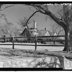
The area opened for settlement after the Red River War in 1874, when Charles Goodnight established ranching operations. The founding of the JA Ranch in 1876 shaped the region's economic development.

Culture

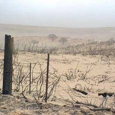
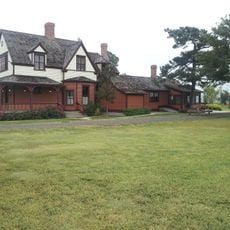
Ranch culture shapes life here, where cattle raising and agricultural traditions define how people work and live. This way of life has formed the community's identity over many generations.

Practical

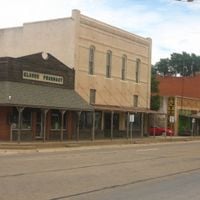
Claude is the administrative center and the best place to find local services and information. It is easily reached via the main roads crossing the region.

Did you know?

The region was shaped by large-scale ranching operations that remain visible today and define the broad, open landscape. These ranches played a key role in creating the Texas ranching heritage.

Location
Inception
1876
Capital city
Claude
Shares border with
Carson County, Gray County, Donley County, Briscoe County, Swisher County, Randall County, Potter County
GPS coordinates
34.97000,-101.35000
Latest update
December 7, 2025 20:41

AroundUs brings together thousands of curated places, local tips, and hidden gems, enriched daily by 60,000 contributors worldwide. Discover all places nearby (Texas).

Around this place
Palo Duro Canyon
United States of America

Palo Duro Canyon

29 km
United States of America

American Quarter Horse Hall of Fame

48.6 km
JA Ranch
United States of America

JA Ranch

22.5 km
Amarillo Civic Center
United States of America

Amarillo Civic Center

51.3 km
Leaning Tower of Britten
United States of America

Leaning Tower of Britten

35.2 km
Atchison, Topeka and Santa Fe Railway 5000
United States of America

Atchison, Topeka and Santa Fe Railway 5000

51.3 km
Chase Tower
United States of America

Chase Tower

51.8 km
Santa Fe Building
United States of America

Santa Fe Building

51.5 km
Panhandle–Plains Historical Museum
United States of America

Panhandle–Plains Historical Museum

51.8 km
Amarillo National Bank Sox Stadium
United States of America

Amarillo National Bank Sox Stadium

48.7 km
McClellan Creek National Grassland
United States of America

McClellan Creek National Grassland

51.4 km
Texas Air & Space Museum
United States of America

Texas Air & Space Museum

42 km
Amarillo Museum of Art
United States of America

Amarillo Museum of Art

51.3 km
Charles and Mary Ann Goodnight Ranch House
United States of America

Charles and Mary Ann Goodnight Ranch House

16.6 km
Potter County Courthouse
United States of America

Potter County Courthouse

51.5 km
Carson County Square House Museum
United States of America

Carson County Square House Museum

41.9 km
Sacred Heart Cathedral
United States of America

Sacred Heart Cathedral

51.4 km
J. Marvin Jones Federal Building and United States Courthouse
United States of America

J. Marvin Jones Federal Building and United States Courthouse

51.5 km
Cruz Gigante de Groom
United States of America

Cruz Gigante de Groom

33.8 km
Donley County Courthouse and Jail
United States of America

Donley County Courthouse and Jail

42.1 km
Courtyard by Marriott, Downtown Amarillo
United States of America

Courtyard by Marriott, Downtown Amarillo

51.6 km
Palo Duro State Park
United States of America

Palo Duro State Park

28.8 km
Llano Cemetery
United States of America

Llano Cemetery

49.4 km
Sandell Drive-In
United States of America

Sandell Drive-In

41.3 km
Lighthouse Peak
United States of America

Lighthouse Peak

31.9 km
Randall County Courthouse
United States of America

Randall County Courthouse

52.7 km
Texas Outdoor Musical
United States of America

Texas Outdoor Musical

30.1 km
Amarillo Globe Dream House
United States of America

Amarillo Globe Dream House

50.7 km
Show the full map
Administrative divisions
« Armstrong County - County administrative division in Texas Panhandle, United States » is provided by Around Us (aroundus.com). Images and texts are derived from Wikimedia project under a Creative Commons license. You are allowed to copy, distribute, and modify copies of this page, under the conditions set by the license, as long as this note is clearly visible.

Discover hidden gems everywhere you go!

From secret cafés to breathtaking viewpoints, skip the crowded tourist spots and find places that match your style. Our app makes it easy with voice search, smart filtering, route optimization, and insider tips from travelers worldwide. Download now for the complete mobile experience.

Around Us App Screenshot

A unique approach to discovering new places

Le Figaro

All the places worth exploring

France Info

A tailor-made excursion in just a few clicks

20 Minutes

Around Us
Travel Guide & Maps
Download

Send to your phone

QR Code
1

Open the camera app on your mobile.

2

Point at the QR code with your camera. A notification will appear.

3

Tap the notification to open the link.