Enable Location

We need your location to show you interesting places around you

Discover nearby places

Find interesting locations and hidden gems around you

Precise directions

Get accurate directions and distances to places

Your location is never shared with other users. It's only used when you tap the location button.

Log in to your account

Start exploring — it's free

Trusted by 62,059 travelers worldwide

Continue with Google
Continue with Apple
or

We will send you a code to connect

By continuing, you accept our Terms and Conditions and our Privacy Policy

Check your inbox

We've sent a pincode in your inbox. Please enter the code below.

National Helium Reserve

National Helium Reserve, Gas storage facility in Amarillo, Texas, United States

The National Helium Reserve is a gas storage facility in Amarillo, Texas, that stores and distributes natural helium from underground formations. The operation uses a network of pipelines and metering stations to move gas from private recovery plants to the Cliffside gas field and onward to end users.

The reserve was founded in 1917 to supply helium for military blimps during World War I, leading to the Helium Act of 1925. This legislation established the framework for organized helium production and storage, which later became critical for space programs and scientific research.

This facility plays an important role in modern industry and science, as helium is needed for medical equipment, research laboratories, and various manufacturing processes. The reserve shows how resources extracted from the ground are distributed to support jobs and economic activity across the region.

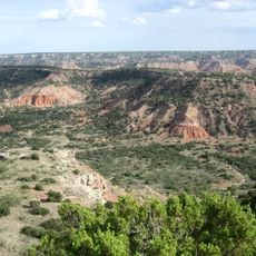
The facility is located about 12 miles northwest of Amarillo and is accessible from the city. Keep in mind this is an active operating site, so tours may be limited or require advance permission.

The pipeline system spans over 420 miles and connects various recovery plants to the Cliffside gas field through a specialized metering network. This extensive infrastructure was one of the largest of its kind for decades and demonstrates the complexity of modern resource management in Texas.

The community of curious travelers

AroundUs brings together thousands of curated places, local tips, and hidden gems, enriched daily by 60,000 contributors worldwide.

Start exploring
Location
GPS coordinates
35.19110,-101.95500
Latest update
December 17, 2025 09:56
Around this place
Cadillac Ranch
United States of America

Cadillac Ranch

2.9 km
Palo Duro Canyon
United States of America

Palo Duro Canyon

37.5 km
United States of America

American Quarter Horse Hall of Fame

13.4 km
Don Harrington Discovery Center
United States of America

Don Harrington Discovery Center

3.9 km
Amarillo Civic Center
United States of America

Amarillo Civic Center

11.4 km
Atchison, Topeka and Santa Fe Railway 5000
United States of America

Atchison, Topeka and Santa Fe Railway 5000

11.6 km
Wonderland Park
United States of America

Wonderland Park

12.5 km
Buffalo Lake National Wildlife Refuge
United States of America

Buffalo Lake National Wildlife Refuge

37.1 km
Chase Tower
United States of America

Chase Tower

10.7 km
Santa Fe Building
United States of America

Santa Fe Building

10.7 km
Panhandle–Plains Historical Museum
United States of America

Panhandle–Plains Historical Museum

23.7 km
Amarillo National Bank Sox Stadium
United States of America

Amarillo National Bank Sox Stadium

14.2 km
Texas Air & Space Museum
United States of America

Texas Air & Space Museum

23.4 km
Texas Tornado
United States of America

Texas Tornado

12.6 km
Amarillo Museum of Art
United States of America

Amarillo Museum of Art

10 km
Potter County Courthouse
United States of America

Potter County Courthouse

11.1 km
Carson County Square House Museum
United States of America

Carson County Square House Museum

54.9 km
Sacred Heart Cathedral
United States of America

Sacred Heart Cathedral

10.9 km
J. Marvin Jones Federal Building and United States Courthouse
United States of America

J. Marvin Jones Federal Building and United States Courthouse

11.2 km
Courtyard by Marriott, Downtown Amarillo
United States of America

Courtyard by Marriott, Downtown Amarillo

10.8 km
Deaf Smith County Historical Museum
United States of America

Deaf Smith County Historical Museum

57.9 km
Palo Duro State Park
United States of America

Palo Duro State Park

39.2 km
Llano Cemetery
United States of America

Llano Cemetery

11.7 km
Lighthouse Peak
United States of America

Lighthouse Peak

36.8 km
Randall County Courthouse
United States of America

Randall County Courthouse

23.7 km
Amarillo Natatorium
United States of America

Amarillo Natatorium

8.4 km
Texas Outdoor Musical
United States of America

Texas Outdoor Musical

34.7 km
Amarillo Globe Dream House
United States of America

Amarillo Globe Dream House

10.2 km
Show the full map
« National Helium Reserve - Gas storage facility in Amarillo, Texas, United States » is provided by Around Us (aroundus.com). Images and texts are derived from Wikimedia project under a Creative Commons license. You are allowed to copy, distribute, and modify copies of this page, under the conditions set by the license, as long as this note is clearly visible.

Discover hidden gems everywhere you go!

From secret cafés to breathtaking viewpoints, skip the crowded tourist spots and find places that match your style. Our app makes it easy with voice search, smart filtering, route optimization, and insider tips from travelers worldwide. Download now for the complete mobile experience.

Around Us App Screenshot

A unique approach to discovering new places

Le Figaro

All the places worth exploring

France Info

A tailor-made excursion in just a few clicks

20 Minutes

Around Us
Travel Guide & Maps
Download

Send to your phone

QR Code
1

Open the camera app on your mobile.

2

Point at the QR code with your camera. A notification will appear.

3

Tap the notification to open the link.