Woodward County

Log in to your account

AroundUs is a community-driven map of interesting places, built by curious explorers like you. It grows with every review, story, and photo you share.
Connect to save your favorite spots, contribute locations, and create personalized routes.
By continuing, you accept our Terms and Conditions and our Privacy Policy
Add to collection
Map
Suggest a change
Share

Woodward County, Administrative county in Oklahoma, United States

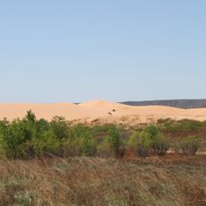
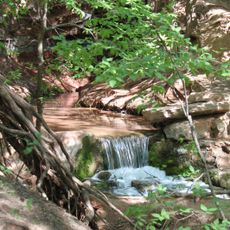
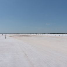
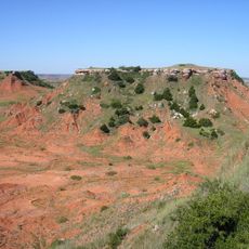
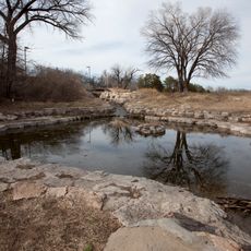
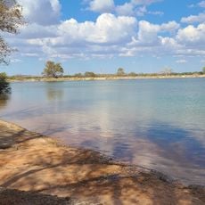
Woodward County is an administrative division in Oklahoma featuring grassland terrain with two major rivers running through the region. The landscape transitions between open prairie and river valleys that shape the character of the area.

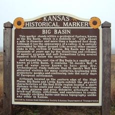
The county formed in 1893 from settlement of the Cherokee Outlet and received its present name through a vote in 1894. Its early identity reflected the pattern of territorial expansion that characterized the period.

Local governance involves three district commissioners who oversee public services and make decisions affecting the county's 20,470 residents.

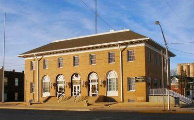
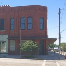
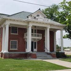
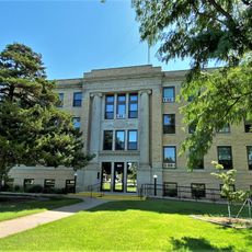
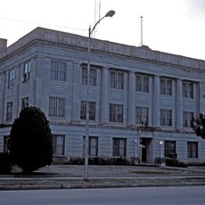
The county seat is located in the city of Woodward and houses the main administrative offices. Most public services and record offices operate on weekday schedules during standard business hours.

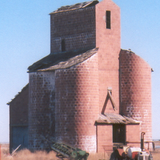
The region is a major wheat-producing area with deep agricultural roots in the community. What often goes unnoticed is how energy development has become equally important to the local economy without overshadowing farming tradition.

Location: Oklahoma

Inception: 1893

Capital city: Woodward

Shares border with: Major County, Woods County, Dewey County, Harper County, Ellis County

Website: http://woodwardcounty.org

GPS coordinates: 36.42000,-99.26000

Latest update: December 10, 2025 15:56

Photos
Around this place
Show the full map
Little Sahara State Park
United States of America

Little Sahara State Park

36.1 km
Foss Reservoir
United States of America

Foss Reservoir

94.9 km
Great Salt Plains Lake
United States of America

Great Salt Plains Lake

102.3 km
Roman Nose State Park
United States of America

Roman Nose State Park

92.3 km
Alabaster Caverns State Park
United States of America

Alabaster Caverns State Park

32.6 km
Salt Plains National Wildlife Refuge
United States of America

Salt Plains National Wildlife Refuge

99.6 km
Gloss Mountain State Park
United States of America

Gloss Mountain State Park

61.3 km
Boiling Springs State Park
United States of America

Boiling Springs State Park

5.3 km
Big Basin Prairie Preserve
United States of America

Big Basin Prairie Preserve

112.5 km
Fort Supply
United States of America

Fort Supply

32 km
Sod House
United States of America

Sod House

75.2 km
Washita National Wildlife Refuge
United States of America

Washita National Wildlife Refuge

90.4 km
Ingersoll Tile Elevator
United States of America

Ingersoll Tile Elevator

88.4 km
Central National Bank
United States of America

Central National Bank

68.1 km
L. L. Stine House
United States of America

L. L. Stine House

12.1 km
Protection High School
United States of America

Protection High School

88.8 km
Cherokee Friends Church
United States of America

Cherokee Friends Church

89.3 km
Stockgrowers State Bank
United States of America

Stockgrowers State Bank

96.9 km
Stein House
United States of America

Stein House

97 km
Girl Scout Little House
United States of America

Girl Scout Little House

97.2 km
Lipscomb County Courthouse
United States of America

Lipscomb County Courthouse

93 km
Ashland Grade School
United States of America

Ashland Grade School

96.9 km
Ellis County Courthouse
United States of America

Ellis County Courthouse

55.8 km
Harper County Courthouse
United States of America

Harper County Courthouse

56.5 km
Comanche County Courthouse
United States of America

Comanche County Courthouse

94.6 km
Alfalfa County Courthouse
United States of America

Alfalfa County Courthouse

89 km
The Artesian Beach
United States of America

The Artesian Beach

44.6 km
Cherokee Strip Museum of Alva
United States of America

Cherokee Strip Museum of Alva

66.9 km
Show the full map
Reviews

Visited this place? Tap the stars to rate it and share your experience / photos with the community! Try now! You can cancel it anytime.

« Woodward County - Administrative county in Oklahoma, United States » is provided by Around Us (aroundus.com). Images and texts are derived from Wikimedia project under a Creative Commons license. You are allowed to copy, distribute, and modify copies of this page, under the conditions set by the license, as long as this note is clearly visible.

Discover hidden gems everywhere you go!

From secret cafés to breathtaking viewpoints, skip the crowded tourist spots and find places that match your style. Our app makes it easy with voice search, smart filtering, route optimization, and insider tips from travelers worldwide. Download now for the complete mobile experience.

Around Us App Screenshot

A unique approach to discovering new places

Le Figaro

All the places worth exploring

France Info

A tailor-made excursion in just a few clicks

20 Minutes