Chest opened
+${chestReward.xp} XP
Explorer
NOUVEAU ×${chestReward.collectible.quantity}
tapez pour fermer
Chest locked

Open chests in the app

Around Us is built for your phone — chests unlock when you walk, explore and capture nearby places.

Enable Location

We need your location to show you interesting places around you

Discover nearby places

Find interesting locations and hidden gems around you

Precise directions

Get accurate directions and distances to places

Your location is never shared with other users. It's only used when you tap the location button.

Riddle's Station

Log in to your account

Start exploring — it's free

Trusted by 72,891 travelers worldwide

Continue with Google
Continue with Apple
or

We will send you a code to connect

By continuing, you accept our Terms and Conditions and our Privacy Policy

Check your inbox

We've sent a pincode in your inbox. Please enter the code below.

Discussion Reviews 1 Photos
1.2k Popularity

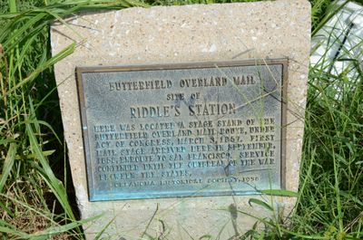
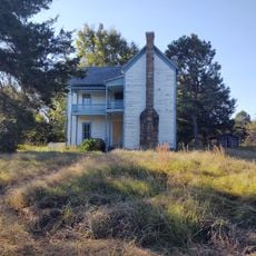
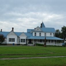
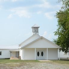
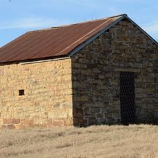
Riddle's Station, Overland Mail stagecoach stop in Oklahoma

Riddle's Station was a stagecoach stop on the Butterfield Overland Mail route through what was once the Choctaw Nation in present-day Latimer County. It sat on the west side of Forche Maline creek and provided travelers with rest, fresh horses, and water and feed for their animals.

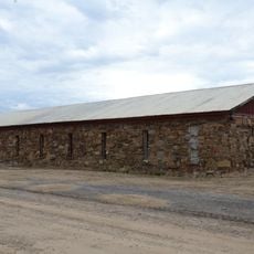
The station was established around 1858 when the Choctaw Council granted Captain John Riddle permission to build a bridge and tollbooth near his site. When the Civil War broke out in 1861, the mail service slowed and eventually stopped as routes became unsafe and were relocated north.

The station was named after Captain John Riddle, a Choctaw leader who held positions on the Choctaw Council and shaped the local community. It reflects how Native American station keepers managed these vital stops and collected tolls to support their businesses and keep services running.

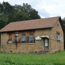
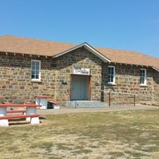
You can reach the station via dirt roads beyond Wilburton, marked by maps and signs to help locate it. The site is positioned near a cemetery on its east side, so plan time to explore the surrounding area.

The Butterfield route was not new but followed existing wagon trails that had been used during the forced removal of the Choctaw and Chickasaw peoples. This reuse of the path connected the history of removal to a new era of communication and commerce.

The community of curious travelers

AroundUs brings together thousands of curated places, local tips, and hidden gems, enriched daily by 60,000 contributors worldwide.

Start exploring
Location
GPS coordinates
34.92053,-95.25670
Latest update
February 9, 2026 07:45
Around this place
Eufaula Lake
United States of America

Eufaula Lake

47.2 km
Robbers Cave State Park
United States of America

Robbers Cave State Park

12 km
Robert S. Kerr Reservoir
United States of America

Robert S. Kerr Reservoir

60.4 km
Arrowhead State Park
United States of America

Arrowhead State Park

43.2 km
Lake Eufaula State Park
United States of America

Lake Eufaula State Park

62.6 km
Lake Wister
United States of America

Lake Wister

47.8 km
Choctaw Capitol Building
United States of America

Choctaw Capitol Building

31.1 km
Peter Conser House
United States of America

Peter Conser House

52.6 km
International Temple, Supreme Assembly, Order of the Rainbow for Girls
United States of America

International Temple, Supreme Assembly, Order of the Rainbow for Girls

46.4 km
Lake Wister State Park
United States of America

Lake Wister State Park

44.3 km
Aldridge Hotel
United States of America

Aldridge Hotel

46.6 km
St. Joseph's Catholic Church
United States of America

St. Joseph's Catholic Church

42.1 km
McAlester House
United States of America

McAlester House

46.1 km
McAlester Scottish Rite Temple
United States of America

McAlester Scottish Rite Temple

46.5 km
Sacred Heart Catholic Church and Rectory
United States of America

Sacred Heart Catholic Church and Rectory

5.1 km
Cole Chapel School
United States of America

Cole Chapel School

26.1 km
Cupco Church
United States of America

Cupco Church

25.5 km
Trahern's Station
United States of America

Trahern's Station

46.9 km
Snow School
United States of America

Snow School

60 km
Terry House
United States of America

Terry House

59.2 km
LeFlore County Courthouse
United States of America

LeFlore County Courthouse

59.6 km
United States of America

Summerfield School

44.1 km
Kinta High School
United States of America

Kinta High School

21 km
First Presbyterian Church
United States of America

First Presbyterian Church

47.6 km
Clayton High School Auditorium
United States of America

Clayton High School Auditorium

37.9 km
Skullyville County Jail
United States of America

Skullyville County Jail

56.6 km
Haskell County Courthouse
United States of America

Haskell County Courthouse

40.5 km
Lake Eufala Dam ORV Area
United States of America

Lake Eufala Dam ORV Area

43.2 km
Show the full map
Reviews
Share your experience

No review yet

Discussions
Start a discussion...

No discussion yet

« Riddle's Station - Overland Mail stagecoach stop in Oklahoma » is provided by Around Us (aroundus.com). Images and texts are derived from Wikimedia project under a Creative Commons license. You are allowed to copy, distribute, and modify copies of this page, under the conditions set by the license, as long as this note is clearly visible.

Discover hidden gems everywhere you go!

From secret cafés to breathtaking viewpoints, skip the crowded tourist spots and find places that match your style. Our app makes it easy with voice search, smart filtering, route optimization, and insider tips from travelers worldwide. Download now for the complete mobile experience.

Around Us App Screenshot

A unique approach to discovering new places

Le Figaro

All the places worth exploring

France Info

A tailor-made excursion in just a few clicks

20 Minutes

Around Us
Travel Guide & Maps
Download

Send to your phone

QR Code
1

Open the camera app on your mobile.

2

Point at the QR code with your camera. A notification will appear.

3

Tap the notification to open the link.