Chest opened
+${chestReward.xp} XP
Explorer
NOUVEAU ×${chestReward.collectible.quantity}
tapez pour fermer
Chest locked

Open chests in the app

Around Us is built for your phone — chests unlock when you walk, explore and capture nearby places.

Enable Location

We need your location to show you interesting places around you

Discover nearby places

Find interesting locations and hidden gems around you

Precise directions

Get accurate directions and distances to places

Your location is never shared with other users. It's only used when you tap the location button.

Checotah

Log in to your account

Start exploring — it's free

Trusted by 72,879 travelers worldwide

Continue with Google
Continue with Apple
or

We will send you a code to connect

By continuing, you accept our Terms and Conditions and our Privacy Policy

Check your inbox

We've sent a pincode in your inbox. Please enter the code below.

Discussion Reviews 1 Photos
33.4k Popularity

Checotah, Administrative town in McIntosh County, United States.

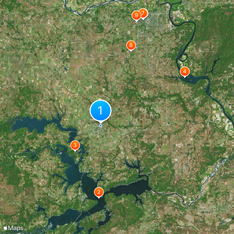
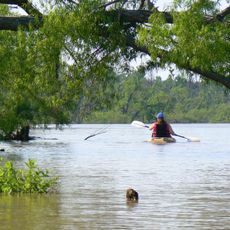
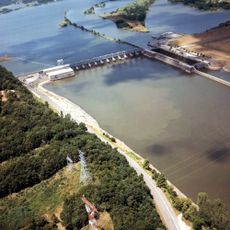
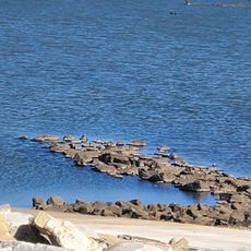
Checotah is a town in McIntosh County, Oklahoma, located where Interstate 40 and U.S. Route 69 meet. The area is shaped by tree-covered land and sits near Eufaula Lake, which adds water and natural surroundings to the landscape.

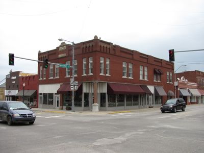
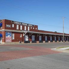
The Missouri-Kansas-Texas Railroad built a railhead in 1872, which led to the town's founding and made it a transportation hub. The Creek Nation granted it an official charter in 1893, securing its political standing.

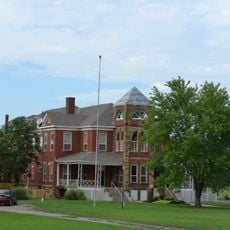
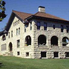
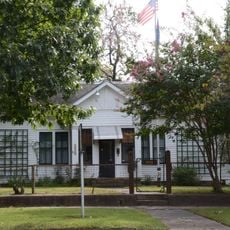
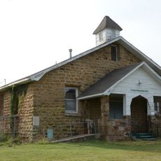
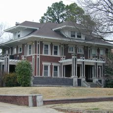
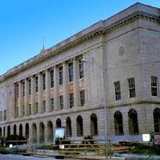
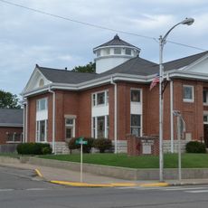
The town center preserves several historic buildings that reflect its local heritage and shape the character of the community. These structures are places where you can experience how the town connects to its roots.

The town sits on a major road corridor and is easy to reach by car, especially for travelers on Interstate 40 passing through the area. Local shops and services meet basic visitor needs throughout the community.

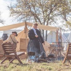
Nearby sits a significant Civil War battlefield that reflects the nation's history during that period. This location draws those interested in learning more about the area's wartime past.

The community of curious travelers

AroundUs brings together thousands of curated places, local tips, and hidden gems, enriched daily by 60,000 contributors worldwide.

Start exploring
Location
Elevation above the sea
198 m
GPS coordinates
35.47194,-95.52389
Latest update
December 19, 2025 23:39
Around this place
Eufaula Lake
United States of America

Eufaula Lake

21.3 km
Lake Eufaula State Park
United States of America

Lake Eufaula State Park

10.6 km
Webbers Falls Lake
United States of America

Webbers Falls Lake

28.6 km
Oklahoma Odd Fellows Home at Checotah
United States of America

Oklahoma Odd Fellows Home at Checotah

880 m
A.W. Patterson House
United States of America

A.W. Patterson House

33.8 km
Grant Foreman House
United States of America

Grant Foreman House

33.7 km
St. Thomas Primitive Baptist Church
United States of America

St. Thomas Primitive Baptist Church

23.7 km
River Country Water Park
United States of America

River Country Water Park

32.5 km
V. R. Coss House
United States of America

V. R. Coss House

33.7 km
Ed Edmondson United States Courthouse
United States of America

Ed Edmondson United States Courthouse

33.7 km
United States of America

W.E.B. DuBois School

23.7 km
First United Methodist Church
United States of America

First United Methodist Church

162 m
Oklahoma Music Hall of Fame
United States of America

Oklahoma Music Hall of Fame

33.4 km
United States of America

Three Rivers Museum

33.4 km
Lake Eufala Dam ORV Area
United States of America

Lake Eufala Dam ORV Area

24.5 km
United States of America

Rotary Park

33 km
United States of America

Gentry Creek Public Use Area

13.2 km
Honey Springs Battlefield
United States of America

Honey Springs Battlefield

7.5 km
United States of America

Taft Institution Lake

29.7 km
United States of America

Padgett Bluff

31.8 km
United States of America

Taylor Bluff

26.7 km
United States of America

Cane Creek Site 18 Reservoir

28.7 km
United States of America

Eagle Crest Golf Course

31.1 km
United States of America

Cobblestone Golf Course

29.4 km
United States of America

Honey Springs Battlefield

7.6 km
United States of America

Plumb Theater

25.9 km
United States of America

Statue, Work of art

33.5 km
United States of America

Work of art, sculpture

33.3 km
Show the full map
Reviews
Share your experience

No review yet

Discussions
Start a discussion...

No discussion yet

« Checotah - Administrative town in McIntosh County, United States » is provided by Around Us (aroundus.com). Images and texts are derived from Wikimedia project under a Creative Commons license. You are allowed to copy, distribute, and modify copies of this page, under the conditions set by the license, as long as this note is clearly visible.

Discover hidden gems everywhere you go!

From secret cafés to breathtaking viewpoints, skip the crowded tourist spots and find places that match your style. Our app makes it easy with voice search, smart filtering, route optimization, and insider tips from travelers worldwide. Download now for the complete mobile experience.

Around Us App Screenshot

A unique approach to discovering new places

Le Figaro

All the places worth exploring

France Info

A tailor-made excursion in just a few clicks

20 Minutes

Around Us
Travel Guide & Maps
Download

Send to your phone

QR Code
1

Open the camera app on your mobile.

2

Point at the QR code with your camera. A notification will appear.

3

Tap the notification to open the link.