McIntosh County

Log in to your account

AroundUs is a community-driven map of interesting places, built by curious explorers like you. It grows with every review, story, and photo you share.
Connect to save your favorite spots, contribute locations, and create personalized routes.
Continue with Google
Continue with Apple
Continue with X
Continue with Facebook
Continue with email
By continuing, you accept our Terms and Conditions and our Privacy Policy
Create an account
Add to collection
Map
Suggest a change
Share

McIntosh County, Administrative division in Oklahoma, United States

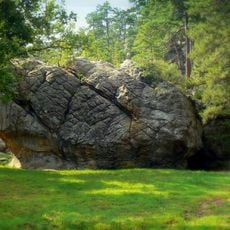
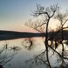
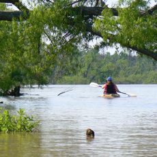
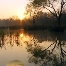
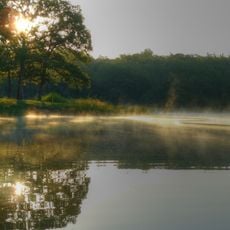
McIntosh County is an administrative division in Oklahoma with rolling hills, wooded regions, and waterways spread throughout. The Eufaula Lake, featuring numerous inlets and peninsulas, is a major geographical feature that shapes the landscape.

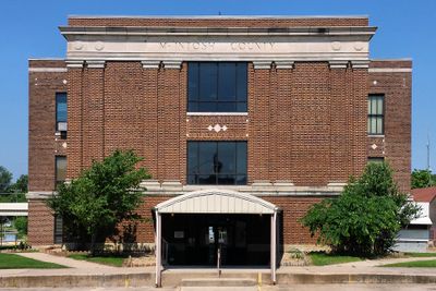
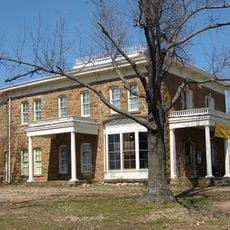
This county was established in 1907 when Oklahoma became a state, taking its name from the McIntosh family. The family had significant influence on the region's early growth and development.

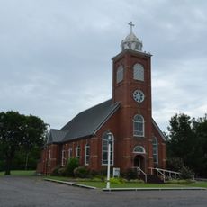
German and Russian traditions shape how locals celebrate and gather throughout the year. You can see these influences in the festivals and community events that bring people together.

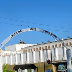
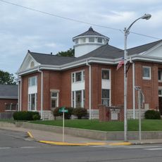
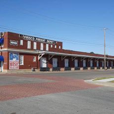
The area consists of small towns and rural communities spread across the county. Plan for travel by car since distances between settlements are significant and public transportation is limited.

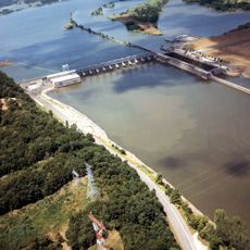
From above, Eufaula Lake displays a complex pattern of inlets and peninsulas that creates an unusual water maze. This intricate shoreline pattern developed naturally and makes the lake visually striking when viewed from the air.

GPS coordinates: 35.36304,-95.66806

Latest update: December 7, 2025 20:40

Photos
Around this place
Eufaula Lake
United States of America

Eufaula Lake

15.5 km
Oklahoma State Penitentiary
United States of America

Oklahoma State Penitentiary

46.7 km
Robbers Cave State Park
United States of America

Robbers Cave State Park

49.9 km
Arrowhead State Park
United States of America

Arrowhead State Park

22.5 km
Creek National Capitol
United States of America

Creek National Capitol

40 km
Five Civilized Tribes Museum
United States of America

Five Civilized Tribes Museum

50.2 km
Lake Eufaula State Park
United States of America

Lake Eufaula State Park

7.3 km
Deep Fork National Wildlife Refuge
United States of America

Deep Fork National Wildlife Refuge

36.5 km
International Temple, Supreme Assembly, Order of the Rainbow for Girls
United States of America

International Temple, Supreme Assembly, Order of the Rainbow for Girls

48.7 km
Webbers Falls Lake
United States of America

Webbers Falls Lake

46.2 km
Eastside Baptist Church
United States of America

Eastside Baptist Church

39.3 km
Okmulgee Park
United States of America

Okmulgee Park

44.2 km
St. Joseph's Catholic Church
United States of America

St. Joseph's Catholic Church

48.2 km
Oklahoma Odd Fellows Home at Checotah
United States of America

Oklahoma Odd Fellows Home at Checotah

18.6 km
McAlester House
United States of America

McAlester House

46.1 km
McAlester Scottish Rite Temple
United States of America

McAlester Scottish Rite Temple

48.4 km
First Baptist Central Church
United States of America

First Baptist Central Church

40.2 km
St. Anthony's Catholic Church
United States of America

St. Anthony's Catholic Church

39.6 km
Cole Chapel School
United States of America

Cole Chapel School

52.2 km
St. Thomas Primitive Baptist Church
United States of America

St. Thomas Primitive Baptist Church

40.6 km
Kinta High School
United States of America

Kinta High School

48.3 km
First Presbyterian Church
United States of America

First Presbyterian Church

48.8 km
Okmulgee Downtown Historic District
United States of America

Okmulgee Downtown Historic District

39.8 km
First United Methodist Church
United States of America

First United Methodist Church

17.7 km
Oklahoma Music Hall of Fame
United States of America

Oklahoma Music Hall of Fame

50.3 km
Okla Theatre
United States of America

Okla Theatre

48.8 km
Honey Springs Battlefield
United States of America

Honey Springs Battlefield

25 km
Nichols Park South Picnic Shelter
United States of America

Nichols Park South Picnic Shelter

28.3 km
Show the full map
Reviews

Visited this place? Tap the stars to rate it and share your experience / photos with the community! Try now! You can cancel it anytime.

« McIntosh County - Administrative division in Oklahoma, United States » is provided by Around Us (aroundus.com). Images and texts are derived from Wikimedia project under a Creative Commons license. You are allowed to copy, distribute, and modify copies of this page, under the conditions set by the license, as long as this note is clearly visible.

Discover hidden gems everywhere you go!

From secret cafés to breathtaking viewpoints, skip the crowded tourist spots and find places that match your style. Our app makes it easy with voice search, smart filtering, route optimization, and insider tips from travelers worldwide. Download now for the complete mobile experience.

Around Us App Screenshot

A unique approach to discovering new places

Le Figaro

All the places worth exploring

France Info

A tailor-made excursion in just a few clicks

20 Minutes