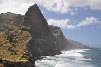
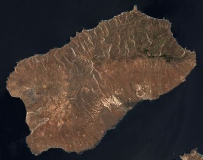
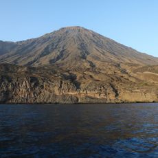
Santo Antão, Mountainous island in Barlavento archipelago, Cape Verde
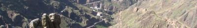
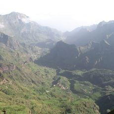
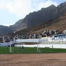
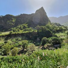
Santo Antão is the northwesternmost island of Cape Verde, featuring steep mountains and deep valleys carved into its terrain. The climate shifts across different parts of the island, creating distinct zones from coastal areas to high peaks.
A navigator named Diogo Afonso discovered the island in the early 1460s, and settlements soon formed near Ribeira Grande. These early communities set the foundation for the villages that grew over the following centuries.
The villages here keep alive old ways of making grogue, a sugarcane spirit tied to farming and daily life in the valleys. Walking through the settlements, you notice how this craft remains part of how people work and trade with their neighbors.
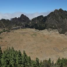
A ferry connects the island to São Vicente in about one hour, with multiple daily departures. Good shoes are needed for hiking the mountainous terrain, and weather at higher elevations can be cool and windy.
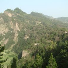
The island is home to about 50 plant species found nowhere else in the world, thriving in its mountainous zones. Some of these plants are rare and fragile, making the natural landscape here particularly precious.
Location: Ribeira Grande
Location: Paul
Location: Porto Novo
Elevation above the sea: 1,175 m
Part of: Barlavento Islands
Address: Santo Antão, Cabo Verde
GPS coordinates: 17.06972,-25.17111
Latest update: December 23, 2025 13:20
Cape Verde offers landscapes and places full of stories that tell how these islands in the Atlantic came to be. This collection shows natural and cultural sites that make the archipelago special — from white sandy beaches to volcanic formations, colonial churches, and markets where the local life is...
Topo da Coroa
13.8 km
Pico da Cruz
15.3 km
Cova-Ribeira da Torre-Paul Natural Park
16.4 km
Cova
12.3 km
Estádio João Serra
16.7 kmMoroços
3.4 km
Don Luis Lighthouse
24.5 km
Farol de Fontes Pereira de Melo
22 kmPonta do Sol Lighthouse
17.3 kmPonta de Mangrande Lighthouse
19.9 km
Vale do Paul
13.9 kmCanyon/ canhão
8.9 kmAmfiteatr
11.8 kmStructure commerciale de plongée sous-marine Blue Eden
11.8 kmCooperativa Babilónia
5.4 kmCanyon/ canhão
6.2 kmGrogue artisanal distillery
7.1 kmUNESCO Património Mundial
19.2 kmFormer Artillery
25.9 kmAldeia
12.2 kmProjecto de Desenvolvimento Comunitario de Lajedos
5.8 kmQuelder Art
13.8 kmQuinta Cochete
5.8 kmPraia De Tropo
11.1 kmPraia dos Curraletes
14.8 kmNossa Senhora da Piedade
20.1 kmWaterfall
4.6 kmWaterfall
9.3 kmVisited this place? Tap the stars to rate it and share your experience / photos with the community! Try now! You can cancel it anytime.
Discover hidden gems everywhere you go!
From secret cafés to breathtaking viewpoints, skip the crowded tourist spots and find places that match your style. Our app makes it easy with voice search, smart filtering, route optimization, and insider tips from travelers worldwide. Download now for the complete mobile experience.
A unique approach to discovering new places❞
— Le Figaro
All the places worth exploring❞
— France Info
A tailor-made excursion in just a few clicks❞
— 20 Minutes