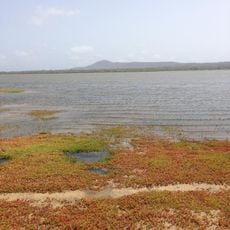
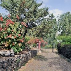
Terras Salgadas, Protected saline area in northwestern Maio Island, Cape Verde.
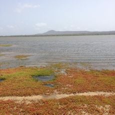
Terras Salgadas is a saline plain covering the northwestern part of Maio Island, within the Parque Natural do Norte da Ilha do Maio. Pale sandy ground dotted with low grey-brown and greenish scrub stretches to a faint line of vegetation, with hazy hills beyond; a narrow tan track curves through it. The area also holds sand dunes, lava formations and marine ecosystems.
Terras Salgadas appears on Jacques-Nicolas Bellin's 1747 map of the Cape Verde islands, labelled "saline" in French and "zoutpan" in Dutch. The area later became part of the Parque Natural do Norte da Ilha do Maio, the protected area covering the north of Maio.
The name Terras Salgadas means "salty lands" in Portuguese, describing the saline plain itself. The nearest settlements are Morrinho, Cascabulho and Santo António, whose residents live beside this protected area in the Parque Natural do Norte da Ilha do Maio. The 1747 map by Jacques-Nicolas Bellin already marked the area, labelling it "saline" in French and "zoutpan" in Dutch.
The reserve lies in the northwest of Maio, with Morrinho, Cascabulho and Santo António the nearest villages; Baía Santana is to the northwest and Baía Galeão to the northeast. The ground is flat sand with low scrub and a tan track curving through it, so orientation is easy but there is almost no shade. Carry water and sun protection, and watch for soft sand underfoot.
Terras Salgadas was already marked on Jacques-Nicolas Bellin's 1747 map, labelled "saline" in French and "zoutpan" in Dutch. The area lies within the Parque Natural do Norte da Ilha do Maio, and the nearest villages are Morrinho, Cascabulho and Santo António.
The community of curious travelers
AroundUs brings together thousands of curated places, local tips, and hidden gems, enriched daily by 92,805 contributors worldwide.