Gorontalo, Administrative region in Sulawesi, Indonesia.
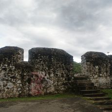
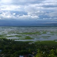
Gorontalo is an administrative region in northern Sulawesi with diverse terrain including hills, valleys, and coastal areas. It spans across multiple districts with both rural villages and urban settlements integrated into its governance structure.
The region was established in 1959 through Law Number 29, with Limboto designated as its administrative center. This founding marked the formal creation of the governance structure that continues to shape local administration.
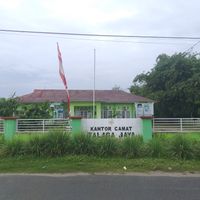
The districts contain 191 rural desa and 14 urban kelurahan, maintaining traditional administrative structures that reflect local governance patterns.
The region spans nineteen districts connecting diverse agricultural and fishing-based communities. Visitors will find a mix of rural and urban areas with varying levels of infrastructure and services.
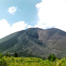
Located 865 meters above sea level, the region supports agricultural activities and fishing communities through its geographical positioning.
Location: Gorontalo
Capital city: Limboto
Elevation above the sea: 865 m
Shares border with: Gorontalo, Bone Bolango, North Gorontalo, Boalemo
Website: http://gorontalokab.go.id
GPS coordinates: 0.57280,122.23370
Latest update: December 7, 2025 20:21
Bunaken
295.2 km
Lore Lindu National Park
325.9 km
Kentur Lokon
298.8 km
Gunung Soputanpatepangan
284.4 km
Kepulauan Togean National Park
106.4 kmSha'ar Hashamayim Synagogue
308.6 km
Mount Klabat
326.4 km
Otanaha Fortress
86.2 km
Tangkoko Batuangus Nature Reserve
345 km
Mount Mahawu
304.9 km
Palu IV Bridge
310.2 km
Bogani Nani Wartabone National Park
161 km
Floating Mosque of Palu
310.6 km
Colo
108.1 km
Mount Tondano
298.1 km
Ban Hin Kiong Temple
308.2 km
Mount Tongkoko
345.8 km
Mount Empung
297.8 km
Pokekea Megalithic Site
337.8 km
Pantai Indah Modisi
245.1 km
Rumah Katu Marine Park
285.2 km
Sintuwu Maroso Square
273.9 km
Tompaluan
298.9 km
Gereja GMIBM Efrata Modisi
245.5 km
Museum dan Monumen Pendaratan Pesawat Ampibi Catalina
84.8 km
Bulud Kanari
245.8 km
Taman Nasional Hutan Mangrove
245.5 km
Modisi Beach
243.6 kmVisited this place? Tap the stars to rate it and share your experience / photos with the community! Try now! You can cancel it anytime.
Discover hidden gems everywhere you go!
From secret cafés to breathtaking viewpoints, skip the crowded tourist spots and find places that match your style. Our app makes it easy with voice search, smart filtering, route optimization, and insider tips from travelers worldwide. Download now for the complete mobile experience.
A unique approach to discovering new places❞
— Le Figaro
All the places worth exploring❞
— France Info
A tailor-made excursion in just a few clicks❞
— 20 Minutes