Enable Location

We need your location to show you interesting places around you

Discover nearby places

Find interesting locations and hidden gems around you

Precise directions

Get accurate directions and distances to places

Your location is never shared with other users. It's only used when you tap the location button.

Log in to your account

Start exploring — it's free

Trusted by 62,896 travelers worldwide

Continue with Google
Continue with Apple
or

We will send you a code to connect

By continuing, you accept our Terms and Conditions and our Privacy Policy

Check your inbox

We've sent a pincode in your inbox. Please enter the code below.

Mount Hiri
Discussion Reviews Photo
1.3k Popularity

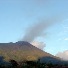
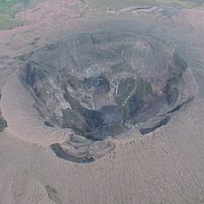
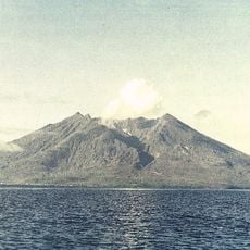
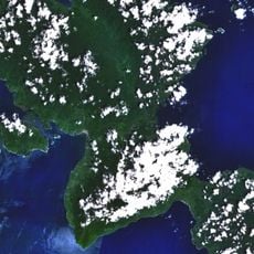
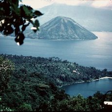
Mount Hiri, Stratovolcano in North Maluku, Indonesia.

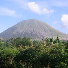
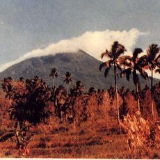
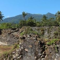
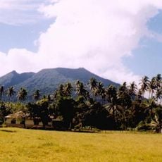
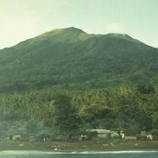
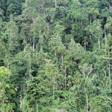
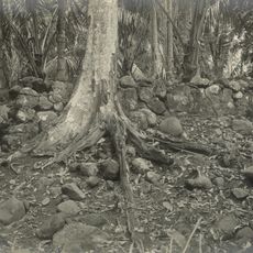
Mount Hiri is a conical stratovolcano located on a forested island north of Ternate in the Maluku Islands, with dense vegetation covering much of its slopes. The island supports a small residential community and remains largely undeveloped.

The volcano formed through geological processes in the tectonically active Maluku region and is part of a volcanic island chain. During World War II, it provided shelter for Sultan Iskander Muhammad Jabir Syah while evading Japanese forces in 1945.

The mountain holds traditional significance for the island's residents who see it as central to their identity and daily life. It serves as a natural landmark that shapes how people understand and navigate their surroundings.

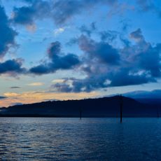
Visitors need to arrange boat transportation from Ternate to reach the island, planning travel around local weather patterns and sea conditions. It is helpful to consult with local guides who understand current access routes and seasonal considerations.

The volcano marks a notable position in the regional chain of volcanic islands and remains relatively unknown compared to other destinations in the area. Its remote location on a smaller island means it receives fewer visitors and offers a quieter experience.

The community of curious travelers

AroundUs brings together thousands of curated places, local tips, and hidden gems, enriched daily by 60,000 contributors worldwide.

Start exploring
Elevation above the sea
630 m
GPS coordinates
0.89792,127.31847
Latest update
December 14, 2025 17:41
« Mount Hiri - Stratovolcano in North Maluku, Indonesia » is provided by Around Us (aroundus.com). Images and texts are derived from Wikimedia project under a Creative Commons license. You are allowed to copy, distribute, and modify copies of this page, under the conditions set by the license, as long as this note is clearly visible.

Discover hidden gems everywhere you go!

From secret cafés to breathtaking viewpoints, skip the crowded tourist spots and find places that match your style. Our app makes it easy with voice search, smart filtering, route optimization, and insider tips from travelers worldwide. Download now for the complete mobile experience.

Around Us App Screenshot

A unique approach to discovering new places

Le Figaro

All the places worth exploring

France Info

A tailor-made excursion in just a few clicks

20 Minutes

Around Us
Travel Guide & Maps
Download

Send to your phone

QR Code
1

Open the camera app on your mobile.

2

Point at the QR code with your camera. A notification will appear.

3

Tap the notification to open the link.