Kahlersberg, Mountain summit in Berchtesgaden Alps, Germany and Austria
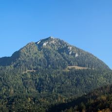
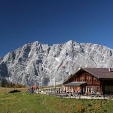
Kahlersberg is a mountain summit in the Berchtesgaden Alps located at the border between Bavaria and Salzburg, standing at 2,350 meters high. The peak sits within the Northern Limestone Alps and features steep rock faces along its ridge line.
The sources record no first-ascent date or climbing history for Kahlersberg. What they document is the route network: a steep marked climb, Route 496, from the west through the Mausloch, and the Eisenpfad from the Landtal valley in the southwest, very steep in places and carrying old markings. The mountain lies on the Germany–Austria border, in the Hagen Mountains of the Berchtesgaden Alps.
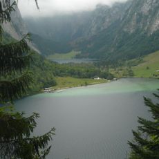
The border between Bavaria and Salzburg runs across the summit, so the peak lies in two countries at once. The route names come from the old climbing tradition here: the western climb passes through the Mausloch, and the southwest approach is the Eisenpfad, still carrying old paint marks. Below the mountain lies the Seeleinsee, a small lake in the Hagen Mountains.
From the west, Route 496 is a steep marked climb through the Mausloch to the summit; the Eisenpfad from the Landtal valley in the southwest is very steep in places and carries old markings. A trackless descent variant runs from the Fensterl wind gap north into the bowl between Kahlersberg and Hochseeleinkopf, mostly over steep scree. The Seeleinsee lies below the mountain.
The descent option through Fensterl wind gap leads across steep scree fields where falling rocks are a real concern. This route demands special navigation skills and is only suitable for very experienced mountaineers.
The community of curious travelers
AroundUs brings together thousands of curated places, local tips, and hidden gems, enriched daily by 94,365 contributors worldwide.