Chest opened
+${chestReward.xp} XP
Explorer
NOUVEAU ×${chestReward.collectible.quantity}
tapez pour fermer
Chest locked

Open chests in the app

Around Us is built for your phone — chests unlock when you walk, explore and capture nearby places.

Enable Location

We need your location to show you interesting places around you

Discover nearby places

Find interesting locations and hidden gems around you

Precise directions

Get accurate directions and distances to places

Your location is never shared with other users. It's only used when you tap the location button.

Jahorina

Log in to your account

Start exploring — it's free

Trusted by 72,891 travelers worldwide

Continue with Google
Continue with Apple
or

We will send you a code to connect

By continuing, you accept our Terms and Conditions and our Privacy Policy

Check your inbox

We've sent a pincode in your inbox. Please enter the code below.

Jahorina
Discussion Reviews 1 Photos
15.2k Popularity

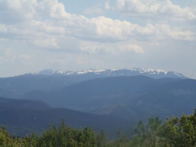
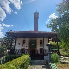
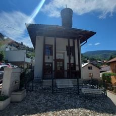
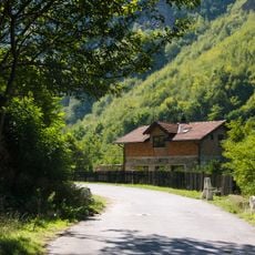
Jahorina, Mountain range in Trnovo Municipality, Bosnia and Herzegovina.

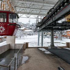
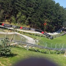
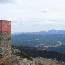
Jahorina is a mountain range with the Ogorjelica peak rising to 1916 meters, forming part of the Dinaric Alps south of Sarajevo. The range features a ski resort with 52 kilometers of slopes and 18 lifts.

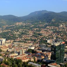
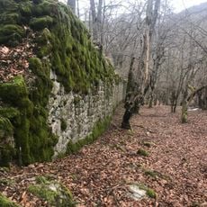
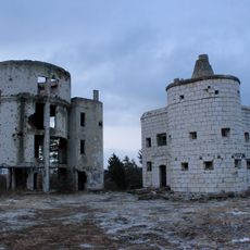
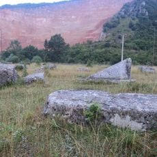
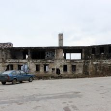
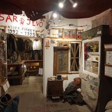
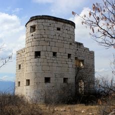
The mountain range formed as part of the Dinaric Alps through geological processes over long periods. During the Bosnian War, the region was occupied and served as a strategic position during the siege of Sarajevo.

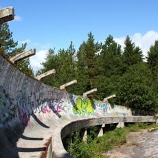
The mountain played a role in winter sports development in Bosnia and gained international attention through alpine competitions at the 1984 Winter Olympics. The slopes and lifts shape the place today and draw athletes from many regions.

The slopes operate from December to April, with both natural and artificial snow coverage. Visitors should know that some areas remain restricted due to landmines and only marked paths should be used.

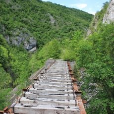
The mountain contains restricted areas with remaining landmines from the war, particularly on its southern slopes, that are off-limits to visitors. These dangerous remnants of the past require people to strictly follow marked paths and respect local safety warnings.

The community of curious travelers

AroundUs brings together thousands of curated places, local tips, and hidden gems, enriched daily by 60,000 contributors worldwide.

Start exploring
Elevation above the sea
1,916 m
GPS coordinates
43.72667,18.57694
Latest update
December 7, 2025 19:31
Around this place
Sarajevo Olympic Bobsleigh and Luge Track
Bosnia and Herzegovina

Sarajevo Olympic Bobsleigh and Luge Track

16.7 km
Trebević
Bosnia and Herzegovina

Trebević

13.8 km
Bijela Tabija
Bosnia and Herzegovina

Bijela Tabija

18.2 km
Trebevićka žičara
Bosnia and Herzegovina

Trebevićka žičara

17.3 km
Goat's Bridge
Bosnia and Herzegovina

Goat's Bridge

17.1 km
Orlovača cave
Bosnia and Herzegovina

Orlovača cave

17.5 km
Ambassadors' Alley
Bosnia and Herzegovina

Ambassadors' Alley

18.3 km
Pavlovac Fortress
Bosnia and Herzegovina

Pavlovac Fortress

16.5 km
Observatory Bistrik kula
Bosnia and Herzegovina

Observatory Bistrik kula

17 km
Alifakovac cemetery
Bosnia and Herzegovina

Alifakovac cemetery

18.4 km
Serbian Orthodox Cathedral in Pale
Bosnia and Herzegovina

Serbian Orthodox Cathedral in Pale

9.6 km
Church of the Dormition in Pale
Bosnia and Herzegovina

Church of the Dormition in Pale

10.1 km
Kekeki Sinan Bakarević Mosque
Bosnia and Herzegovina

Kekeki Sinan Bakarević Mosque

18.5 km
Црква Светог великомученика Георгија у Трнову
Serbia

Црква Светог великомученика Георгија у Трнову

12.5 km
Cekovic's house
Bosnia and Herzegovina

Cekovic's house

10.3 km
Bali-beg Malkočević Mosque
Bosnia and Herzegovina

Bali-beg Malkočević Mosque

18.4 km
Црква Светог пророка Илије на Лукама
Serbia

Црква Светог пророка Илије на Лукама

10.1 km
Jakub-pasha Mosque
Bosnia and Herzegovina

Jakub-pasha Mosque

18.3 km
Krupac necropolis
Bosnia and Herzegovina

Krupac necropolis

18.3 km
Église Saint-Joseph de Pale
Bosnia and Herzegovina

Église Saint-Joseph de Pale

10.1 km
Višegradska kapija
Bosnia and Herzegovina

Višegradska kapija

18.4 km
Sunnyland
Bosnia and Herzegovina

Sunnyland

18.3 km
Motel Osmice
Bosnia and Herzegovina

Motel Osmice

18.1 km
Dariva
Bosnia and Herzegovina

Dariva

18.1 km
Sarajevo 1992 War Museum
Bosnia and Herzegovina

Sarajevo 1992 War Museum

18.4 km
Kula Palež
Bosnia and Herzegovina

Kula Palež

17.3 km
Trebević summit
Bosnia and Herzegovina

Trebević summit

13.9 km
Bistrica viaduct
Bosnia and Herzegovina

Bistrica viaduct

10.2 km
Show the full map
Reviews
Share your experience

No review yet

Discussions
Start a discussion...

No discussion yet

« Jahorina - Mountain range in Trnovo Municipality, Bosnia and Herzegovina » is provided by Around Us (aroundus.com). Images and texts are derived from Wikimedia project under a Creative Commons license. You are allowed to copy, distribute, and modify copies of this page, under the conditions set by the license, as long as this note is clearly visible.

Discover hidden gems everywhere you go!

From secret cafés to breathtaking viewpoints, skip the crowded tourist spots and find places that match your style. Our app makes it easy with voice search, smart filtering, route optimization, and insider tips from travelers worldwide. Download now for the complete mobile experience.

Around Us App Screenshot

A unique approach to discovering new places

Le Figaro

All the places worth exploring

France Info

A tailor-made excursion in just a few clicks

20 Minutes

Around Us
Travel Guide & Maps
Download

Send to your phone

QR Code
1

Open the camera app on your mobile.

2

Point at the QR code with your camera. A notification will appear.

3

Tap the notification to open the link.