Chest opened
+${chestReward.xp} XP
Explorer
NOUVEAU ×${chestReward.collectible.quantity}
tapez pour fermer

See the monuments around you in AR Open chests in the app

Around Us is built for your phone — point your camera at the streets and discover the monuments and places around you in augmented reality. Around Us is built for your phone — chests unlock when you walk, explore and capture nearby places.

•

Enable Location

We need your location to show you interesting places around you

Discover nearby places

Find interesting locations and hidden gems around you

Precise directions

Get accurate directions and distances to places

Your location is never shared with other users. It's only used when you tap the location button.

Trebević

Log in to your account

Start exploring — it's free

Trusted by 94,364 travelers worldwide

Continue with Google
Continue with Apple
or

We will send you a code to connect

By continuing, you accept our Terms and Conditions and our Privacy Policy

Check your inbox

We've sent a pincode in your inbox. Please enter the code below.

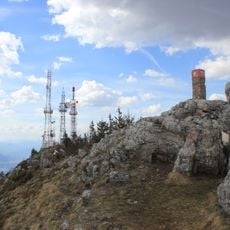
Trebević, Mountain peak in Sarajevo, Bosnia and Herzegovina.

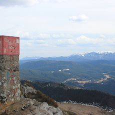
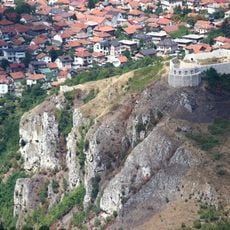
Trebević is a mountain in central Bosnia and Herzegovina, located in the territories of Republika Srpska, Sarajevo and Istočno Sarajevo, bordering Jahorina. Its highest peak, Sofe, reaches 1,628 meters (5,341 ft), making it the second shortest of the Sarajevo mountains. The mountain has forested slopes and is reached from Sarajevo by the Trebević Cable Car, which starts from the neighbourhood of Bistrik.

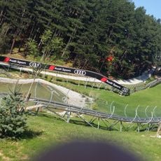
The peak gained international attention during the 1984 Winter Olympics when it hosted bobsled races on a specially built track. This event brought global recognition and shaped the mountain's modern identity.

The name Trebević comes from the Slavic verb trebiti, meaning to sacrifice or destroy, and from Trebišta, an Old Slavic word for an altar; peaks here likely served as sites of pagan ritual sacrifice after the Slavs settled. Since 1954 the mountain has held protected park-forest status, and on 9 April 2014 the Sarajevo Canton Assembly declared it a protected landscape.

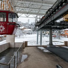
A renovated cable car from the Bistrik neighborhood provides quick access to the upper slopes, while drivers can reach the Brus station and hikers have multiple marked trails to choose from. Weather conditions vary by season, so visitors should plan accordingly and wear proper footwear.

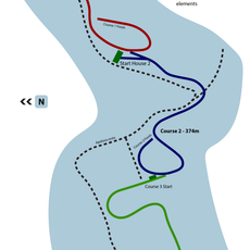
An abandoned bobsled track from the 1984 Olympics sits on the mountain slopes as an unusual concrete structure surrounded by forest. This leftover course provides a tangible reminder of the sporting event that once brought the world to this location.

The community of curious travelers

AroundUs brings together thousands of curated places, local tips, and hidden gems, enriched daily by 94,364 contributors worldwide.

Start exploring
Location
Elevation above the sea
1,629 m
GPS coordinates
43.81841,18.46089
Latest update
October 31, 2026 03:30
Around this place
Bijela Tabija
Bosnia and Herzegovina

Bijela Tabija

2.9 mi
Trebevićka žičara
Bosnia and Herzegovina

Trebevićka žičara

2.2 mi
Tomb of the Seven Brothers
Bosnia and Herzegovina

Tomb of the Seven Brothers

3 mi
Goat's Bridge
Bosnia and Herzegovina

Goat's Bridge

2.4 mi
Sarajevo Olympic Bobsleigh and Luge Track
Bosnia and Herzegovina

Sarajevo Olympic Bobsleigh and Luge Track

1.8 mi
Church of Saint Anthony of Padua
Bosnia and Herzegovina

Church of Saint Anthony of Padua

3 mi
Konak
Bosnia and Herzegovina

Konak

3 mi
Ambassadors' Alley
Bosnia and Herzegovina

Ambassadors' Alley

2.9 mi
Observatory Bistrik kula
Bosnia and Herzegovina

Observatory Bistrik kula

2 mi
Building of the National bank with movable property, the historic building
Bosnia and Herzegovina

Building of the National bank with movable property, the historic building

3 mi
Alifakovac cemetery
Bosnia and Herzegovina

Alifakovac cemetery

3 mi
Kekeki Sinan Bakarević Mosque
Bosnia and Herzegovina

Kekeki Sinan Bakarević Mosque

2.9 mi
Franciscan monastery Saint Anthony of Padua in Sarajevo
Bosnia and Herzegovina

Franciscan monastery Saint Anthony of Padua in Sarajevo

3 mi
Bali-beg Malkočević Mosque
Bosnia and Herzegovina

Bali-beg Malkočević Mosque

2.9 mi
Црква Светог пророка Илије на Лукама
Serbia

Црква Светог пророка Илије на Лукама

2.3 mi
Jakub-pasha Mosque
Bosnia and Herzegovina

Jakub-pasha Mosque

2.9 mi
Motel Osmice
Bosnia and Herzegovina

Motel Osmice

2.7 mi
Sunnyland
Bosnia and Herzegovina

Sunnyland

2.8 mi
Sarajevo Brewery Museum
Bosnia and Herzegovina

Sarajevo Brewery Museum

3 mi
Dariva
Bosnia and Herzegovina

Dariva

3 mi
Hotel Zlatište
Bosnia and Herzegovina

Hotel Zlatište

3 mi
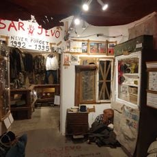
Sarajevo 1992 War Museum
Bosnia and Herzegovina

Sarajevo 1992 War Museum

2.9 mi
Kula Palež
Bosnia and Herzegovina

Kula Palež

2.2 mi
Trebević summit
Bosnia and Herzegovina

Trebević summit

70 ft
House of Mehmed-beg Fadilpašić
Bosnia and Herzegovina

House of Mehmed-beg Fadilpašić

3 mi
Kula Zlatište
Bosnia and Herzegovina

Kula Zlatište

2.9 mi
Trebević (bukid)
Bosnia and Herzegovina

Trebević (bukid)

50 ft
Dobrik viaduct
Bosnia and Herzegovina

Dobrik viaduct

2.3 mi
Show the full map
Reviews
Share your experience

No review yet

Discussions
Start a discussion...

No discussion yet

« Trebević - Mountain peak in Sarajevo, Bosnia and Herzegovina » is provided by Around Us (aroundus.com). Images and texts are derived from Wikimedia project under a Creative Commons license. You are allowed to copy, distribute, and modify copies of this page, under the conditions set by the license, as long as this note is clearly visible.

Discover hidden gems everywhere you go!

From secret cafés to breathtaking viewpoints, skip the crowded tourist spots and find places that match your style. Our app makes it easy with voice search, smart filtering, route optimization, and insider tips from travelers worldwide. Download now for the complete mobile experience.

Around Us App Screenshot
❝

A unique approach to discovering new places❞

— Le Figaro

❝

All the places worth exploring❞

— France Info

❝

A tailor-made excursion in just a few clicks❞

— 20 Minutes

Around Us
Travel Guide & Maps
Download

Send to your phone

QR Code
1

Open the camera app on your mobile.

2

Point at the QR code with your camera. A notification will appear.

3

Tap the notification to open the link.