Chest opened
+${chestReward.xp} XP
Explorer
NOUVEAU ×${chestReward.collectible.quantity}
tapez pour fermer
Chest locked

Open chests in the app

Around Us is built for your phone — chests unlock when you walk, explore and capture nearby places.

Enable Location

We need your location to show you interesting places around you

Discover nearby places

Find interesting locations and hidden gems around you

Precise directions

Get accurate directions and distances to places

Your location is never shared with other users. It's only used when you tap the location button.

Log in to your account

Start exploring — it's free

Trusted by 73,028 travelers worldwide

Continue with Google
Continue with Apple
or

We will send you a code to connect

By continuing, you accept our Terms and Conditions and our Privacy Policy

Check your inbox

We've sent a pincode in your inbox. Please enter the code below.

Trebišnjica wellsprings group
Discussion Reviews Photo
1.6k Popularity

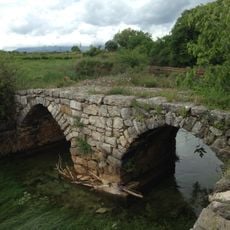
Trebišnjica wellsprings group, Natural spring system in Bileća, Bosnia and Herzegovina

The Trebišnjica wellsprings group consists of three major outlets: Dejanova Pećina, Vrelo Oko, and Nikšičko Vrelo that together form a significant water source. Located at approximately 325 meters (1,066 feet) elevation, these springs feed the river of the same name.

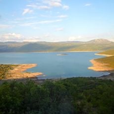
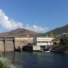
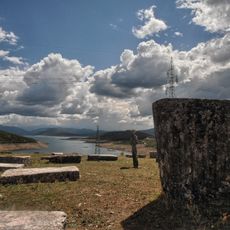
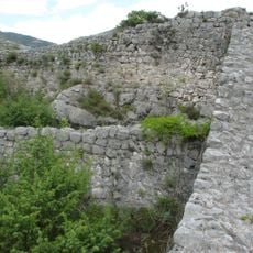
The springs remained visible until 1967, when construction of the Trebinje-1 Hydroelectric Power Station submerged the original outlets beneath Bilećko Lake. Despite being underwater today, the spring system continues to flow beneath the surface.

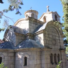
The springs take their name from the Trebišnjica River, which has held central importance for local people for generations. Today, the waters remain a focal point where residents connect with their natural surroundings.

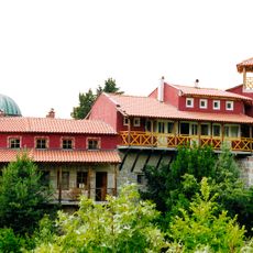
Access is available through marked paths near Bileća, where information boards explain the underground water system and its connection to the Trebišnjica River. The warmer months offer the best conditions for exploring the area and understanding how the springs connect to the broader landscape.

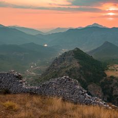
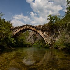
The system forms part of one of the world's longest sinking river systems, where water flows both above and below ground across significant distances. This geological phenomenon makes the region a rare example of how underground water shapes the landscape.

The community of curious travelers

AroundUs brings together thousands of curated places, local tips, and hidden gems, enriched daily by 60,000 contributors worldwide.

Start exploring
GPS coordinates
42.86445,18.42126
Latest update
December 14, 2025 14:26
Around this place
Tvrdoš Monastery
Bosnia and Herzegovina

Tvrdoš Monastery

19.4 km
Hercegovačka Gračanica
Bosnia and Herzegovina

Hercegovačka Gračanica

17.8 km
Bilećko Lake
Bosnia and Herzegovina

Bilećko Lake

4.6 km
Arslanagića Ćuprija
Bosnia and Herzegovina

Arslanagića Ćuprija

17.6 km
Dobrićevo Monastery
Bosnia and Herzegovina

Dobrićevo Monastery

5.2 km
Trebinje 1 Hydroelectric Power Station
Bosnia and Herzegovina

Trebinje 1 Hydroelectric Power Station

15.8 km
Duži Monastery
Bosnia and Herzegovina

Duži Monastery

21.9 km
Police City Stadium
Bosnia and Herzegovina

Police City Stadium

18.2 km
Church of the transfiguration of Jesus Christ in Trebinje
Bosnia and Herzegovina

Church of the transfiguration of Jesus Christ in Trebinje

18.3 km
Manastir Svetih apostola Petra i Pavla
Bosnia and Herzegovina

Manastir Svetih apostola Petra i Pavla

23.6 km
Cathedral of the Birth of Mary
Bosnia and Herzegovina

Cathedral of the Birth of Mary

18.2 km
Ključ Castle
Bosnia and Herzegovina

Ključ Castle

26.1 km
Osman-paša Resulbegović mosque
Bosnia and Herzegovina

Osman-paša Resulbegović mosque

18.2 km
Sultan Ahmed mosque
Bosnia and Herzegovina

Sultan Ahmed mosque

18.1 km
Klobuk Fortress
Bosnia and Herzegovina

Klobuk Fortress

20.5 km
Saint George monastery, Zubci
Bosnia and Herzegovina

Saint George monastery, Zubci

26.4 km
Crkva Svetog Save
Bosnia and Herzegovina

Crkva Svetog Save

1.4 km
Bileća necropolis
Bosnia and Herzegovina

Bileća necropolis

5.7 km
Muzeum Hercegowiny
Bosnia and Herzegovina

Muzeum Hercegowiny

18.1 km
Église Saint-Lazare de Vlahovići
Bosnia and Herzegovina

Église Saint-Lazare de Vlahovići

28 km
Saint Lazarus church in Bileća
Bosnia and Herzegovina

Saint Lazarus church in Bileća

1.8 km
Mičevac
Bosnia and Herzegovina

Mičevac

17.9 km
Grebnice-Bunčići necropolis
Bosnia and Herzegovina

Grebnice-Bunčići necropolis

4.3 km
Trebinje Transfiguration Cathedral
Bosnia and Herzegovina

Trebinje Transfiguration Cathedral

17.9 km
Old bridge Mostaći
Bosnia and Herzegovina

Old bridge Mostaći

19.4 km
Roman bridge Vučija
Bosnia and Herzegovina

Roman bridge Vučija

22.8 km
Church of Saint Petka
Bosnia and Herzegovina

Church of Saint Petka

19.4 km
Храм Свете Недеље у Талежи
Serbia

Храм Свете Недеље у Талежи

22.8 km
Show the full map
Reviews
Share your experience

No review yet

Discussions
Start a discussion...

No discussion yet

« Trebišnjica wellsprings group - Natural spring system in Bileća, Bosnia and Herzegovina » is provided by Around Us (aroundus.com). Images and texts are derived from Wikimedia project under a Creative Commons license. You are allowed to copy, distribute, and modify copies of this page, under the conditions set by the license, as long as this note is clearly visible.

Discover hidden gems everywhere you go!

From secret cafés to breathtaking viewpoints, skip the crowded tourist spots and find places that match your style. Our app makes it easy with voice search, smart filtering, route optimization, and insider tips from travelers worldwide. Download now for the complete mobile experience.

Around Us App Screenshot

A unique approach to discovering new places

Le Figaro

All the places worth exploring

France Info

A tailor-made excursion in just a few clicks

20 Minutes

Around Us
Travel Guide & Maps
Download

Send to your phone

QR Code
1

Open the camera app on your mobile.

2

Point at the QR code with your camera. A notification will appear.

3

Tap the notification to open the link.