Enable Location

We need your location to show you interesting places around you

Discover nearby places

Find interesting locations and hidden gems around you

Precise directions

Get accurate directions and distances to places

Your location is never shared with other users. It's only used when you tap the location button.

Log in to your account

Start exploring — it's free

Trusted by 67,874 travelers worldwide

Continue with Google
Continue with Apple
or

We will send you a code to connect

By continuing, you accept our Terms and Conditions and our Privacy Policy

Check your inbox

We've sent a pincode in your inbox. Please enter the code below.

Topolnitsa Reservoir
Discussion Reviews Photo
3.3k Popularity

Topolnitsa Reservoir, body of water

Topolnitsa Reservoir is a large body of water set in the Sredna Gora mountains of western Bulgaria, formed by a concrete dam built across the Topolnitsa River. The water stretches between green, rounded hills, with open shores along parts of its banks.

The dam was built in the years following World War II and finished in the early 1960s, primarily to supply water to the agricultural plains nearby. It was part of a broader effort to develop water infrastructure across Bulgaria during that period.

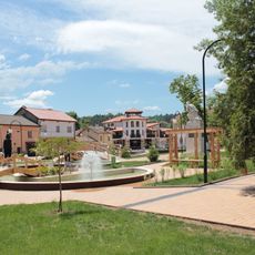
Locals from the Panagyurishte area come here to fish and walk along the shores, especially on weekends. The flat banks make it easy to sit by the water, and the surrounding hills give the place a quiet, open feeling.

The reservoir is reached by road from the villages of Muhovo and Poibrene, both connected to the town of Panagyurishte. Having your own transport makes the visit much easier, as public connections to the area are limited.

The Topolnitsa Reservoir is one of three connected reservoirs on the same river, with two others sitting further upstream. Inside the dam structure itself, a small hydroelectric plant generates electricity for the local grid.

The community of curious travelers

AroundUs brings together thousands of curated places, local tips, and hidden gems, enriched daily by 60,000 contributors worldwide.

Start exploring
Elevation above the sea
400 m
GPS coordinates
42.43139,24.00500
Latest update
March 3, 2026 13:56
Reviews
Share your experience

No review yet

Discussions
Start a discussion...

No discussion yet

« Topolnitsa Reservoir - body of water » is provided by Around Us (aroundus.com). Images and texts are derived from Wikimedia project under a Creative Commons license. You are allowed to copy, distribute, and modify copies of this page, under the conditions set by the license, as long as this note is clearly visible.

Discover hidden gems everywhere you go!

From secret cafés to breathtaking viewpoints, skip the crowded tourist spots and find places that match your style. Our app makes it easy with voice search, smart filtering, route optimization, and insider tips from travelers worldwide. Download now for the complete mobile experience.

Around Us App Screenshot

A unique approach to discovering new places

Le Figaro

All the places worth exploring

France Info

A tailor-made excursion in just a few clicks

20 Minutes

Around Us
Travel Guide & Maps
Download

Send to your phone

QR Code
1

Open the camera app on your mobile.

2

Point at the QR code with your camera. A notification will appear.

3

Tap the notification to open the link.