Niagara Escarpment, Rock formation in Ontario, Canada.
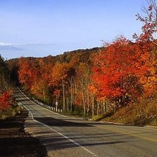
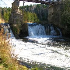
The Niagara Escarpment is an arc-shaped cuesta about 1,050 kilometres long, running from New York through Ontario, Michigan, Wisconsin and Illinois. Its cliff face is dolomitic limestone of the Silurian Lockport Formation over softer shale. The Niagara River plunges over it at Niagara Falls, and the Genesee River cuts three waterfalls at Rochester.
The rock formation began over 400 million years ago when layers of limestone, dolostone, shale, and sandstone were deposited. These layers later shaped the cliffs and valleys visible today.
The Bruce Trail follows the escarpment for about 890 km from Queenston on the Niagara River to Tobermory on the Bruce Peninsula. Hamilton residents call the escarpment "The Mountain"; from 1892 to 1936 the Hamilton Incline Railway carried people between the lower city and the upper part. In Wisconsin's High Cliff State Park, effigy mounds and the remains of an early 20th-century limestone quarry and kiln show how people used the ridge.
A long hiking trail runs along the entire formation and connects different conservation areas. Access is possible at several points, with some sections easier to reach than others.
Along the cliffs grow Eastern White Cedars that can reach over 1000 years in age. These trees form the oldest forest ecosystem in eastern North America.
The community of curious travelers
AroundUs brings together thousands of curated places, local tips, and hidden gems, enriched daily by 92,750 contributors worldwide.