Təmtəmíxʷtən/Belcarra Regional Park

Log in to your account

AroundUs is a community-driven map of interesting places, built by curious explorers like you. It grows with every review, story, and photo you share.
Connect to save your favorite spots, contribute locations, and create personalized routes.
Continue with Google
Continue with Apple
Continue with X
Continue with Facebook
Continue with email
By continuing, you accept our Terms and Conditions and our Privacy Policy
Create an account

Təmtəmíxʷtən/Belcarra Regional Park

Add to collection
Map
Suggest a change
Share

Təmtəmíxʷtən/Belcarra Regional Park, Nature reserve in Anmore, Canada.

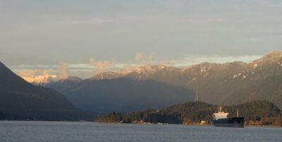
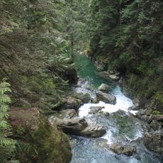
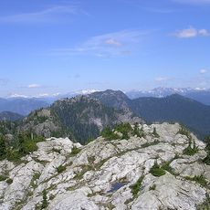
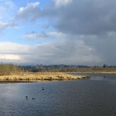
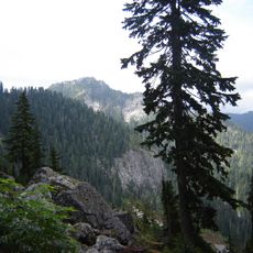
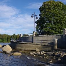
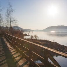
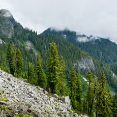
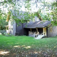
təmtəmíxʷtən/Belcarra Regional Park is a nature reserve covering about 1,100 hectares, stretching from Belcarra Bay to Sasamat Lake with forests, rocky beaches, and views overlooking Indian Arm and Burrard Inlet. The terrain combines thick woodlands, open shorelines, and varying elevations across its landscape.

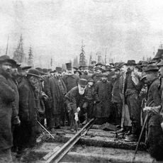
Vancouver received management of the Admiralty Point lands in 1913, which were handed to Metro Vancouver in 1972. This transfer enabled gradual expansion toward Sasamat Lake and Buntzen Ridge in the following decades.

The name təmtəmíxʷtən comes from the hən̓q̓əmin̓əm̓ language of the Tsleil-Waututh Nation and means 'the biggest place for all the people'. This naming reflects the ongoing connection between the land and its original inhabitants.

The park features over 26 kilometers of hiking trails and about 9 kilometers of cycling paths, with White Pine Beach at Sasamat Lake offering swimming opportunities. The various routes suit different activities and fitness levels.

The area protects specialized habitats such as eelgrass beds, woodlands, and wetlands classified as environmentally sensitive zones. These areas support diverse wildlife ranging from bears and deer to marine species.

Location: Anmore

Operator: Metro Vancouver Regional Parks

Website: https://metrovancouver.org/services/regional-parks/park/t%C9%99mt%C9%99m%C3%ADx%CA%B7t%C9%99n-belcarra-regional-park

GPS coordinates: 49.30912,-122.91105

Latest update: December 12, 2025 09:07

Photos
Reviews

Visited this place? Tap the stars to rate it and share your experience / photos with the community! Try now! You can cancel it anytime.

« Təmtəmíxʷtən/Belcarra Regional Park - Nature reserve in Anmore, Canada » is provided by Around Us (aroundus.com). Images and texts are derived from Wikimedia project under a Creative Commons license. You are allowed to copy, distribute, and modify copies of this page, under the conditions set by the license, as long as this note is clearly visible.

Discover hidden gems everywhere you go!

From secret cafés to breathtaking viewpoints, skip the crowded tourist spots and find places that match your style. Our app makes it easy with voice search, smart filtering, route optimization, and insider tips from travelers worldwide. Download now for the complete mobile experience.

Around Us App Screenshot

A unique approach to discovering new places

Le Figaro

All the places worth exploring

France Info

A tailor-made excursion in just a few clicks

20 Minutes