Enable Location

We need your location to show you interesting places around you

Discover nearby places

Find interesting locations and hidden gems around you

Precise directions

Get accurate directions and distances to places

Your location is never shared with other users. It's only used when you tap the location button.

Lai da Curnera

Log in to your account

Start exploring — it's free

Trusted by 62,119 travelers worldwide

Continue with Google
Continue with Apple
or

We will send you a code to connect

By continuing, you accept our Terms and Conditions and our Privacy Policy

Check your inbox

We've sent a pincode in your inbox. Please enter the code below.

Lai da Curnera

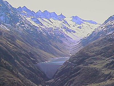
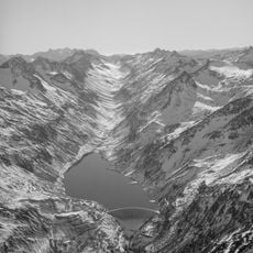
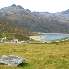
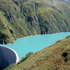
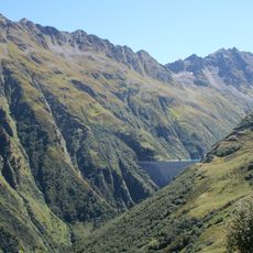
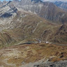
Lai da Curnera, reservoir in the municipality of Tujetsch, in the Grisons, Switzerland

Lai da Curnera is a dam built in 1966 across a high mountain valley in Graubünden, standing 153 meters tall with a crown length of 350 meters. The water is managed through a network of pipes connecting to two other nearby lakes, forming an integrated system for regional water storage.

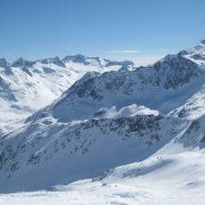
The dam was constructed in the mid-20th century during the 1960s to control water flow and support regional water management. Since its completion, it has shaped the water infrastructure of the region and become a technical landmark of alpine engineering.

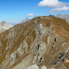
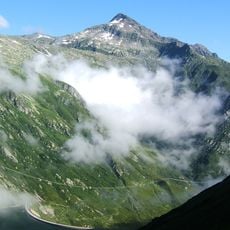
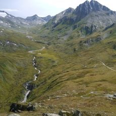
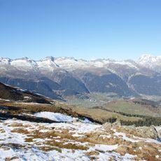
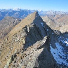
The area around this reservoir is deeply tied to hiking traditions and outdoor recreation, where visitors come to experience the landscape on foot. The dam has become a symbol of regional efforts to work with nature while preserving the connection to the land.

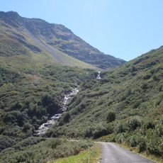
Access is by foot on a path from Passtarasse that takes about one and a half hours, as the road to the dam is closed to vehicles. The route is suitable for strollers, making it family-friendly, and parking is available at Passtarasse on the Oberalp Pass road.

The water is managed through an underground network of pipes connecting this lake with two other reservoirs in neighboring valleys, a hidden feat of alpine engineering. This concealed system allows water to be transported between mountains and used for both hydroelectric power and regional supply.

The community of curious travelers

AroundUs brings together thousands of curated places, local tips, and hidden gems, enriched daily by 60,000 contributors worldwide.

Start exploring
Elevation above the sea
1,956 m
GPS coordinates
46.62667,8.71361
Latest update
February 7, 2026 11:01
« Lai da Curnera - reservoir in the municipality of Tujetsch, in the Grisons, Switzerland » is provided by Around Us (aroundus.com). Images and texts are derived from Wikimedia project under a Creative Commons license. You are allowed to copy, distribute, and modify copies of this page, under the conditions set by the license, as long as this note is clearly visible.

Discover hidden gems everywhere you go!

From secret cafés to breathtaking viewpoints, skip the crowded tourist spots and find places that match your style. Our app makes it easy with voice search, smart filtering, route optimization, and insider tips from travelers worldwide. Download now for the complete mobile experience.

Around Us App Screenshot

A unique approach to discovering new places

Le Figaro

All the places worth exploring

France Info

A tailor-made excursion in just a few clicks

20 Minutes

Around Us
Travel Guide & Maps
Download

Send to your phone

QR Code
1

Open the camera app on your mobile.

2

Point at the QR code with your camera. A notification will appear.

3

Tap the notification to open the link.