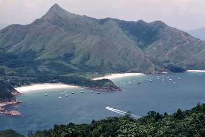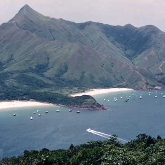
Sharp Peak, Mountain summit in Sai Kung East Country Park, Hong Kong.
Sharp Peak (Nam She Tsim) is a 468-metre hill in Sai Kung East Country Park, north of Tai Long Wan on the Sai Kung Peninsula. Its pointed summit rises from steep, rock-strewn slopes; the ridge running northwest toward Ko Lau Wan is known locally as Tung Lung Yi Cha, and the northern coastline as the Thousand Streams Coast.
The name 蚺蛇尖 is read in Cantonese as "Yim She" for 蚺蛇, but the official English form Nam She Tsim uses the alternative reading "Nam" for 蚺, so the hill is commonly written and pronounced as 南蛇尖 (Nam She Tsim). Old maps label it 南蛇頭. The peak has no official trail or signposts, and the Agriculture, Fisheries and Conservation Department lists it among 17 high-risk locations in country parks where fatal and serious accidents have occurred.
The Cantonese name 蚺蛇尖 is pronounced "Yim She" for 蚺蛇, but the official English form Nam She Tsim uses the reading "Nam", so locals commonly say and write 南蛇尖; old maps mark it as 南蛇頭. The ridge running northwest toward Ko Lau Wan is nicknamed Tung Lung Yi Cha, and the northern coastline is known as Chin Kai Coast.
The area is best explored during dry seasons when rock sections remain stable underfoot. Hikers should wear sturdy footwear and prepare for changing weather conditions, particularly at higher elevations.
From the summit, visitors can look across multiple bays of Tai Long Wan, including the remote Ham Tin Wan with its fine sandy beaches. On clear days, views extend across the South China Sea to the distant coastline.
The community of curious travelers
AroundUs brings together thousands of curated places, local tips, and hidden gems, enriched daily by 94,630 contributors worldwide.