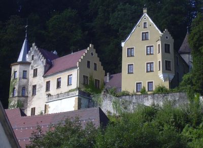
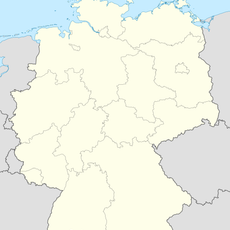
Lauterstein, municipality in Germany
Location: Göppingen
Location: Mittleres Fils-Lautertal GVV
Elevation above the sea: 468 m
Website: http://lauterstein.de
GPS coordinates: 48.71000,9.86139
Latest update: March 13, 2025 18:58
Kaltes Feld
2.9 km
Schloss Weißenstein
1.9 km
Stuifen
4.9 km
Reiterleskapelle
2.9 km
Messelberg
3.1 km
Burg Ravenstein
5 km
Kaltes Feld mit Hornberg, Galgenberg und Eierberg
2.6 km
St. Bernhardus
4.9 km
Burg Granegg
2.7 km
Schloss Winzingen
2.9 km
St.-Michaels-Kirche
6.6 km
Bargauer Horn
6.7 km
Bernhardus
4.9 km
Friedhofskapelle
233 m
Eybacher Hütte
4.7 km
Lourdes-Grotte (Treffelhausen)
3.3 km
St. Sebastian und Walburga
2.2 km
Heldenberg
1.8 km
St. Petrus
1.8 km
Bergrutschung Tannenwald
6.5 km
Falkenhöhle
6.1 km
St. Johannes
4 km
Schönberg
3.6 km
1 Linde bei der Kitzinghofkapelle
7.8 km
Kaltes Feld bis Rosenstein
6.9 km
Birkenhülbe
7 km
Forellenloch beim Schloß von Weißenstein
1.8 km
Teufelsklinge
8.9 kmReviews
Visited this place? Tap the stars to rate it and share your experience / photos with the community! Try now! You can cancel it anytime.
Discover hidden gems everywhere you go!
From secret cafés to breathtaking viewpoints, skip the crowded tourist spots and find places that match your style. Our app makes it easy with voice search, smart filtering, route optimization, and insider tips from travelers worldwide. Download now for the complete mobile experience.
A unique approach to discovering new places❞
— Le Figaro
All the places worth exploring❞
— France Info
A tailor-made excursion in just a few clicks❞
— 20 Minutes