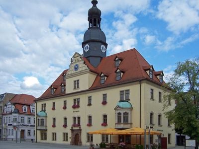
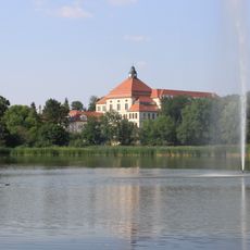
Borna, District capital in Landkreis Leipzig, Germany.
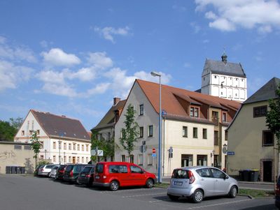
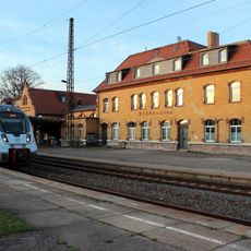
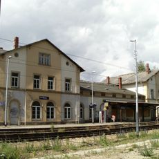
Borna is a district capital in Saxony located about 25 kilometers southeast of Leipzig. The town serves as a transportation hub with its railway connections, linking residents and visitors to Leipzig and surrounding areas.
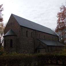
The town first appeared in written records in 1251 as an established settlement within a farming region. By the 1800s, industrial growth transformed it into an economic center that shaped the surrounding landscape.
The town gives young residents a voice through a youth parliament established in 2008, where they participate in decisions affecting their community. This allows them to influence local development and share their perspectives directly with city leaders.
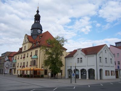
The railway station provides direct access to Leipzig and other regional towns, making it easy to arrive by train. Walking through the town center is straightforward, with main facilities and attractions located within reasonable distance.
The nickname 'Zwibbel-Borne' reflects the town's deep historical connection to onion farming, which once defined local life and trade. This forgotten agricultural past remains part of the town's identity and story.
Location: Landkreis Leipzig
Elevation above the sea: 159 m
Shares border with: Rötha, Kitzscher, Frohburg, Fockendorf, Treben, Regis-Breitingen, Neukieritzsch
Website: https://borna.de
GPS coordinates: 51.11667,12.50000
Latest update: December 12, 2025 05:35
Wiprechtskirche Eula
4 km
Emmauskirche
1 km
Speicherbecken Borna
3.4 km
Halde Trages
7.1 km
Gymnasium „Am Breiten Teich“
1.4 km
Schloss Zedtlitz
1.5 km
Speicherbecken Witznitz
3.4 km
Stadtkirche St. Marien
952 m
Kunigundenkirche
741 m
Borna railway station
974 m
District court Borna
984 m
Volksplatz Borna
1.2 km
Bürgerhaus Goldener Stern
816 m
Burg Borna
661 m
Bahnhof Frohburg
6.7 km
Burg Regis
4.5 km
Bockwitz
3.4 km
Wyhraaue
334 m
Pedunculate oak Haubitz
4 km
Einzeldenkmale der Sachgesamtheit Dorfkirche Benndorf (siehe Sachgesamtheitsliste gleiche Anschrift - Obj. 09303018): Kirche, Kirchhofsmauer mit Doppelportal sowie Grabmal v. Einsiedel und Grabplatte v. Pöllnitz Bubendorfer Straße -
5.8 km
Kirche (mit Ausstattung), Kirchhof mit Einfriedung, Grabmal Fam. von Arnim-Kitzscher und Leichenhalle Kirchsteig -
5.9 km
Kirche (mit Ausstattung), Kirchhof mit Einfriedungsmauer, Kirchhofstor und Pforte Am Denkmal -
4.6 km
Schule Victoriastraße 2
3.8 km
Schulgebäude Leipziger Straße 67; 67a
1.2 km
Villa mit Einfriedung Johann-Sebastian-Bach-Straße 1
985 m
Volksplatz Borna
1.2 km
Kirche (mit Ausstattung) und Kirchhof mit Einfriedungsmauer und barockem Grabstein Dorfstraße -
1.9 km
Ehemaliges Offizierskasino, heute Kath. Pfarrkirche, mit Einfriedung Stauffenbergstraße 7
714 mVisited this place? Tap the stars to rate it and share your experience / photos with the community! Try now! You can cancel it anytime.
Discover hidden gems everywhere you go!
From secret cafés to breathtaking viewpoints, skip the crowded tourist spots and find places that match your style. Our app makes it easy with voice search, smart filtering, route optimization, and insider tips from travelers worldwide. Download now for the complete mobile experience.
A unique approach to discovering new places❞
— Le Figaro
All the places worth exploring❞
— France Info
A tailor-made excursion in just a few clicks❞
— 20 Minutes