Enable Location

We need your location to show you interesting places around you

Discover nearby places

Find interesting locations and hidden gems around you

Precise directions

Get accurate directions and distances to places

Your location is never shared with other users. It's only used when you tap the location button.

Schlayerturm

Log in to your account

Start exploring — it's free

Trusted by 62,033 travelers worldwide

Continue with Google
Continue with Apple
or

We will send you a code to connect

By continuing, you accept our Terms and Conditions and our Privacy Policy

Check your inbox

We've sent a pincode in your inbox. Please enter the code below.

Schlayerturm

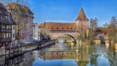
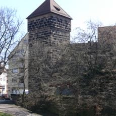
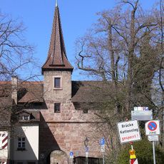
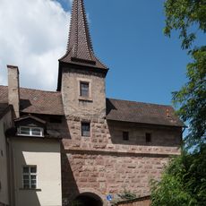
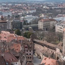
Schlayerturm, Medieval fortified tower in Nürnberg, Germany.

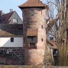
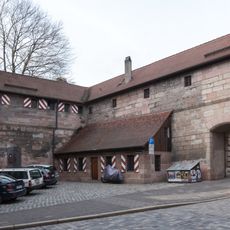
The Schlayerturm is a quadratic sandstone structure with an octagonal tent roof, standing on a small river island at the Pegnitz outflow. The structure displays typical features of early 15th-century defensive architecture and is protected as a historical monument today.

The tower was built between 1419 and 1422 as part of Nuremberg's final fortification system. It originally bore the name 'Grünes F' and marked a turning point in the city's defensive strategy.

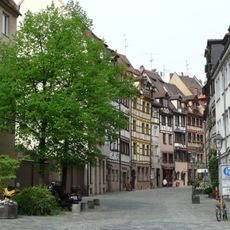
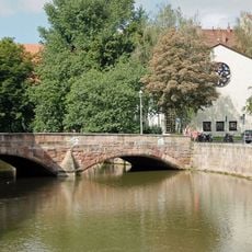
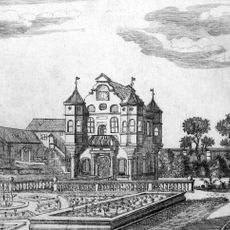
The tower was long part of the city's everyday landscape and appears in artworks by Albrecht Dürer. Its riverside location shaped how Nuremberg residents understood their defense system and their relationship with the waterway.

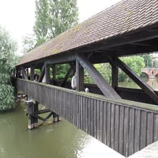
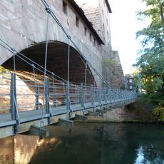
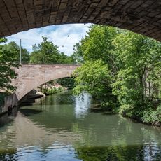
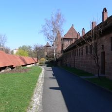
The tower sits near the Maxbrücke and can be easily reached by visitors on foot. Best access is via the banks of the Pegnitz, though the immediate surroundings may be damp and moss-covered.

The tower stands on a small river island, which made it particularly vulnerable to flooding and influenced its construction methods. This exposed location required special techniques to keep the structure safe from water damage over the centuries.

The community of curious travelers

AroundUs brings together thousands of curated places, local tips, and hidden gems, enriched daily by 60,000 contributors worldwide.

Start exploring
Location
Address
Altstadt - St. Sebald, 90403 Nürnberg, Germany
GPS coordinates
49.45430,11.07080
Latest update
December 6, 2025 19:00
Historic sites and landmarks to visit in Nuremberg

Nuremberg holds layers of history within its walls. The city's medieval heart, surrounded by ancient fortifications, tells stories of craft and commerce from centuries past. Stone churches still stand where they were built in the 14th century, and narrow streets wind between half-timbered houses...

« Schlayerturm - Medieval fortified tower in Nürnberg, Germany » is provided by Around Us (aroundus.com). Images and texts are derived from Wikimedia project under a Creative Commons license. You are allowed to copy, distribute, and modify copies of this page, under the conditions set by the license, as long as this note is clearly visible.

Discover hidden gems everywhere you go!

From secret cafés to breathtaking viewpoints, skip the crowded tourist spots and find places that match your style. Our app makes it easy with voice search, smart filtering, route optimization, and insider tips from travelers worldwide. Download now for the complete mobile experience.

Around Us App Screenshot

A unique approach to discovering new places

Le Figaro

All the places worth exploring

France Info

A tailor-made excursion in just a few clicks

20 Minutes

Around Us
Travel Guide & Maps
Download

Send to your phone

QR Code
1

Open the camera app on your mobile.

2

Point at the QR code with your camera. A notification will appear.

3

Tap the notification to open the link.