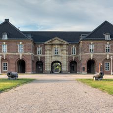
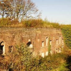
Fort Fusternberg, Military fortification in Fusternberg district, Wesel, Germany
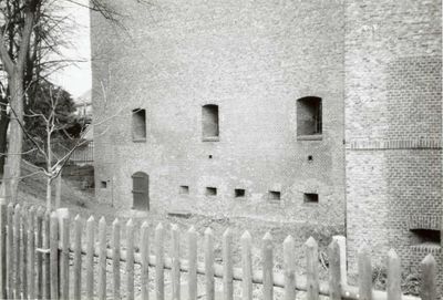
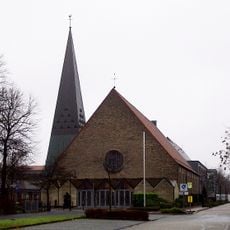
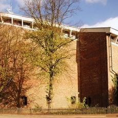
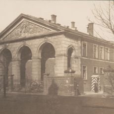
Fort Fustenberg is a military fortification located east of Wesel's city center, featuring original defensive structures from 1856 including a redoubt and right caponier that remain visible today. These surviving elements are now integrated into the church complex, creating a blend of military and religious architecture.
The fort was built in 1856 as a defensive structure for Wesel and remained in military use until 1908, when the city purchased the site. The 1920s saw partial demolition and conversion to religious purposes, transforming the military facility into a church complex.
The Church of Peace to the Holy Angels now occupies the fort's redoubt, blending military heritage with religious practice in the community. This combination shows how defensive structures evolved into spaces for worship and gathering.
The site is accessible from outside and displays the surviving defensive structures integrated into the church complex. Visitors can explore an exhibition in the basement about the location's history when the church grounds are open to the public.
During economic hardship, the fort served unusual purposes such as potato storage during periods of inflation and later as an air raid shelter in World War II. These shifting uses reveal how important the location became for the community during times of crisis.
The community of curious travelers
AroundUs brings together thousands of curated places, local tips, and hidden gems, enriched daily by 60,000 contributors worldwide.