Enable Location

We need your location to show you interesting places around you

Discover nearby places

Find interesting locations and hidden gems around you

Precise directions

Get accurate directions and distances to places

Your location is never shared with other users. It's only used when you tap the location button.

Schönleitenschrofen

Log in to your account

Start exploring — it's free

Trusted by 63,051 travelers worldwide

Continue with Google
Continue with Apple
or

We will send you a code to connect

By continuing, you accept our Terms and Conditions and our Privacy Policy

Check your inbox

We've sent a pincode in your inbox. Please enter the code below.

Schönleitenschrofen
Discussion Reviews 1 Photos
800+ Popularity

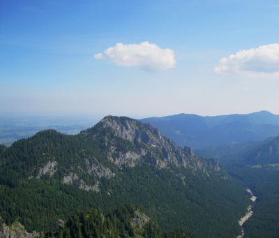
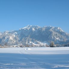
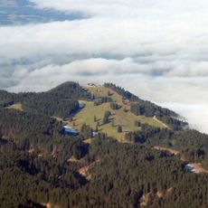
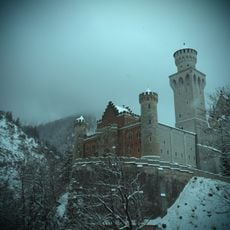
Schönleitenschrofen, Mountain summit in Ammergauer Alps, Germany.

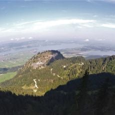
Schönleitenschrofen is a mountain summit in the Ammergauer Alps that rises to about 1,700 meters in elevation. The peak is reached via several hiking routes that wind through forested areas and alpine terrain with varying degrees of difficulty.

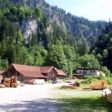
The mountain was historically used by herders who drove livestock to high-altitude pastures in the Alps. These ancient routes gradually became the hiking trails that visitors use today.

The summit draws hikers and climbers who use it as a destination to experience the mountain landscape of the region. Local communities maintain an active relationship with this place through their support of trail maintenance and visitor facilities.

The best time to hike is during warmer months when the trails are clear of snow and easy to walk on. It helps to start early in the day and bring plenty of water and a map, as some sections are exposed and can be disorienting.

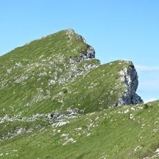
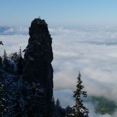
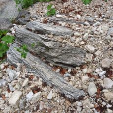
Hikers pass by a striking rock formation called the Franziskaner needle while ascending the route. This distinctive landmark serves as a memorable visual guide and helps visitors navigate the climb.

The community of curious travelers

AroundUs brings together thousands of curated places, local tips, and hidden gems, enriched daily by 60,000 contributors worldwide.

Start exploring
Elevation above the sea
1,702 m
GPS coordinates
47.57166,10.80823
Latest update
December 14, 2025 20:02
Reviews
Share your experience

No review yet

Discussions
Start a discussion...

No discussion yet

« Schönleitenschrofen - Mountain summit in Ammergauer Alps, Germany » is provided by Around Us (aroundus.com). Images and texts are derived from Wikimedia project under a Creative Commons license. You are allowed to copy, distribute, and modify copies of this page, under the conditions set by the license, as long as this note is clearly visible.

Discover hidden gems everywhere you go!

From secret cafés to breathtaking viewpoints, skip the crowded tourist spots and find places that match your style. Our app makes it easy with voice search, smart filtering, route optimization, and insider tips from travelers worldwide. Download now for the complete mobile experience.

Around Us App Screenshot

A unique approach to discovering new places

Le Figaro

All the places worth exploring

France Info

A tailor-made excursion in just a few clicks

20 Minutes

Around Us
Travel Guide & Maps
Download

Send to your phone

QR Code
1

Open the camera app on your mobile.

2

Point at the QR code with your camera. A notification will appear.

3

Tap the notification to open the link.