Tymfi, Mountain peak in Ioannina Regional Unit, Greece
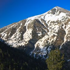
Tymfi is a mountain peak in the northern Pindus range reaching about 2,500 meters with limestone formations spanning across the landscape. It sits within the Vikos-Aoös National Park and offers multiple trails and climbing opportunities for visitors.
Strabo (Book 7, Ch. 7) records the name Tymphe or Stymphe, linked to Tymphaea and the Tymphaeans, one of the tribes of ancient Epirus; the meaning of the name is unknown. The name then disappears from accounts: on du Bocage's 1820 map the mountain is called Paleo-Vouni, and Pouqueville gives Lazaris in 1826. Gamila is the name of the highest peak, not of the mountain.
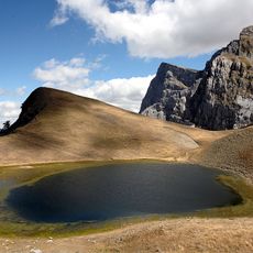
The peaks carry Greek names: Gamila means camel, Karteros mighty, Megala Litharia big rocks, and Astráka a roof's eaves, from the Slavic streha. Tsouka Rossa means red peak in Aromanian, and Goura comes from Latin gula, a mountain spring. The alpine lakes have their own legends, the best known being Drakolimni, the dragon lake.
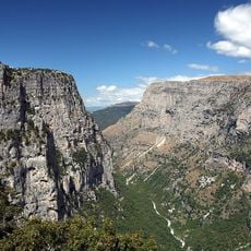
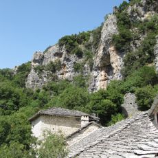
Ascents to the peaks start from Vradeto, a seven-hour walk, or from Mikro Papingo, three hours to the Astraka hut at 1,930 m, which opens in summer and serves as a base for Gamila, Ploskos and Astraka. From Vradeto, the Rizina lake lies about four hours on foot. The north side forms cliffs up to 400 m, and the western side is cut by the Vikos Gorge.
Near Papingo, the Provatina cave reaches 408 m deep and was first found in 1965 by British speleologists of the Cambridge University Caving Club. The nearby Chasm of Epos, 451 m deep, drains water from the surrounding plateaus. Other shafts carry names from mythology, such as the Hole of Odysseus.
The community of curious travelers
AroundUs brings together thousands of curated places, local tips, and hidden gems, enriched daily by 94,467 contributors worldwide.