Enable Location

We need your location to show you interesting places around you

Discover nearby places

Find interesting locations and hidden gems around you

Precise directions

Get accurate directions and distances to places

Your location is never shared with other users. It's only used when you tap the location button.

18th arrondissement of Paris

Log in to your account

Join the adventure

Create your free account and start exploring (like 60k+ others)

We will send you a code to connect

or
Continue with Google
Continue with Apple
By continuing, you accept our Terms and Conditions and our Privacy Policy

Check your inbox

We've sent a pincode in your inbox. Please enter the code below.

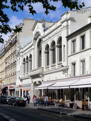
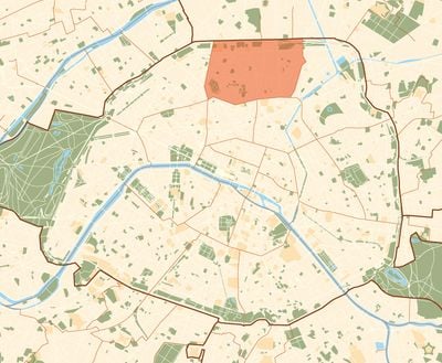
18th arrondissement of Paris, Administrative district in northern Paris, France

Description

The 18th arrondissement includes four neighborhoods – Grandes-Carrières, Clignancourt, La Goutte-d'Or, and La Chapelle – that stretch across the northern part of Paris. The Montmartre hill rises in the west and the streets slope down toward the flatter eastern sections where markets and apartment blocks fill the lanes.

History

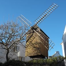
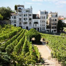
This district became part of Paris on January 17, 1860, when the city expanded its borders and absorbed surrounding communes. Montmartre remained a separate village with vineyards and windmills on its slopes until the annexation.

Culture

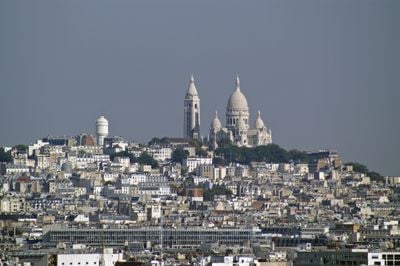
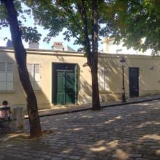
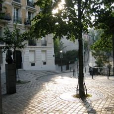
The name Montmartre derives from "hill of martyrs" and today the hillside hosts painters who set up easels in small squares where visitors watch them work. Artists continue to sell portraits and sketches along the sloping streets that wind between cafes and shops.

Practical

Several metro lines cross the district and connect its neighborhoods to the center, with stations near intersections and shopping streets. The steep slopes of Montmartre require comfortable shoes, while the eastern sections are flat and easier to explore on foot.

Did you know?

A small vineyard still survives on the Montmartre hill and produces a limited amount of wine each year. The autumn harvest is celebrated with a local festival where residents and visitors can walk through the vines.

Location
Inception
1860
Shares border with
8th arrondissement of Paris, 9th arrondissement of Paris, 10th arrondissement of Paris, 17th arrondissement of Paris, 19th arrondissement of Paris
GPS coordinates
48.89215,2.34445
Latest update
December 13, 2025 16:19

AroundUs brings together thousands of curated places, local tips, and hidden gems, enriched daily by 60,000 contributors worldwide. Discover all places nearby (Paris).

« 18th arrondissement of Paris - Administrative district in northern Paris, France » is provided by Around Us (aroundus.com). Images and texts are derived from Wikimedia project under a Creative Commons license. You are allowed to copy, distribute, and modify copies of this page, under the conditions set by the license, as long as this note is clearly visible.

Discover hidden gems everywhere you go!

From secret cafés to breathtaking viewpoints, skip the crowded tourist spots and find places that match your style. Our app makes it easy with voice search, smart filtering, route optimization, and insider tips from travelers worldwide. Download now for the complete mobile experience.

Around Us App Screenshot

A unique approach to discovering new places

Le Figaro

All the places worth exploring

France Info

A tailor-made excursion in just a few clicks

20 Minutes

Around Us
Travel Guide & Maps
Download

Send to your phone

QR Code
1

Open the camera app on your mobile.

2

Point at the QR code with your camera. A notification will appear.

3

Tap the notification to open the link.