Enable Location

We need your location to show you interesting places around you

Discover nearby places

Find interesting locations and hidden gems around you

Precise directions

Get accurate directions and distances to places

Your location is never shared with other users. It's only used when you tap the location button.

Étretat

Log in to your account

Start exploring — it's free

Trusted by 61,573 travelers worldwide

Continue with Google
Continue with Apple
or

We will send you a code to connect

By continuing, you accept our Terms and Conditions and our Privacy Policy

Check your inbox

We've sent a pincode in your inbox. Please enter the code below.

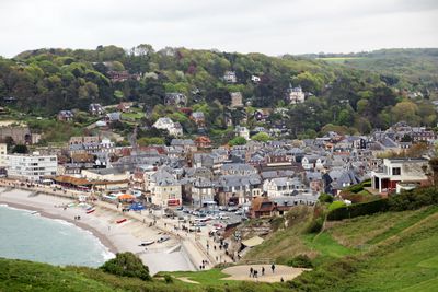
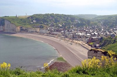
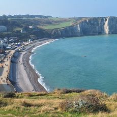
Étretat, Coastal commune in Normandy, France

Description

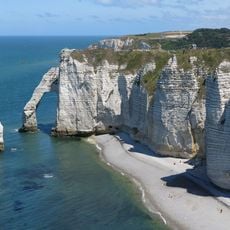
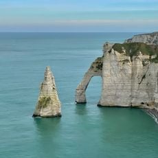
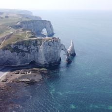
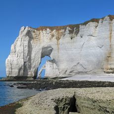
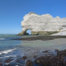
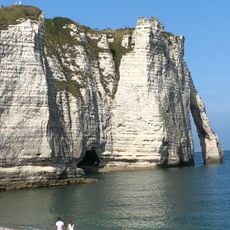
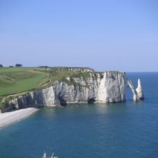
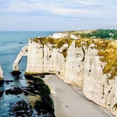
Étretat is a commune in the arrondissement of Le Havre on the Seine-Maritime coast of Normandy, set between tall chalk cliffs. The settlement stretches along a pebble cove, surrounded by three named rock arches called Porte d'Aval, Porte d'Amont, and Manneporte, as well as the needle-shaped formation L'Aiguille.

History

In the 19th century, the construction of a railway line turned the small fishing harbor into a popular destination for Parisians and other visitors from northern France. The natural arches were carved by centuries of wind and waves working on the soft chalk layer.

Culture

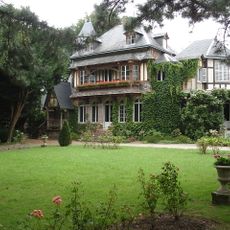
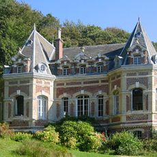
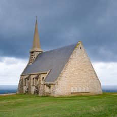
This part of the Norman coast drew writers such as Maurice Leblanc, who set his Arsène Lupin stories here and owned a house in the area. Today, walkers visit the cliffs in all seasons, and some explore the caves at the base of the rock formations when the tide is low.

Practical

Several paths lead up to the clifftops and offer different viewpoints over the rock arches and the sea, though some sections are steep and uneven. During strong winds or rain, the paths can become slippery, so sturdy footwear is recommended.

Did you know?

The arches and the needle form natural frames through which sunrise and sunset can be seen, and their appearance changes with the tides and light. At low tide, flat rock platforms and smaller caves at the base of the cliffs become visible, which are otherwise underwater.

Location
Elevation above the sea
63 m
Shares border with
Bénouville, Bordeaux-Saint-Clair, Le Tilleul
Phone
GPS coordinates
49.70639,0.20667
Latest update
December 15, 2025 16:07

AroundUs brings together thousands of curated places, local tips, and hidden gems, enriched daily by 60,000 contributors worldwide. Discover all places nearby (canton of Criquetot-l'Esneval).

Wild beaches in France: Mediterranean, Atlantic coasts and coves

The French coastline stretches over more than 3,100 miles and features a notable variety of beaches. From Brittany's granite coasts to Mediterranean coves, including wide Atlantic stretches and Corsican bays with clear waters, each coastal area has its own character. This selection takes you away...

« Étretat - Coastal commune in Normandy, France » is provided by Around Us (aroundus.com). Images and texts are derived from Wikimedia project under a Creative Commons license. You are allowed to copy, distribute, and modify copies of this page, under the conditions set by the license, as long as this note is clearly visible.

Discover hidden gems everywhere you go!

From secret cafés to breathtaking viewpoints, skip the crowded tourist spots and find places that match your style. Our app makes it easy with voice search, smart filtering, route optimization, and insider tips from travelers worldwide. Download now for the complete mobile experience.

Around Us App Screenshot

A unique approach to discovering new places

Le Figaro

All the places worth exploring

France Info

A tailor-made excursion in just a few clicks

20 Minutes

Around Us
Travel Guide & Maps
Download

Send to your phone

QR Code
1

Open the camera app on your mobile.

2

Point at the QR code with your camera. A notification will appear.

3

Tap the notification to open the link.