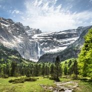
Verdon Gorge, Canyon in Alpes-de-Haute-Provence and Var, France.
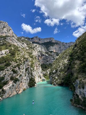
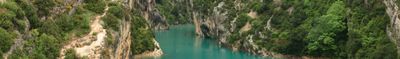
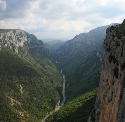
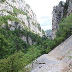
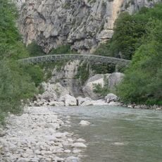
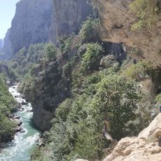
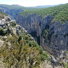
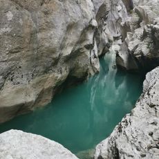
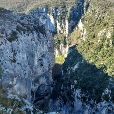
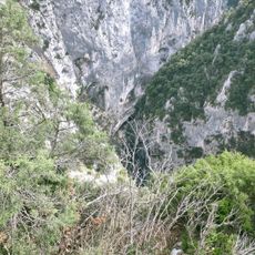
Verdon Gorge is a 25-kilometer cut through limestone walls in southern France, dropping as deep as 700 meters into the rock. The river below flows through narrow passages while cliff faces rise on both sides in vertical sheets.
The cut formed millions of years ago when seawater deposited limestone and later uplifts raised the land. The river began cutting through the rock after the sea withdrew, shaping the current gorge over long stretches of time.
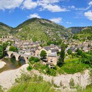
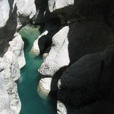
The name comes from the turquoise color of the river, caused by glacial sediment that changes with the light. Local people from villages like Moustiers-Sainte-Marie and Castellane simply call the river
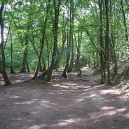
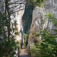
The scenic road on both rims provides viewpoints, while the path at the bottom is suited only to experienced walkers with sturdy footwear. Water and sun protection are needed, as shade is limited and the return trip takes several hours.
More than 1,500 climbing routes run up the walls, making this one of the largest natural climbing areas in France. Some sections close in winter to protect nesting sites for birds of prey that build homes in the rock cracks.
Location: Alpes-de-Haute-Provence
Location: Var
Width: 1,500 m
Address: Verdon Gorge, France
Website: https://lesgorgesduverdon.fr
GPS coordinates: 43.74966,6.32856
Latest update: December 12, 2025 17:29
France offers diverse winter destinations spanning both urban and natural landscapes. The Alpine regions contain several ski areas, including Chamonix-Mont-Blanc at the base of Western Europe's highest peak, Les Trois Vallées with its extensive network of runs, and L'Alpe d'Huez at elevations above...
France displays a range of geological formations shaped by millions of years of natural processes. White chalk cliffs mark the northern coast, including the cliffs of Étretat and the rock of Mont Saint-Michel in Normandy. In southern regions, deep limestone gorges cut through the landscape, while...
France offers motorcyclists a diverse landscape, from Alpine peaks to Mediterranean coasts, including wine regions. The country is suitable for all riding styles, with demanding mountain roads, winding coastal routes, and rural paths. Key routes include the Col de la Bonette, reaching 2802 meters...
Sentier Martel
1.4 km
Plan de Canjuers
4.9 km
Verdon Regional Natural Park
11.9 km
Pont de l'Artuby
5.2 km
Point Sublime
7.3 km
Couloir Samson
7 km
Styx du Verdon
579 m
L'Estellier Footbridge
1.3 km
Grottes de Saint-Maurin
7.6 km
Château de la Palud-sur-Verdon
3.5 km
Grand Margès
4.1 km
Chapelle Notre-Dame de la Baume
7.7 km
Canyon de l'Artuby
6.5 km
The Galetas Beach
8.7 km
Réserve naturelle régionale de Saint-Maurin
7.5 km
Château d'Aiguines
7.4 km
Église Notre-Dame de Vauvert
3.6 km
Église Saint-Jean d'Aiguines
7.5 km
Col d'Illoire
6.2 km
View from the Balcon de la Mescla
4.4 km
Château de Rougon
8 km
Église Saint-Michel de Trigance
9.2 km
Sentier de L'Imbut
1.9 km
Église Notre-Dame-de-la-Roche-et-Saint-Romain de Rougon
8.1 km
Grand aven de la Nouguière
6.1 km
Chapelle Saint-Christophe de Rougon
7.9 km
Grand aven de Canjuers
5.8 km
Chapelle Saint-Roch de Trigance
9.1 kmVisited this place? Tap the stars to rate it and share your experience / photos with the community! Try now! You can cancel it anytime.
Discover hidden gems everywhere you go!
From secret cafés to breathtaking viewpoints, skip the crowded tourist spots and find places that match your style. Our app makes it easy with voice search, smart filtering, route optimization, and insider tips from travelers worldwide. Download now for the complete mobile experience.
A unique approach to discovering new places❞
— Le Figaro
All the places worth exploring❞
— France Info
A tailor-made excursion in just a few clicks❞
— 20 Minutes