L'Estellier Footbridge, Steel footbridge in Verdon Gorge, France
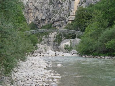
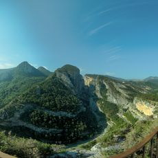
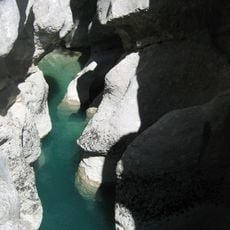
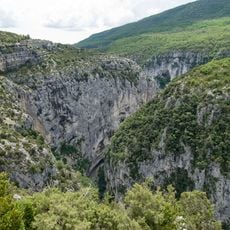
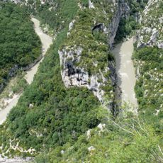
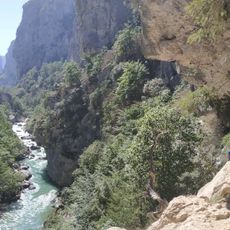
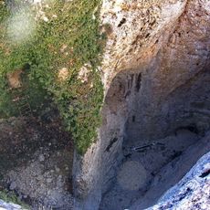
L'Estellier Footbridge is a steel structure that crosses the Verdon River, connecting the two banks of the gorge. The bridge allows hikers to access remote sections of the valley where foot traffic is the only practical way through the narrow canyon.
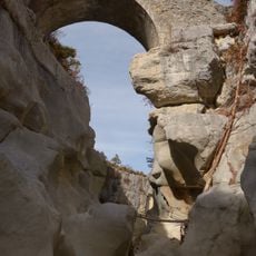
The bridge was built in 2004 following a devastating flood that destroyed the earlier structure. Its construction was necessary to restore the hiking connection through this remote section of the gorge.
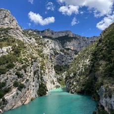
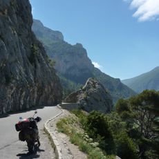
The footbridge serves as an essential connection point for the White-Martel trail, extending 15 kilometers along the right bank of the Verdon River.
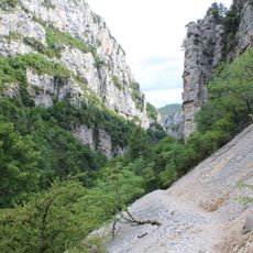
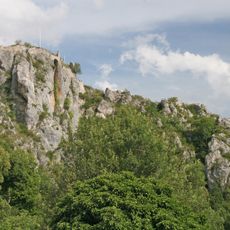
The bridge is reached by hiking trails starting from either La Palud-sur-Verdon or Aiguines. Depending on the season and conditions, some routes may be restricted, so visitors should check ahead.
The bridge sits at about 564 meters elevation and features a steel arch design specifically built to handle the extreme narrowness of the canyon. This design approach reflects the engineering challenges posed by such remote mountain locations.
Location: La Palud-sur-Verdon
Location: Aiguines
GPS coordinates: 43.74292,6.34147
Latest update: December 14, 2025 13:03
Verdon Gorge
1.3 km
Sentier Martel
500 m
Pont de l'Artuby
4 km
Point Sublime
7.1 km
Couloir Samson
6.8 km
Styx du Verdon
1.9 km
Mourre de Chanier
11 km
Grottes de Saint-Maurin
8.8 km
Château de la Palud-sur-Verdon
4.1 km
Grand Margès
5.3 km
Chapelle Notre-Dame de la Baume
8.5 km
Canyon de l'Artuby
5.2 km
Château de Trigance
8.5 km
Réserve naturelle régionale de Saint-Maurin
8.8 km
Château d'Aiguines
8.7 km
Église Notre-Dame de Vauvert
4.1 km
Église Saint-Jean d'Aiguines
8.7 km
View from the Balcon de la Mescla
3.2 km
Château de Rougon
7.8 km
Pont de Sautet
8.7 km
Église Saint-Michel de Trigance
8.3 km
Sentier de L'Imbut
628 m
Église Notre-Dame-de-la-Roche-et-Saint-Romain de Rougon
7.9 km
Grand aven de la Nouguière
5.6 km
Chapelle Saint-Christophe de Rougon
7.8 km
Grand aven de Canjuers
5.3 km
Chapelle Saint-Roch de Trigance
8.2 km
Route des Crêtes
579 mVisited this place? Tap the stars to rate it and share your experience / photos with the community! Try now! You can cancel it anytime.
Discover hidden gems everywhere you go!
From secret cafés to breathtaking viewpoints, skip the crowded tourist spots and find places that match your style. Our app makes it easy with voice search, smart filtering, route optimization, and insider tips from travelers worldwide. Download now for the complete mobile experience.
A unique approach to discovering new places❞
— Le Figaro
All the places worth exploring❞
— France Info
A tailor-made excursion in just a few clicks❞
— 20 Minutes