Gavarnie Cirque
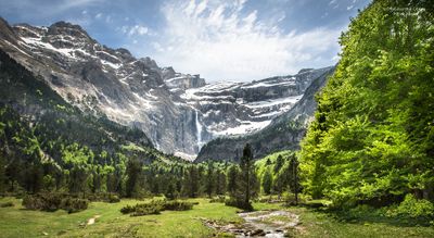
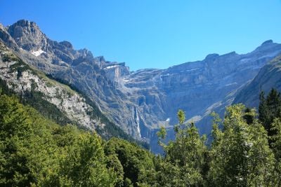
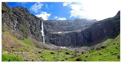
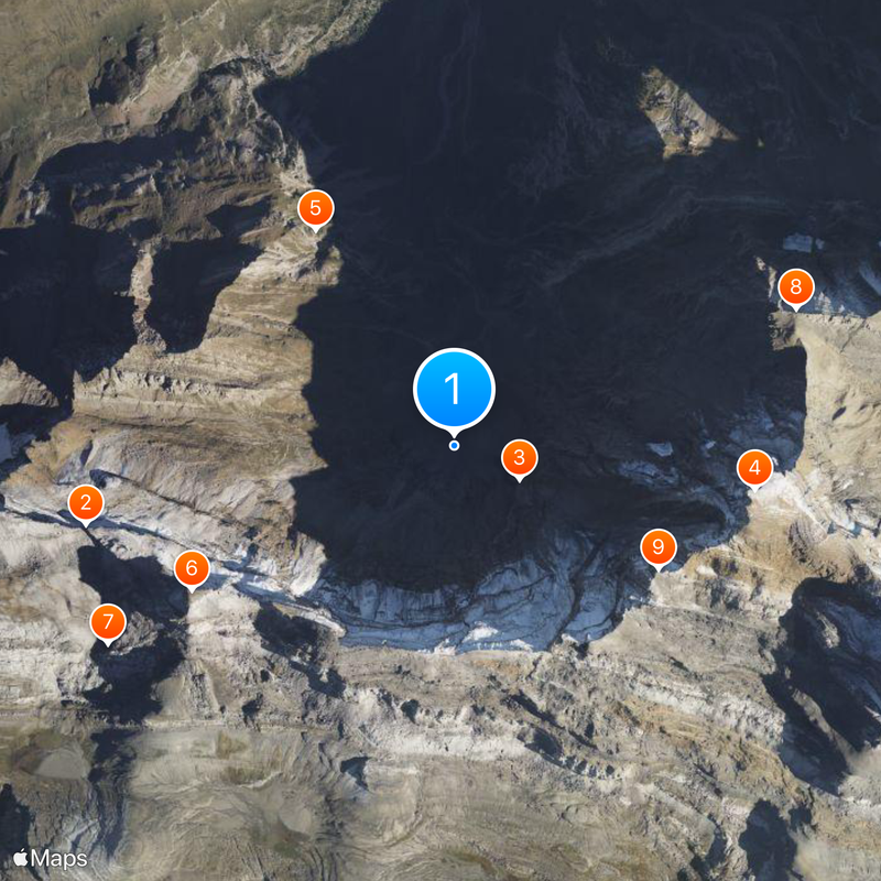
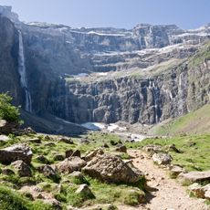
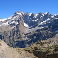
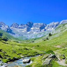
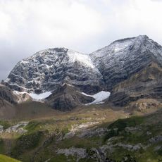
Gavarnie Cirque, Natural amphitheater in Hautes-Pyrénées, France
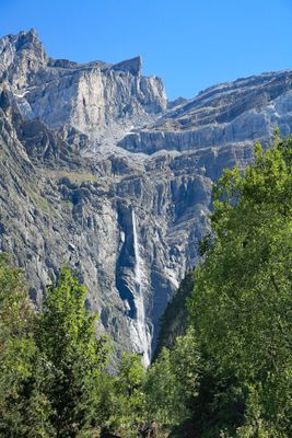
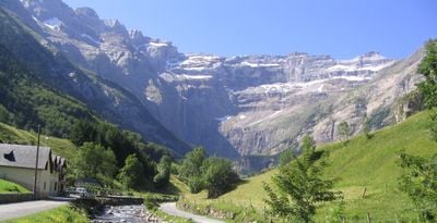
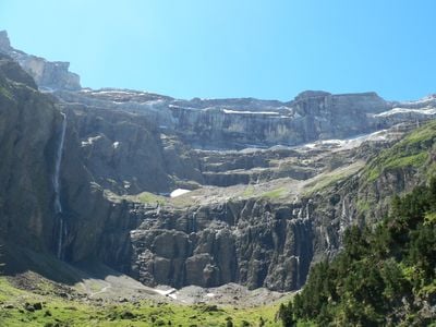
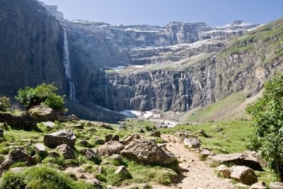
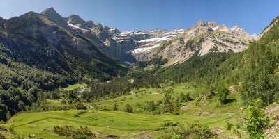
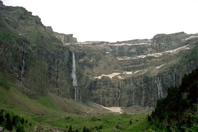
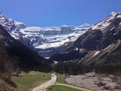
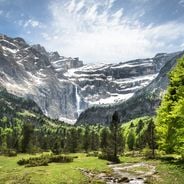
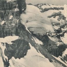
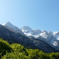
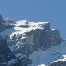
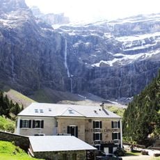
Gavarnie Cirque is a large natural amphitheater in the Pyrenees with steep rock walls surrounding an open space. The formation has an open front where a waterfall flows down, and the walls create a curved shape that rises high above the valley floor.
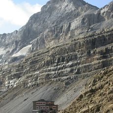
This geological shape developed over many millions of years as water and ice slowly carved into the mountains. Ancient glaciers moved slowly through the landscape, grinding away rock and creating the bowl-shaped valley we see today.
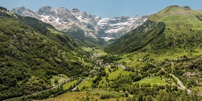
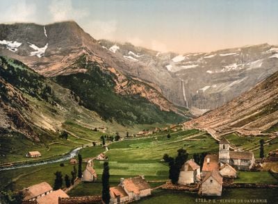
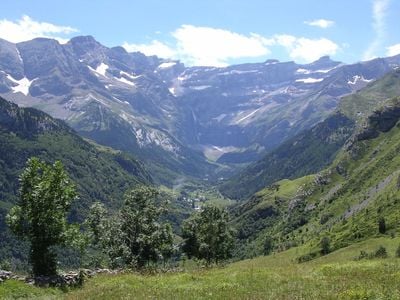
The place reflects mountain heritage and draws visitors who come to experience its scale and natural beauty. Local guides and mountain communities have shaped how people engage with and move through this landscape.
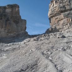
You can reach this place by hiking from the nearby village using paths that range from gentle walks to more demanding routes. If you prefer not to walk the entire way, other options are available during the warmer months to help you get higher up.
A major waterfall plunges down from the upper rock walls here and stands as one of the tallest in the continental region. During spring when snow melt flows down the mountainside, many smaller waterfalls appear across the rock face.
Location: Hautes-Pyrénées
Accessibility: Wheelchair limited access
Address: 65120 Gavarnie-Gèdre, France
Phone: +33562924910
Website: http://upload.wikimedia.org/wikipedia/commons/9/90/Gavarnie-Cirque.JPG
GPS coordinates: 42.69500,-0.00889
Latest update: December 14, 2025 19:58
France offers diverse winter destinations spanning both urban and natural landscapes. The Alpine regions contain several ski areas, including Chamonix-Mont-Blanc at the base of Western Europe's highest peak, Les Trois Vallées with its extensive network of runs, and L'Alpe d'Huez at elevations above...
France offers motorcyclists a diverse landscape, from Alpine peaks to Mediterranean coasts, including wine regions. The country is suitable for all riding styles, with demanding mountain roads, winding coastal routes, and rural paths. Key routes include the Col de la Bonette, reaching 2802 meters...
La Brèche de Roland
2.1 km
Gavarnie Falls
409 m
Pico Marboré
1.7 km
Cirque d'Estaubé
1.4 km
El Casco
1.7 km
Grotto of Casteret
2.2 km
Petit Astazou
2.1 km
Pico Central de la Cascada
1.3 kmCascade Glacier
1.2 km
Picos de la Cascada Oriental
1.5 km
Glacier du Col de la Cascade
1.2 km
Pico Occidental de la Cascada
1.3 kmHelmet Glacier
1.4 km
Ouest du Marboré Glacier
1.5 km
Épaule Glacier
1.1 kmScenic viewpoint
2 kmScenic viewpoint
2.1 kmWaterfall
372 mWaterfall
294 mHôtellerie du Cirque
1 kmWaterfall
318 mWaterfall
353 mWaterfall
598 mWaterfall
728 mWaterfall
313 mWaterfall
290 mWaterfall
1.2 kmWaterfall
1.1 kmVisited this place? Tap the stars to rate it and share your experience / photos with the community! Try now! You can cancel it anytime.
Discover hidden gems everywhere you go!
From secret cafés to breathtaking viewpoints, skip the crowded tourist spots and find places that match your style. Our app makes it easy with voice search, smart filtering, route optimization, and insider tips from travelers worldwide. Download now for the complete mobile experience.
A unique approach to discovering new places❞
— Le Figaro
All the places worth exploring❞
— France Info
A tailor-made excursion in just a few clicks❞
— 20 Minutes