Pont au Change

Log in to your account

AroundUs is a community-driven map of interesting places, built by curious explorers like you. It grows with every review, story, and photo you share.
Connect to save your favorite spots, contribute locations, and create personalized routes.
Continue with Google
Continue with Apple
Continue with X
Continue with Facebook
Continue with email
By continuing, you accept our Terms and Conditions and our Privacy Policy
Create an account

Pont au Change

Add to collection
Map
Suggest a change
Share

Pont au Change, Road bridge in central Paris, France

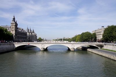
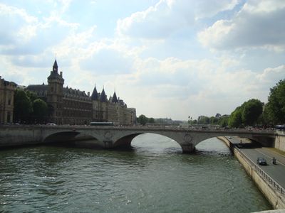
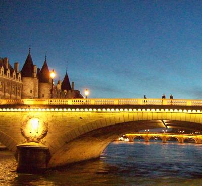
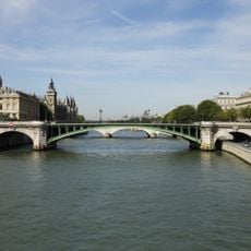
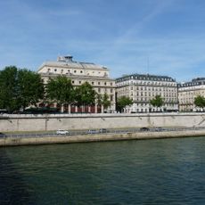
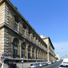
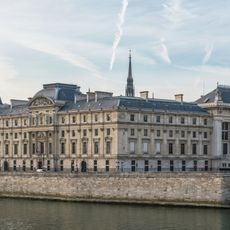
The Pont au Change is a road bridge crossing the Seine that connects the 1st and 4th arrondissements and measures 103 meters long. The structure features three elliptical stone arches supporting an 18-meter wide roadway and two 6-meter wide sidewalks.

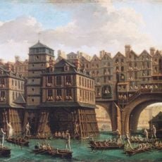
The bridge was built in 1860 under Napoleon III and replaced earlier structures going back to 872 when a fortified stone crossing stood at this location. This sequence of rebuilding reflects the continuous importance of this river crossing to the city's development.

The name comes from medieval goldsmiths and money changers who ran shops on earlier versions of this crossing. Today, visitors can still sense this trading heritage reflected in nearby street names and the bridge's position in what was once the commercial heart of Paris.

The bridge is open daily for both vehicle and pedestrian traffic, connecting Place du Chatelet with surrounding streets. Visitors should note that traffic here can be quite busy, especially during peak hours.

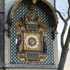
The bridge bears Napoleon's imperial N insignia carved by sculptor Cabat, which also appears on the nearby Pont Saint-Michel. This shared decoration connects the two bridges as works from the same construction period.

Location: 1st arrondissement of Paris

Location: 4th arrondissement of Paris

Location: Quartier Notre-Dame

Location: Saint-Germain-l'Auxerrois

Location: Quartier Saint-Merri

Inception: 1860

Architects: Paul-Martin Gallocher de Lagalisserie

Length: 103 m

Part of: road network of Paris

Shares border with: boulevard du Palais, quai de Gesvres, quai de la Mégisserie

GPS coordinates: 48.85666,2.34677

Latest update: December 7, 2025 20:20

Photos
Reviews

Visited this place? Tap the stars to rate it and share your experience / photos with the community! Try now! You can cancel it anytime.

« Pont au Change - Road bridge in central Paris, France » is provided by Around Us (aroundus.com). Images and texts are derived from Wikimedia project under a Creative Commons license. You are allowed to copy, distribute, and modify copies of this page, under the conditions set by the license, as long as this note is clearly visible.

Discover hidden gems everywhere you go!

From secret cafés to breathtaking viewpoints, skip the crowded tourist spots and find places that match your style. Our app makes it easy with voice search, smart filtering, route optimization, and insider tips from travelers worldwide. Download now for the complete mobile experience.

Around Us App Screenshot

A unique approach to discovering new places

Le Figaro

All the places worth exploring

France Info

A tailor-made excursion in just a few clicks

20 Minutes