Enable Location

We need your location to show you interesting places around you

Discover nearby places

Find interesting locations and hidden gems around you

Precise directions

Get accurate directions and distances to places

Your location is never shared with other users. It's only used when you tap the location button.

Le Reculet

Log in to your account

Start exploring — it's free

Trusted by 61,978 travelers worldwide

Continue with Google
Continue with Apple
or

We will send you a code to connect

By continuing, you accept our Terms and Conditions and our Privacy Policy

Check your inbox

We've sent a pincode in your inbox. Please enter the code below.

Le Reculet

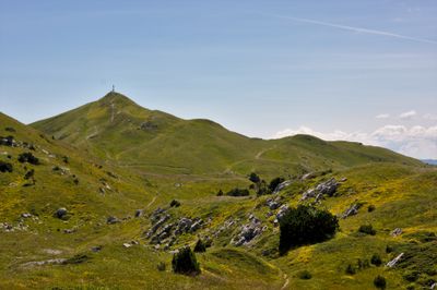
Le Reculet, Mountain summit in Thoiry, France

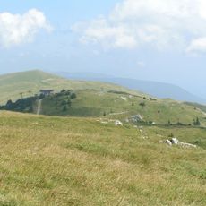
Le Reculet is a mountain summit in the French Jura rising to 1717 meters (5633 feet) with steep limestone cliffs and rocky slopes. The peak features the distinctive limestone formations typical of this section of the Jura range.

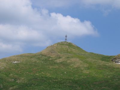
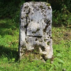
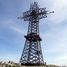
Shepherds began using the slopes of this mountain in the 14th century to graze their flocks in the Jura region. The site gained new significance in the late 1800s when residents placed a cross at the summit as a marker of their community.

The iron cross at the summit connects this peak to the local community's identity. For more than a century, it has served as a symbol of belonging to the mountain landscape and is noticed by visitors as a quiet reminder of collective heritage.

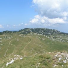
Hikers typically start from Tiocan at around 860 meters (2820 feet) elevation and follow marked trails through forest to reach the summit. The paths are well-marked and the terrain becomes steeper higher up, requiring sturdy footwear and basic fitness.

On clear days, visitors can see Lake Geneva, Mont Blanc, and the Alps stretching across the horizon from the summit. This unusual vantage point allows one to take in three major mountain landscapes in a single panoramic view.

The community of curious travelers

AroundUs brings together thousands of curated places, local tips, and hidden gems, enriched daily by 60,000 contributors worldwide.

Start exploring
Location
Elevation above the sea
1,717 m
Made from material
limestone
GPS coordinates
46.25698,5.92983
Latest update
December 10, 2025 20:05
« Le Reculet - Mountain summit in Thoiry, France » is provided by Around Us (aroundus.com). Images and texts are derived from Wikimedia project under a Creative Commons license. You are allowed to copy, distribute, and modify copies of this page, under the conditions set by the license, as long as this note is clearly visible.

Discover hidden gems everywhere you go!

From secret cafés to breathtaking viewpoints, skip the crowded tourist spots and find places that match your style. Our app makes it easy with voice search, smart filtering, route optimization, and insider tips from travelers worldwide. Download now for the complete mobile experience.

Around Us App Screenshot

A unique approach to discovering new places

Le Figaro

All the places worth exploring

France Info

A tailor-made excursion in just a few clicks

20 Minutes

Around Us
Travel Guide & Maps
Download

Send to your phone

QR Code
1

Open the camera app on your mobile.

2

Point at the QR code with your camera. A notification will appear.

3

Tap the notification to open the link.