Réserve naturelle nationale de la haute-chaîne du Jura

Log in to your account

AroundUs is a community-driven map of interesting places, built by curious explorers like you. It grows with every review, story, and photo you share.
Connect to save your favorite spots, contribute locations, and create personalized routes.
Continue with Google
Continue with Apple
Continue with X
Continue with Facebook
Continue with email
By continuing, you accept our Terms and Conditions and our Privacy Policy
Create an account
Add to collection
Map
Suggest a change
Share

Réserve naturelle nationale de la haute-chaîne du Jura, National nature reserve in Eastern France.

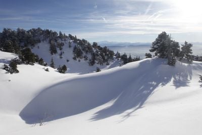
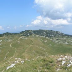
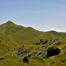
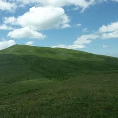
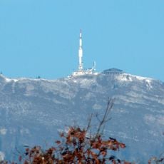
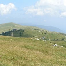
The Réserve naturelle nationale de la haute-chaîne du Jura is a protected area spanning multiple valleys and slopes along the French-Swiss border, distributed across 17 towns. The landscape alternates between forests, open meadows, and rocky formations, with the highest peaks reaching around 1,720 meters.

The area formed through tectonic movements during Alpine mountain building roughly 20 million years ago. Glaciers then shaped the current landscape with its valleys and slopes during the last ice age.

The area maintains traditional mountain farming through controlled grazing that helps preserve high-altitude grasslands and local wildlife. These practices shape how the landscape looks and how people in surrounding villages interact with the land.

Visitors can use marked trails throughout the year, accessible from several towns including Gex, Divonne-les-Bains, and Thoiry. Wear sturdy footwear and check weather conditions before visiting, as the elevation means conditions can change quickly.

The area holds around 950 flowering plant species and serves as habitat for over 200 vertebrate species, including golden eagles and lynx. This variety makes it a valuable refuge for rare mountain species.

Location: Chézery-Forens

Location: Collonges

Location: Confort

Location: Crozet

Location: Divonne-les-Bains

Location: Échenevex

Location: Farges

Location: Gex

Location: Léaz

Location: Lélex

Location: Mijoux

Location: Péron

Location: Saint-Jean-de-Gonville

Location: Sergy

Location: Thoiry

Location: Vesancy

Location: Valserhône

Inception: February 26, 1993

Elevation above the sea: 580 m

Website: https://rnn-hautechainedujura.fr

GPS coordinates: 46.29750,5.98444

Latest update: December 14, 2025 13:06

Photos
Reviews

Visited this place? Tap the stars to rate it and share your experience / photos with the community! Try now! You can cancel it anytime.

« Réserve naturelle nationale de la haute-chaîne du Jura - National nature reserve in Eastern France » is provided by Around Us (aroundus.com). Images and texts are derived from Wikimedia project under a Creative Commons license. You are allowed to copy, distribute, and modify copies of this page, under the conditions set by the license, as long as this note is clearly visible.

Discover hidden gems everywhere you go!

From secret cafés to breathtaking viewpoints, skip the crowded tourist spots and find places that match your style. Our app makes it easy with voice search, smart filtering, route optimization, and insider tips from travelers worldwide. Download now for the complete mobile experience.

Around Us App Screenshot

A unique approach to discovering new places

Le Figaro

All the places worth exploring

France Info

A tailor-made excursion in just a few clicks

20 Minutes