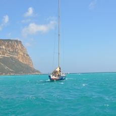
Falaises Soubeyranes, Maritime cliffs in Bouches-du-Rhône, France
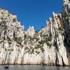
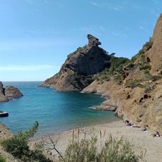
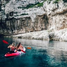
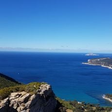
Falaises Soubeyranes are the seaward drop of the Soubeyran plateau, running just over four kilometres between Cassis and La Ciotat. The wall is layered limestone, sandstone and puddingstone, cut by wind erosion and holding fossils. Cap Canaille reaches 363 m above Cassis; the highest point, 394 m, lies in La Ciotat and makes this France's tallest sea cliff.
The name comes from the Provençal 'sobeiranas' (classic spelling) or 'soubeirano' (Mistralian spelling), meaning 'sovereign'. The cliffs are the seaward drop of the Soubeyran plateau, also called the massif de la Canaille, falling over roughly four kilometres between Cassis and La Ciotat. Cap Canaille reaches 363 m in Cassis, while the highest point, 394 m, lies in La Ciotat southwest of the Bau Rous, making this France's highest sea cliff.
The name comes from the Provençal sobeiranas, 'sovereign', for the cliffs' commanding position. The massif is a noted mineralogy site: limestone, sandstone and puddingstone layers hold fossils. A ridge-top hiking path runs above the cliffs, and the rock faces are used for climbing; the underground hydrogeological network is reserved for experienced cavers.
The best access is via the Crêtes Road D141, with parking available at the Belvédère des Calanques in Cassis. The walking trails are especially popular during warmer months, so starting early helps you avoid crowds.
The cliffs are a mineralogy site: limestone, sandstone and puddingstone layers hold fossils, and wind erosion sculpted the face. Behind the ridge lies a large hydrogeological network, hard to reach, where caving is reserved for specialists. The highest point, 394 m in La Ciotat, makes these France's tallest sea cliffs.
The community of curious travelers
AroundUs brings together thousands of curated places, local tips, and hidden gems, enriched daily by 92,775 contributors worldwide.