Puy de Paugnat, Dormant volcano in Auvergne-Rhône-Alpes, France
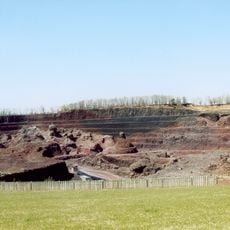
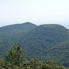
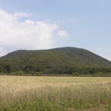
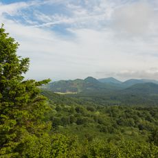
Puy de Paugnat is a dormant volcano in Puy-de-Dôme that reaches 898 meters, with steep slopes covered by forest on most sides. Its northeastern face, however, remains more open and exposed, revealing the volcanic rock beneath.
Puy de Paugnat is a scoria cone formed by effusive eruptions; the date of its last eruption is unknown. Thermoluminescence dating by Guérin (1983) gave 30,500 ± 7,000 years BP, placing the eruption at the end of the Würm glaciation. Its northeastern flank was quarried for pozzolana for about fifty years, until the open-pit operation closed in 2001.
The name Paugnat comes from the hamlet of the same name, 500 metres to the northeast, on the territory of Charbonnières-les-Varennes. The volcano's pouzzolane was quarried for around fifty years until 2001, and the open-pit cut on the northeastern flank remains visible today. A waymarked loop circles the hill, part of it shared with the GR 441 long-distance path.
A loop path circles the volcano, and its eastern section is shared with a variant of the GR441 long-distance trail. The D 16/D 90 road passes the northern side and the Clermont-Ferrand to Mont-Dore railway the south-west side. The north-east flank is taken up by the former open-pit quarry, so the wooded paths lie on the other sides.
The quarry walls expose the internal structure of a Strombolian cone: scoria layers dipping outward at about 30°, a red oxidised core and a black reduced rim, with spindle-shaped bombs and twisted lava fragments beneath the pozzolan. Thermoluminescence dating by Guérin (1983) gave an age of 30,500 ± 7,000 years BP.
The community of curious travelers
AroundUs brings together thousands of curated places, local tips, and hidden gems, enriched daily by 92,863 contributors worldwide.