Roc de Gleisin, Mountain summit in Savoie, France
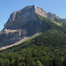
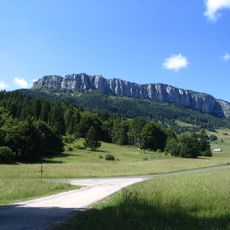
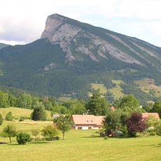
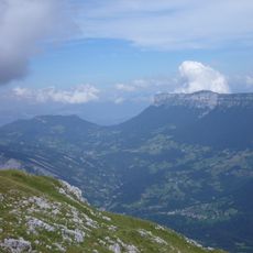
Roc de Gleisin is a limestone mountain in the Chartreuse massif, rising to 1,434 metres between Entremont-le-Vieux and Saint-Pierre-d'Entremont in Savoie. Its western side forms long rock bars that also mark the boundary of Corbel. The summit ridge is uneven, with two blocky prominences near the right and a sheer, fissured face above coniferous forest.
Roc de Gleisin lies between Entremont-le-Vieux and Saint-Pierre-d'Entremont in Savoie, and the rock bars on its western side also mark the boundary of the Corbel district. The summit stands at 1,434 metres and the mountain is mostly limestone.
The ridge path links the two communes that share the mountain, Entremont-le-Vieux and Saint-Pierre-d'Entremont in Savoie, and the rock bars on the western side mark the boundary with Corbel. Walkers can continue south to Roche Veyrand, north to the Col de la Cluse, or east back down to Saint-Pierre-d'Entremont.
The ascent is possible via the Col du Grapillon trail with moderate climbing demands throughout the route. Wear sturdy hiking boots and be prepared for rocky terrain on the way up.
The summit ridge links three routes: south to Roche Veyrand, north to the Col de la Cluse, and east back down to Saint-Pierre-d'Entremont in Savoie. The rock bars on the western side also mark the boundary of the Corbel district, so the mountain doubles as a territorial marker.
The community of curious travelers
AroundUs brings together thousands of curated places, local tips, and hidden gems, enriched daily by 93,897 contributors worldwide.